Alves Mariane Branco, Erbisti Rafael Santos, Nobre Aline Araújo, Simões Taynãna César, Tavares Alessandre de Medeiros, Melo Márcia Cristina, Pedreira Rodrigo Moreira, de Araújo Jan Pierre Martins, Carvalho Marilia Sá, Honório Nildimar Alves
Departamento de Métodos Estatísticos, Instituto de Matemática, Universidade Federal do Rio de Janeiro, Rio de Janeiro, Brazil.
Departamento de Estatística, Instituto de Matemática e Estatística, Universidade Federal Fluminense, Niterói, Brazil.
PLoS Negl Trop Dis. 2025 Apr 29;19(4):e0012984. doi: 10.1371/journal.pntd.0012984. eCollection 2025 Apr.
Urban arbovirus transmission is spatially and temporally heterogeneous. Estimating the risk of dengue through statistical models that consider simultaneous variability in space and time provides more realistic estimates of transmission dynamics, facilitating the identification of priority areas for intervention focused on surveillance and control. These models also enable predictions to support timely interventions for arboviruses like dengue, chikungunya, and Zika.
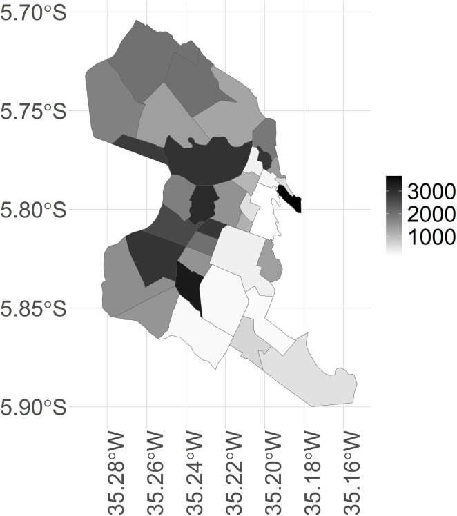
METHODOLOGY/PRINCIPAL FINDINGS: We analyzed dengue case reports by epidemiological week and neighborhood in Natal, RN from 2015 to 2018. Temporal conditional autoregressive models were fitted using the Integrated Nested Laplace Approximation method. The predictors included a set of entomological, climatic and sociosanitary indicators with temporal lags, along with structures of temporal and spatial dependence. Additionally, we used an offset term to represent the expected number of dengue cases per neighborhood at each epidemiological week, under the hypothesis of homogeneity in the occurrence of cases across the municipality. We forecasted dengue case counts for the subsequent four weeks, addressing both zero occurrences and fluctuations during non-zero periods. Weekly risk dynamics were visualized through predictive maps, enabling the timely identification of neighborhoods with high and persistent dengue risk, that is, areas consistently exhibiting a high number of dengue cases that remained concentrated in the same location for several weeks. The optimal model revealed a significant rise in dengue occurrence probability during the observation week, associated with increased cases in the previous week, the Aedes egg positivity index from the prior four weeks, and the mean daytime temperature 6-8 weeks earlier. Dengue risk also rose with a one-standard-deviation increase in the density of the impoverished population per occupied area and the mean Aedes egg density index from the preceding 3-5 weeks.
CONCLUSIONS/SIGNIFICANCE: The proposed Bayesian space-time analysis can contribute to the operational control of dengue and Aedes aegypti by identifying priority areas and forecasting dengue cases for the next four weeks. It also quantifies the effects of entomological, sociosanitary, climatic and demographic indicators on both the likelihood of dengue occurrence and the intensity of outbreaks.
城市虫媒病毒传播在空间和时间上具有异质性。通过考虑空间和时间同时变化的统计模型来估计登革热风险,能更真实地估计传播动态,有助于确定以监测和控制为重点的干预优先区域。这些模型还能进行预测,以支持对登革热、基孔肯雅热和寨卡等虫媒病毒的及时干预。
方法/主要发现:我们分析了2015年至2018年巴西里约热内卢州纳塔尔市按流行病学周和社区划分的登革热病例报告。使用集成嵌套拉普拉斯近似方法拟合时间条件自回归模型。预测变量包括一组具有时间滞后的昆虫学、气候和社会卫生指标,以及时间和空间依赖性结构。此外,我们使用一个偏移项来表示在全市病例发生均匀性假设下,每个流行病学周每个社区的登革热病例预期数量。我们预测了随后四周的登革热病例数,处理了零发病情况以及非零时期的波动。通过预测地图直观展示每周风险动态,能够及时识别登革热高风险且持续存在的社区,即那些连续数周一直有大量登革热病例且集中在同一地点的区域。最优模型显示,在观察周登革热发生概率显著上升,这与前一周病例增加、前四周的埃及伊蚊卵阳性指数以及6 - 8周前的平均日间温度有关。登革热风险也会随着每占用面积贫困人口密度增加一个标准差以及前3 - 5周平均埃及伊蚊卵密度指数的增加而上升。
结论/意义:所提出的贝叶斯时空分析可通过确定优先区域和预测未来四周的登革热病例,为登革热和埃及伊蚊的实际防控做出贡献。它还量化了昆虫学、社会卫生、气候和人口指标对登革热发生可能性和疫情爆发强度的影响。