Dammert Lucas, Thalmann Tomas, Monetti David, Neuner Hans-Berndt, Mandlburger Gottfried
Research Units Engineering Geodesy and Photogrammetry, Department Geodesy and Geoinformation, TU Wien, 1040 Vienna, Austria.
Skyability GmbH, 7011 Siegendorf, Austria.
Sensors (Basel). 2025 Jun 20;25(13):3838. doi: 10.3390/s25133838.
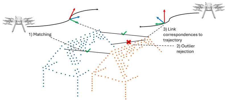
In our contribution, we conduct a thematic literature review on trajectory estimation using a decentralized multi-sensor system based on robotic total stations (RTS) with a focus on unmanned aerial system (UAS) platforms. While RTS are commonly used for trajectory estimation in areas where GNSS is not sufficiently accurate or is unavailable, they are rarely used for UAS trajectory estimation. Extending the RTS with integrated camera images allows for UAS pose estimation (position and orientation). We review existing research on the entire RTS measurement processes, including time synchronization, atmospheric refraction, prism interaction, and RTS-based image evaluation. Additionally, we focus on integrated trajectory estimation using UAS onboard measurements such as IMU and laser scanning data. Although many existing articles address individual steps of the decentralized multi-sensor system, we demonstrate that a combination of existing works related to UAS trajectory estimation and RTS calibration is needed to allow for trajectory estimation at sub-cm and sub-0.01 gon accuracies, and we identify the challenges that must be addressed. Investigations into the use of RTS for kinematic tasks must be extended to realistic distances (approx. 300-500 m) and speeds (>2.5 m s). In particular, image acquisition with the integrated camera must be extended by a time synchronization approach. As to the estimation of UAS orientation based on RTS camera images, the results of initial simulation studies must be validated by field tests, and existing approaches for integrated trajectory estimation must be adapted to optimally integrate RTS data.
在我们的论文中,我们对基于机器人全站仪(RTS)的分散式多传感器系统进行了轨迹估计的主题文献综述,重点关注无人机(UAS)平台。虽然RTS通常用于全球导航卫星系统(GNSS)不够精确或无法使用的区域的轨迹估计,但它们很少用于无人机轨迹估计。通过集成相机图像扩展RTS可实现无人机姿态估计(位置和方向)。我们回顾了关于整个RTS测量过程的现有研究,包括时间同步、大气折射、棱镜相互作用以及基于RTS的图像评估。此外,我们关注使用无人机机载测量(如惯性测量单元(IMU)和激光扫描数据)进行的集成轨迹估计。尽管许多现有文章讨论了分散式多传感器系统的各个步骤,但我们证明,需要将与无人机轨迹估计和RTS校准相关的现有工作结合起来,才能实现亚厘米和亚0.01弧度精度的轨迹估计,并且我们确定了必须解决的挑战。对RTS在运动任务中的使用的研究必须扩展到实际距离(约300 - 500米)和速度(>2.5米/秒)。特别是,必须通过时间同步方法扩展集成相机的图像采集。关于基于RTS相机图像的无人机方向估计,初始模拟研究的结果必须通过现场测试进行验证,并且必须调整现有的集成轨迹估计方法,以最佳地集成RTS数据。