Unité Epidémiologie, Institut Pasteur de Madagascar, BP 1274, Antananarivo (101), Madagascar.
BMC Infect Dis. 2010 Feb 5;10:21. doi: 10.1186/1471-2334-10-21.
Tuberculosis (TB), an infectious disease caused by the Mycobacterium tuberculosis is endemic in Madagascar. The capital, Antananarivo is the most seriously affected area. TB had a non-random spatial distribution in this setting, with clustering in the poorer areas. The aim of this study was to explore this pattern further by a Bayesian approach, and to measure the associations between the spatial variation of TB risk and national control program indicators for all neighbourhoods.
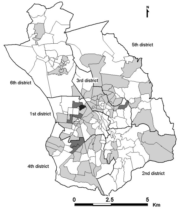
Combination of a Bayesian approach and a generalized linear mixed model (GLMM) was developed to produce smooth risk maps of TB and to model relationships between TB new cases and national TB control program indicators. The TB new cases were collected from records of the 16 Tuberculosis Diagnostic and Treatment Centres (DTC) of the city from 2004 to 2006. And five TB indicators were considered in the analysis: number of cases undergoing retreatment, number of patients with treatment failure and those suffering relapse after the completion of treatment, number of households with more than one case, number of patients lost to follow-up, and proximity to a DTC.
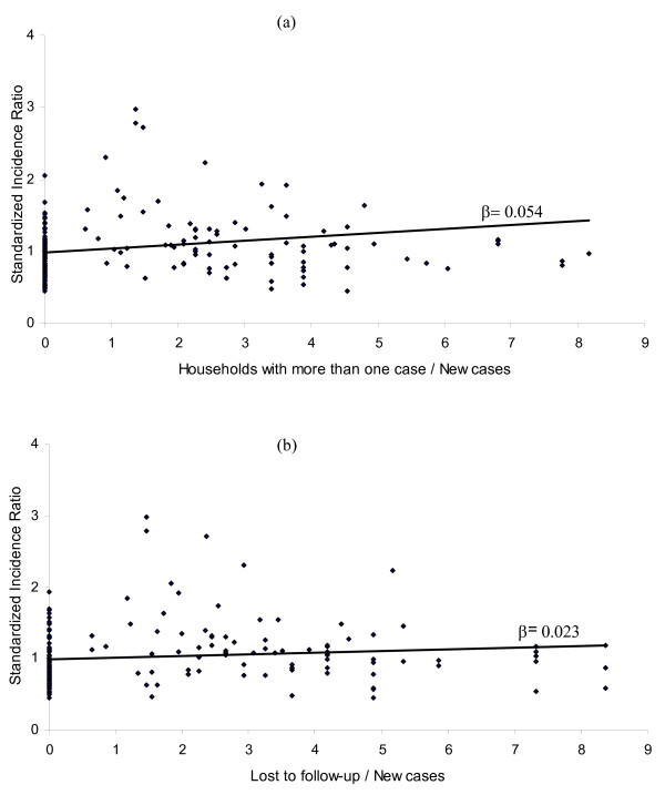
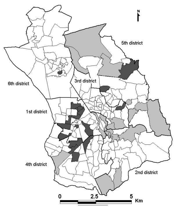
In Antananarivo, 43.23% of the neighbourhoods had a standardized incidence ratio (SIR) above 1, of which 19.28% with a TB risk significantly higher than the average. Identified high TB risk areas were clustered and the distribution of TB was found to be associated mainly with the number of patients lost to follow-up (SIR: 1.10, CI 95%: 1.02-1.19) and the number of households with more than one case (SIR: 1.13, CI 95%: 1.03-1.24).
The spatial pattern of TB in Antananarivo and the contribution of national control program indicators to this pattern highlight the importance of the data recorded in the TB registry and the use of spatial approaches for assessing the epidemiological situation for TB. Including these variables into the model increases the reproducibility, as these data are already available for individual DTCs. These findings may also be useful for guiding decisions related to disease control strategies.
结核病(TB)是一种由结核分枝杆菌引起的传染病,在马达加斯加流行。首都塔那那利佛是受影响最严重的地区。在这种情况下,结核病的空间分布没有随机性,而是在较贫困的地区呈聚集性。本研究旨在通过贝叶斯方法进一步探讨这种模式,并衡量所有社区的结核病风险的空间变化与国家结核病控制规划指标之间的关联。
开发了一种贝叶斯方法和广义线性混合模型(GLMM)的组合,以生成结核病的平滑风险图,并对结核病新发病例与国家结核病控制规划指标之间的关系进行建模。结核病新发病例来自 2004 年至 2006 年城市 16 个结核病诊断和治疗中心(DTC)的记录。在分析中考虑了五个结核病指标:接受复治的病例数、治疗失败和治疗完成后复发的患者数、有一个以上病例的家庭数、失访患者数以及与 DTC 的距离。
在塔那那利佛,43.23%的社区标准化发病比(SIR)高于 1,其中 19.28%的社区结核病风险显著高于平均水平。确定的高结核病风险区域呈聚集性分布,结核病的分布与失访患者人数(SIR:1.10,95%CI:1.02-1.19)和有一个以上病例的家庭数(SIR:1.13,95%CI:1.03-1.24)密切相关。
塔那那利佛的结核病空间模式以及国家控制规划指标对该模式的贡献,突出了结核病登记处记录的数据和空间方法评估结核病流行病学情况的重要性。将这些变量纳入模型可提高可重复性,因为这些数据已经可用于各个 DTC。这些发现也可能有助于指导与疾病控制策略相关的决策。