Storeygard Adam, Balk Deborah, Levy Marc, Deane Glenn
Department of Economics, Brown University, Providence, RI 02912.
Popul Space Place. 2008 May;14(3):209-229. doi: 10.1002/psp.484. Epub 2008 Mar 25.
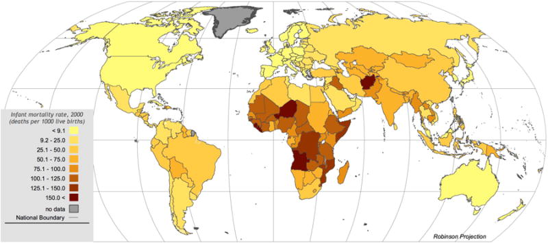
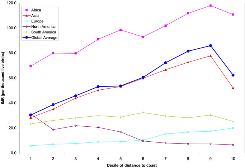
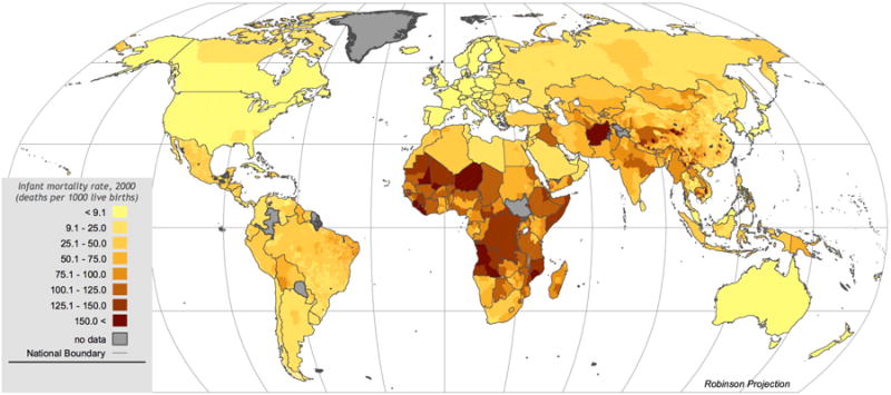
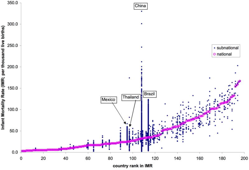
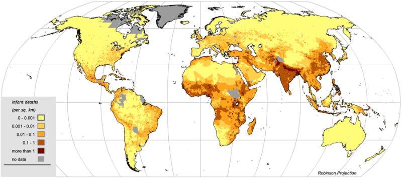
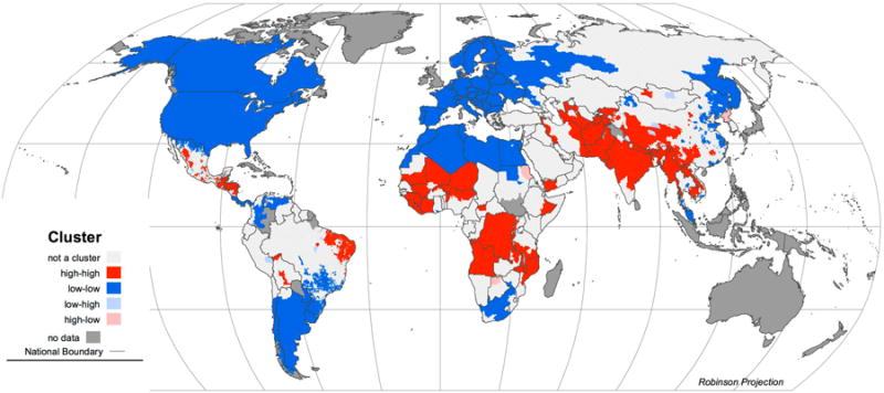
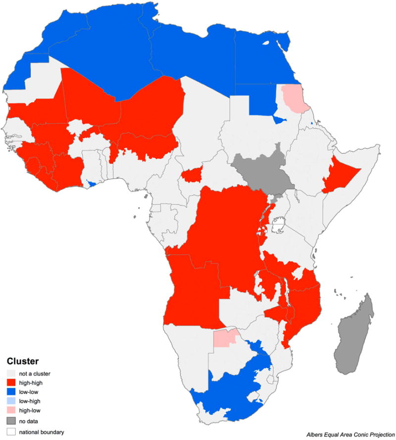
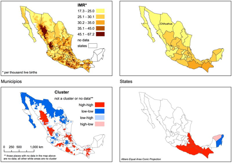
We describe the compilation of a spatially explicit dataset detailing infant mortality rates in over 10,000 national and subnational units worldwide, benchmarked to the year 2000. Although their resolution is highly variable, subnational data are available for countries representing over 90% of non-OECD population. Concentration of global infant deaths is higher than implied by national data alone. Assigning both national and subnational data to map grid cells so that they may be easily integrated with other geographic data, we generate infant mortality rates for environmental regions, including biomes and coastal zones, by continent. Rates for these regions also show striking refinements from the use of the higher resolution data. Possibilities and limitations for related work are discussed.
我们描述了一个空间明确的数据集的编制情况,该数据集详细记录了全球10000多个国家和次国家单位的婴儿死亡率,并以2000年为基准。尽管次国家数据的分辨率差异很大,但90%以上非经合组织人口的国家都有次国家数据。全球婴儿死亡的集中程度高于仅由国家数据所显示的情况。我们将国家和次国家数据分配到地图网格单元中,以便它们能够轻松地与其他地理数据整合,从而生成各大洲环境区域(包括生物群落和沿海地带)的婴儿死亡率。这些区域的死亡率也因使用了更高分辨率的数据而有显著改善。我们还讨论了相关工作的可能性和局限性。