School of Earth Sciences, University of Bristol, Queen's Road, Bristol BS8 1RJ, UK.
Roy M. Huffington Department of Earth Sciences, Southern Methodist University, P.O. Box 750395, Dallas, Texas 75275-0395, USA.
Nat Commun. 2014 Apr 3;5:3471. doi: 10.1038/ncomms4471.
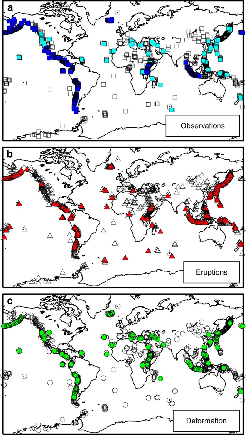
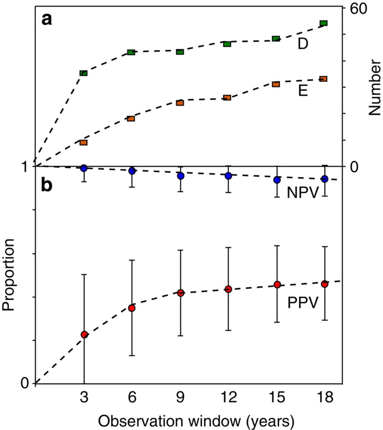
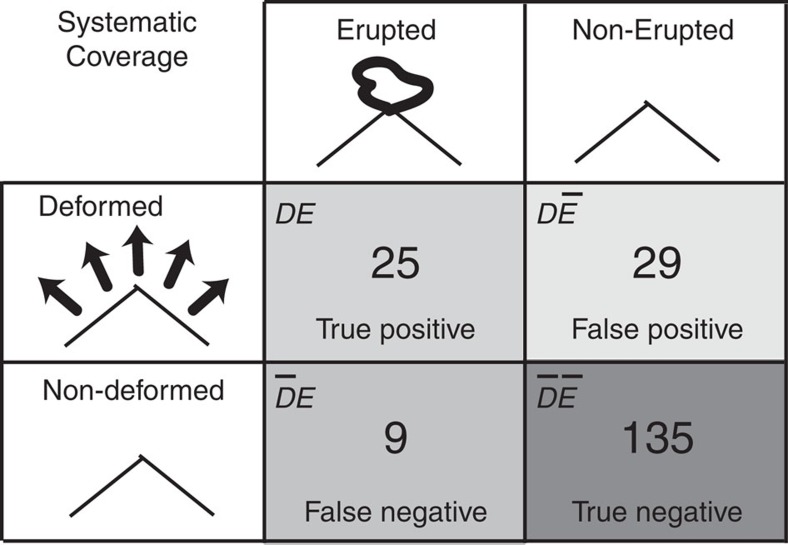
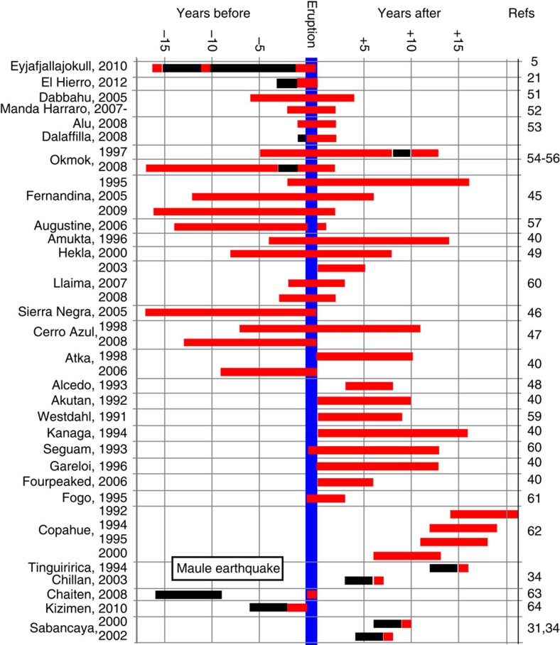
A key challenge for volcanological science and hazard management is that few of the world's volcanoes are effectively monitored. Satellite imagery covers volcanoes globally throughout their eruptive cycles, independent of ground-based monitoring, providing a multidecadal archive suitable for probabilistic analysis linking deformation with eruption. Here we show that, of the 198 volcanoes systematically observed for the past 18 years, 54 deformed, of which 25 also erupted. For assessing eruption potential, this high proportion of deforming volcanoes that also erupted (46%), together with the proportion of non-deforming volcanoes that did not erupt (94%), jointly represent indicators with 'strong' evidential worth. Using a larger catalogue of 540 volcanoes observed for 3 years, we demonstrate how this eruption-deformation relationship is influenced by tectonic, petrological and volcanic factors. Satellite technology is rapidly evolving and routine monitoring of the deformation status of all volcanoes from space is anticipated, meaning probabilistic approaches will increasingly inform hazard decisions and strategic development.
火山学科学和灾害管理面临的一个主要挑战是,世界上很少有火山得到有效监测。卫星图像在整个喷发周期内对全球的火山进行监测,独立于地面监测,提供了一个适合进行概率分析的数十年档案,将变形与喷发联系起来。在这里,我们表明,在过去 18 年中系统观测的 198 座火山中,有 54 座发生了变形,其中 25 座也发生了喷发。为了评估喷发潜力,这种同时发生变形和喷发的火山比例(46%),以及没有发生变形的火山喷发比例(94%),共同代表了具有“强”证据价值的指标。使用一个更大的目录,即对 540 座火山进行 3 年观测,我们展示了这种喷发-变形关系如何受到构造、岩石学和火山因素的影响。卫星技术正在迅速发展,预计从太空对所有火山的变形状态进行常规监测,这意味着概率方法将越来越多地为灾害决策和战略发展提供信息。