Pearson Amber L
Department of Geography, Environment and Spatial Sciences, Michigan State University, East Lansing, MI, 48824, USA.
Environmental Science and Policy Program, Michigan State University, East Lansing, MI, 48824, USA.
Int J Health Geogr. 2016 Sep 20;15(1):33. doi: 10.1186/s12942-016-0062-8.
Most water access studies involve self-reported measures such as time spent or simple spatial measures such as Euclidean distance from home to source. GPS-based measures of access are often considered actual access and have shown little correlation with self-reported measures. One main obstacle to widespread use of GPS-based measurement of access to water has been technological limitations (e.g., battery life). As such, GPS-based measures have been limited by time and in sample size.
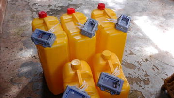
The aim of this pilot study was to develop and test a novel GPS unit, (≤4-week battery life, waterproof) to measure access to water. The GPS-based method was pilot-tested to estimate number of trips per day, time spent and distance traveled to source for all water collected over a 3-day period in five households in south-western Uganda. This method was then compared to self-reported measures and commonly used spatial measures of access for the same households.
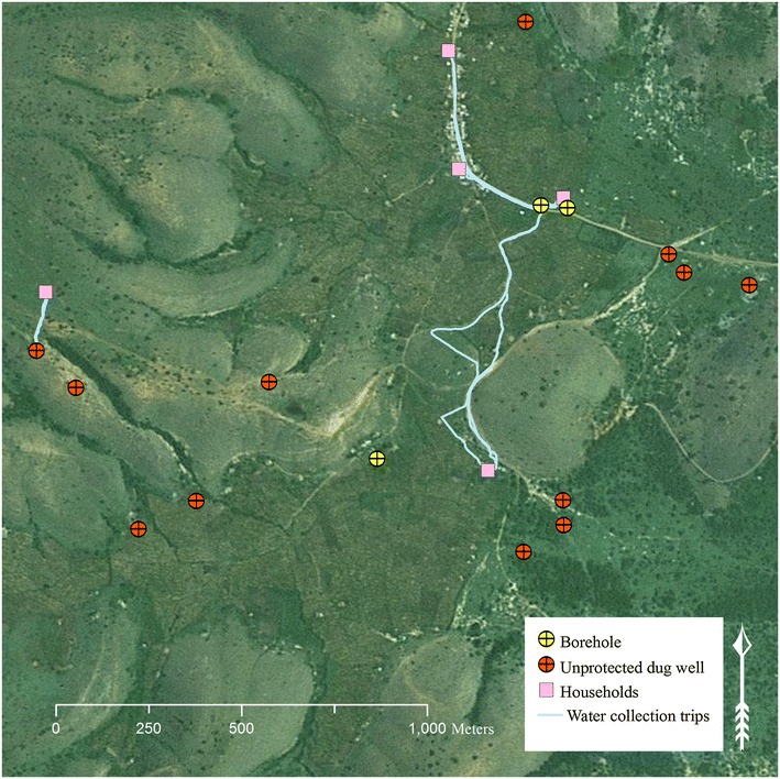
Time spent collecting water was significantly overestimated using a self-reported measure, compared to GPS-based (p < 0.05). In contrast, both the GIS Euclidean distances to nearest and actual primary source significantly underestimated distances traveled, compared to the GPS-based measurement of actual travel paths to water source (p < 0.05). Households did not consistently collect water from the source nearest their home. Comparisons between the GPS-based measure and self-reported meters traveled were not made, as respondents did not feel that they could accurately estimate distance. However, there was complete agreement between self-reported primary source and GPS-based.
Reliance on cross-sectional self-reported or simple GIS measures leads to misclassification in water access measurement. This new method offers reductions in such errors and may aid in understanding dynamic measures of access to water for health studies.
大多数获取水源的研究采用自我报告的测量方法,如花费的时间,或简单的空间测量方法,如从家到水源的欧几里得距离。基于全球定位系统(GPS)的获取水源测量方法通常被视为实际获取情况,且与自我报告的测量方法相关性不大。基于GPS的水源获取测量方法广泛应用的一个主要障碍是技术限制(如电池续航时间)。因此,基于GPS的测量方法在时间和样本量方面都受到限制。
本试点研究的目的是开发并测试一种新型GPS设备(电池续航时间≤4周,防水),用于测量水源获取情况。在乌干达西南部的五户家庭中,对基于GPS的方法进行了试点测试,以估计在3天内收集所有水源的每日出行次数、花费的时间和前往水源的距离。然后将该方法与这些家庭的自我报告测量方法以及常用的获取水源空间测量方法进行比较。
与基于GPS的测量方法相比,使用自我报告测量方法时,收集水所花费的时间被显著高估(p<0.05)。相比之下,与基于GPS的实际前往水源路径测量相比,地理信息系统(GIS)到最近水源和实际主要水源的欧几里得距离均显著低估了出行距离(p<(0.05))。家庭并非始终从离家最近的水源取水。由于受访者认为无法准确估计距离,因此未对基于GPS的测量方法与自我报告的出行距离进行比较。然而,自我报告的主要水源与基于GPS的测量结果完全一致。
依赖横断面自我报告或简单的GIS测量方法会导致水源获取测量中的错误分类。这种新方法可减少此类误差,并可能有助于在健康研究中理解获取水源的动态测量情况。