Zhang Xinping, Wang Dexiang, Hao Hongke, Zhang Fangfang, Hu Youning
College of Forestry, Northwest A&F University, Yangling 712100, China.
Tourism Department, Shaanxi Vocational & Technical College, Xi'an 710100, China.
Int J Environ Res Public Health. 2017 Jul 26;14(8):840. doi: 10.3390/ijerph14080840.
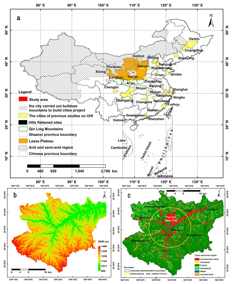
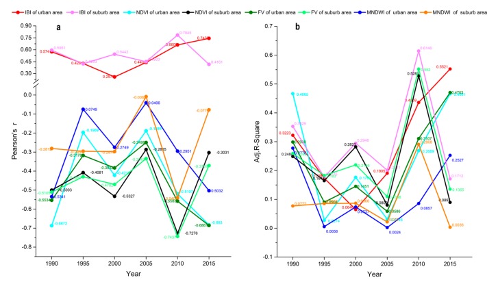
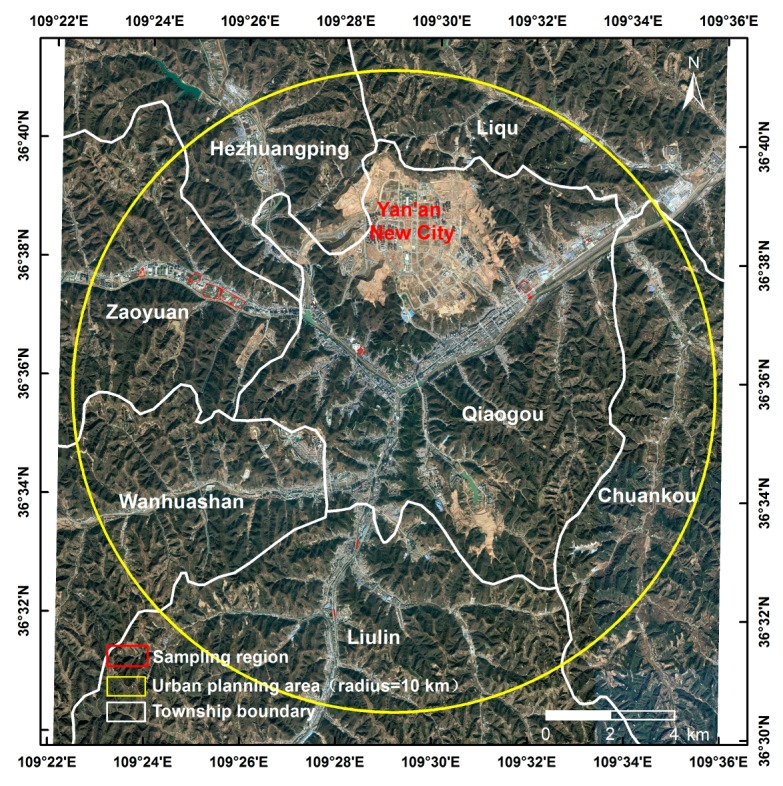
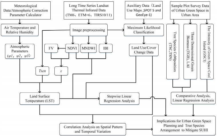
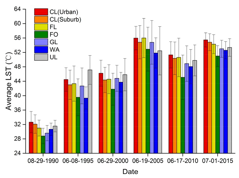
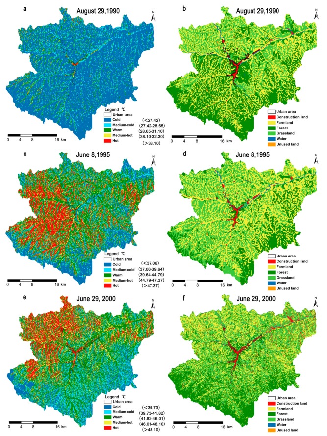
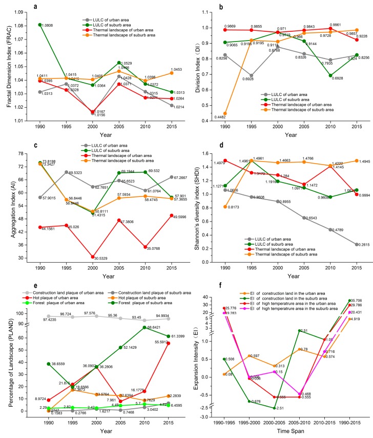
In this study Yan'an City, a typical hilly valley city, was considered as the study area in order to explain the relationships between the surface urban heat island (SUHI) and land use/land cover (LULC) types, the landscape pattern metrics of LULC types and land surface temperature (LST) and remote sensing indexes were retrieved from Landsat data during 1990-2015, and to find factors contributed to the green space cool island intensity (GSCI) through field measurements of 34 green spaces. The results showed that during 1990-2015, because of local anthropogenic activities, SUHI was mainly located in lower vegetation cover areas. There was a significant suburban-urban gradient in the average LST, as well as its heterogeneity and fluctuations. Six landscape metrics comprising the fractal dimension index, percentage of landscape, aggregation index, division index, Shannon's diversity index, and expansion intensity of the classified LST spatiotemporal changes were paralleled to LULC changes, especially for construction land, during the past 25 years. In the urban area, an index-based built-up index was the key positive factor for explaining LST increases, whereas the normalized difference vegetation index and modified normalized difference water index were crucial factors for explaining LST decreases during the study periods. In terms of the heat mitigation performance of green spaces, mixed forest was better than pure forest, and the urban forest configuration had positive effects on GSCI. The results of this study provide insights into the importance of species choice and the spatial design of green spaces for cooling the environment.
在本研究中,以典型的丘陵河谷城市延安市为研究区域,旨在阐释城市地表热岛(SUHI)与土地利用/土地覆盖(LULC)类型之间的关系,从1990 - 2015年的陆地卫星数据中获取LULC类型的景观格局指标、地表温度(LST)以及遥感指数,并通过对34个绿地的实地测量找出影响绿地冷岛强度(GSCI)的因素。结果表明,在1990 - 2015年期间,由于当地的人为活动,SUHI主要位于植被覆盖较低的区域。平均LST及其异质性和波动存在显著的城郊梯度。在过去25年中,包括分形维数指数、景观百分比、聚集指数、分割指数、香农多样性指数以及分类LST时空变化的扩展强度在内的六个景观指标与LULC变化平行,尤其是建设用地。在城市区域,基于指数的建成区指数是解释LST升高的关键正向因素,而归一化植被指数和改进的归一化差异水体指数是解释研究期间LST降低的关键因素。就绿地的降温性能而言,混交林优于纯林,城市森林配置对GSCI有积极影响。本研究结果为物种选择和绿地空间设计对环境降温的重要性提供了见解。