Ben Ramadan Awatef Ahmed, Jackson-Thompson Jeannette, Schmaltz Chester Lee
Missouri Cancer Registry and Research Center, University of Missouri-Columbia.
School of Medicine Department of Health Management and Informatics, University of Missouri-Columbia.
Online J Public Health Inform. 2017 Dec 30;9(3):e197. doi: 10.5210/ojphi.v9i3.8084. eCollection 2017.
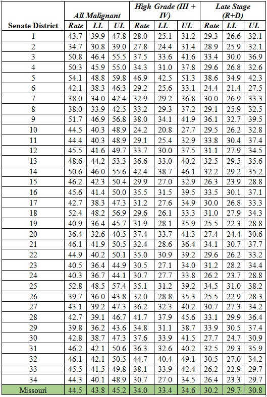
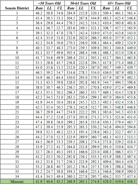
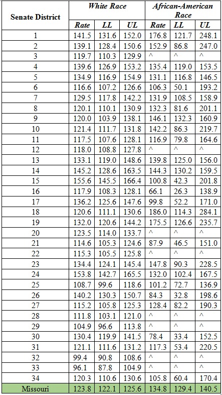
To measure and interactively visualize female breast cancer (FBC) incidence rates in Missouri by age, race, stage and grade, and senate district of residence at diagnosis from 2008 to 2012.
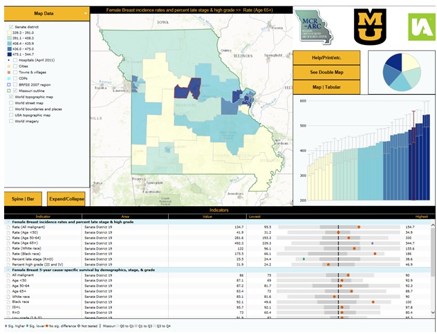
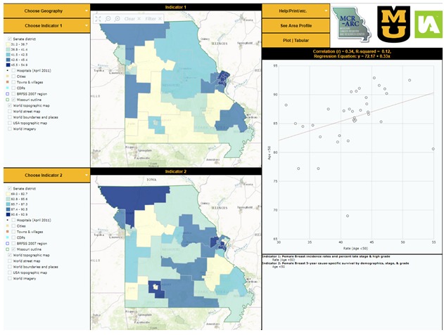
An observational epidemiological study. The FBC cases in counties split by senate districts were geocoded. Population database was created. A database was created within SEER*Stat. The incidence rates and the 95% Confidence Interval (CI) were age standardized using US 2000 Standard Population. The Census Bureau's Cartographic Boundary Files were used to create maps showing Missouri senate districts. Incidence results were loaded along with the maps into InstantAtlas™ software to produce interactive reports.
Cancer profiles were created for all 34 Missouri senate districts. An area profile and a double map that included interactive maps, graphs, and tables for the 34 Missouri senate districts were built.
The results may provide an estimation of social inequality within the state and could provide clues about the impact of level of coverage and accessibility to screening and health care services on disease prevention and early diagnosis.
测量并以交互方式可视化2008年至2012年密苏里州女性乳腺癌(FBC)的发病率,按年龄、种族、分期、分级以及诊断时居住的参议院选区划分。
一项观察性流行病学研究。按参议院选区划分各县的FBC病例进行地理编码。创建人口数据库。在SEER*Stat内创建一个数据库。发病率和95%置信区间(CI)使用美国2000年标准人口进行年龄标准化。利用人口普查局的制图边界文件创建显示密苏里州参议院选区的地图。将发病率结果与地图一起加载到InstantAtlas™软件中以生成交互式报告。
为密苏里州所有34个参议院选区创建了癌症概况。构建了一个地区概况以及一幅双地图,其中包括密苏里州34个参议院选区的交互式地图、图表和表格。
研究结果可能为该州的社会不平等情况提供一个估计,并可为筛查和医疗服务的覆盖水平及可及性对疾病预防和早期诊断的影响提供线索。