Doctoral Program on Space Technology Applications, Beijing 100191, China.
School of Electronic and Information Engineering, Beihang University, Beijing 100191, China.
Sensors (Basel). 2018 Oct 8;18(10):3350. doi: 10.3390/s18103350.
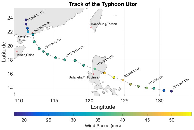
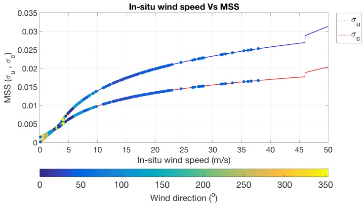
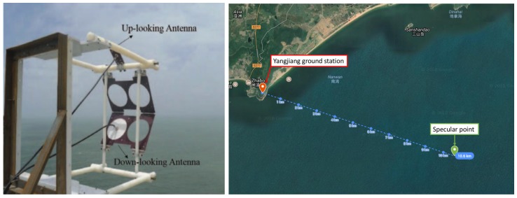
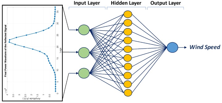
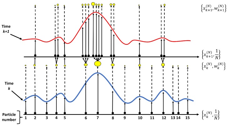
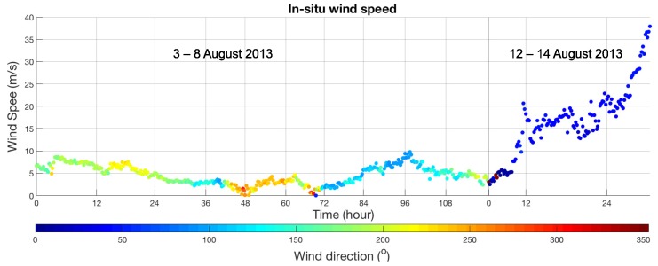
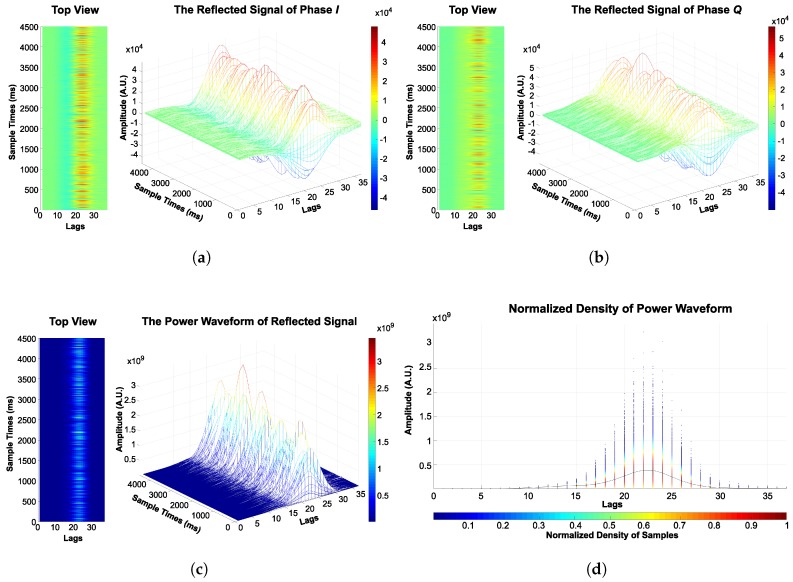
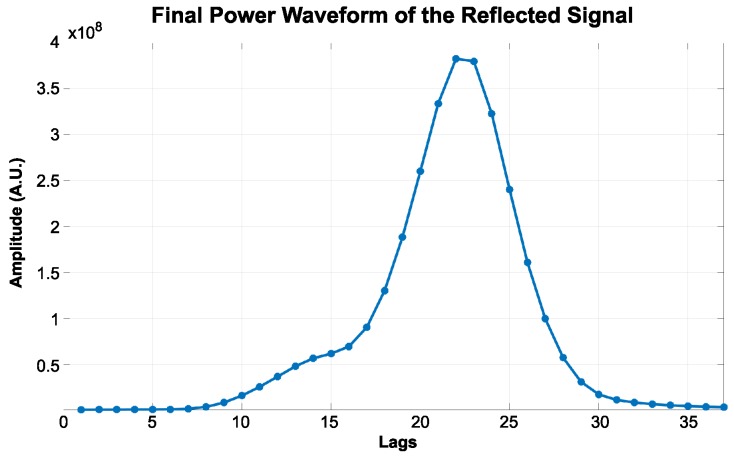
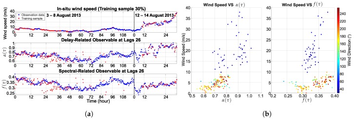
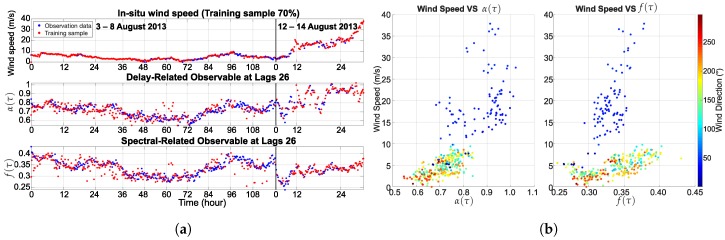
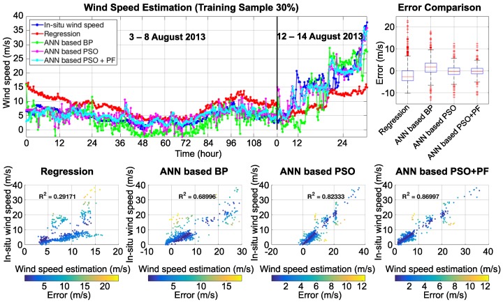
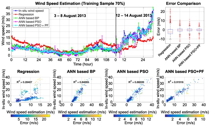
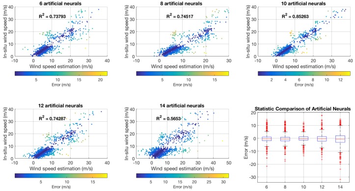
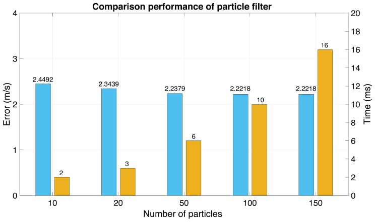
Oceanographic remote sensing, which is based on the sensitivity of reflected signals from the Global Navigation Satellite Systems (GNSS), so-called GNSS-Reflectometry (GNSS-R), is very useful for the observation of ocean wind speed. Wind speed estimation over the ocean is the core factor in maritime transportation management and the study of climate change. The main concept of the GNSS-R technique is using the different times between the reflected and the direct signals to measure the wind speed and wind direction. Accordingly, this research proposes a novel technique for wind speed estimation involving the integration of an artificial neural network and the particle filter based on a theoretical model. Moreover, particle swarm optimization was applied to find the optimal weight and bias of the artificial neural network, in order to improve the accuracy of the estimation result. The observation dataset of the reflected signal information from BeiDou Geostationary Earth Orbit (GEO) satellite number 4 was used as an input for the estimation model. The data consisted of two phases with and components. Two periods of BeiDou data were selected, the first period was from 3 to 8 August 2013 and the second period was from 12 to 14 August 2013, which corresponded to events from the typhoon Utor. The in situ wind speed measurement collected from the buoy station was used to validate the results. A coastal experiment was conducted at the Yangjiang site located in the South China Sea. The results show the ability of the proposed technique to estimate wind speed with a root mean square error of approximately 1.9 m/s.
海洋遥感基于全球导航卫星系统(GNSS)反射信号的敏感性,即所谓的 GNSS-Reflectometry(GNSS-R),对于观测海洋风速非常有用。海洋风速估计是海上运输管理和气候变化研究的核心因素。GNSS-R 技术的主要概念是利用反射和直射信号之间的不同时间来测量风速和风向。因此,本研究提出了一种基于理论模型的风速估计新方法,该方法结合了人工神经网络和粒子滤波器。此外,还应用粒子群优化算法来寻找人工神经网络的最优权重和偏差,以提高估计结果的准确性。将北斗静止地球轨道(GEO)卫星 4 的反射信号信息观测数据集用作估计模型的输入。数据由 和 两个分量组成。选择了两个北斗数据周期,第一个周期是 2013 年 8 月 3 日至 8 日,第二个周期是 2013 年 8 月 12 日至 14 日,对应于 Utor 台风事件。使用从浮标站收集的现场风速测量数据来验证结果。在南海的阳江站点进行了沿海实验。结果表明,该技术具有以大约 1.9 m/s 的均方根误差估计风速的能力。