Department of Architecture, Built Environment and Construction Engineering (DABC), Politecnico di Milano, 20133 Milano, Italy.
College of Surveying and Geo-Informatics, Tongji University, Shanghai 200092, China.
Sensors (Basel). 2018 Oct 29;18(11):3682. doi: 10.3390/s18113682.
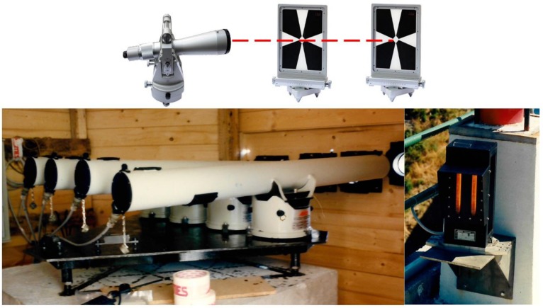
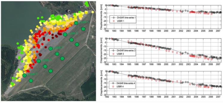
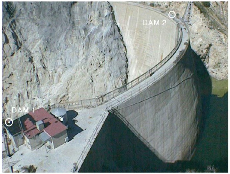
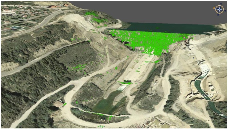
In recent years, the measurement of dam displacements has benefited from a great improvement of existing technology, which has allowed a higher degree of automation. This has led to data collection with an improved temporal and spatial resolution. Robotic total stations and GNSS (Global Navigation Satellite System) techniques, often in an integrated manner, may provide efficient solutions for measuring 3D displacements on precise locations on the outer surfaces of dams. On the other hand, remote-sensing techniques, such as terrestrial laser scanning, ground-based SAR (synthetic aperture radar) and satellite differential interferometric SAR offer the chance to extend the observed region to a large portion of a structure and its surrounding areas, integrating the information that is usually provided in a limited number of in-situ control points. The design and implementation of integrated monitoring systems have been revealed as a strategic solution to analyze different situations in a spatial and temporal context. Research devoted to the optimization of data processing tools has evolved with the aim of improving the accuracy and reliability of the measured deformations. The analysis of the observed data for the interpretation and prediction of dam deformations under external loads has been largely investigated on the basis of purely statistical or deterministic methods. The latter may integrate observation from geodetic, remote-sensing and geotechnical/structural sensors with mechanical models of the dam structure. In this paper, a review of the available technologies for dam deformation monitoring is provided, including those sensors that are already applied in routinary operations and some experimental solutions. The aim was to support people who are working in this field to have a complete view of existing solutions, as well as to understand future directions and trends.
近年来,大坝位移测量得益于现有技术的重大改进,这使得自动化程度更高。这导致以更高的时空分辨率进行数据采集。机器人全站仪和全球导航卫星系统(GNSS)技术,通常以集成的方式,可以为在大坝外表面的精确位置测量三维位移提供有效的解决方案。另一方面,遥感技术,如地面激光扫描、地基合成孔径雷达(SAR)和卫星差分干涉 SAR,为扩展观测区域提供了机会,将结构及其周围区域的信息整合到通常在有限数量的现场控制点提供的信息中。集成监测系统的设计和实施已被证明是一种分析空间和时间背景下不同情况的战略解决方案。致力于优化数据处理工具的研究旨在提高测量变形的准确性和可靠性。根据纯粹的统计或确定性方法,对观测数据进行了大量分析,以解释和预测大坝在外荷载作用下的变形。后者可以将大地测量、遥感和岩土/结构传感器的观测与大坝结构的力学模型相结合。本文对大坝变形监测的现有技术进行了综述,包括已在常规作业中应用的传感器和一些实验解决方案。目的是为从事该领域工作的人员提供对现有解决方案的全面了解,以及了解未来的方向和趋势。