Tattoni Clara, Soardi Erica, Prosser Filippo, Odasso Maurizio, Zatelli Paolo, Ciolli Marco
Dipartimento di Ingegneria Civile Ambientale e Meccanica, Università degli Studi di Trento, Trento, Italy.
Sezione di Botanica, Fondazione Museo Civico di Rovereto, Rovereto, Italy.
PeerJ. 2019 Feb 5;7:e6394. doi: 10.7717/peerj.6394. eCollection 2019.
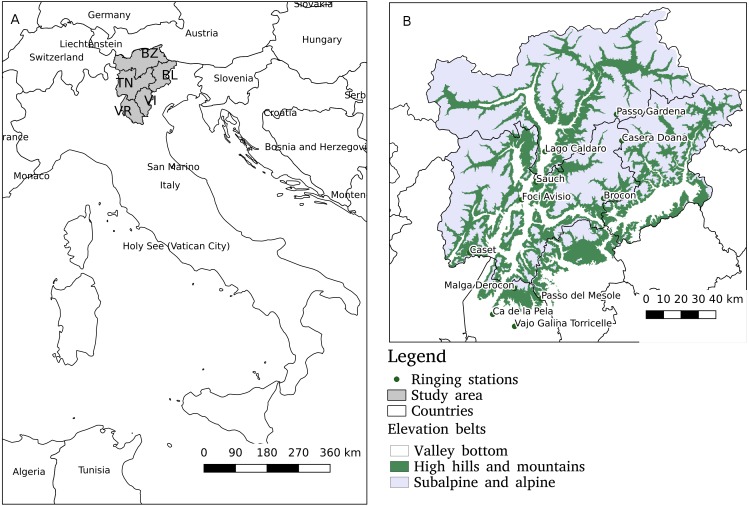
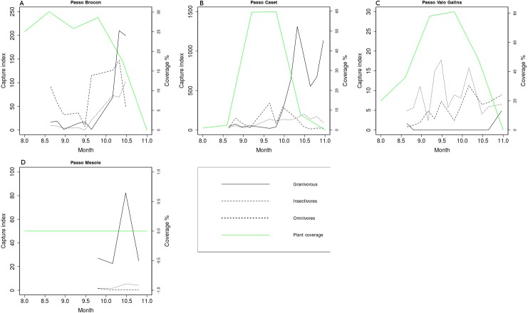
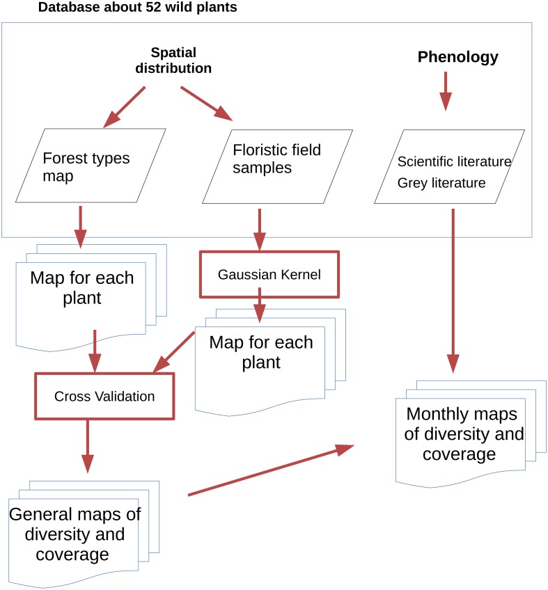
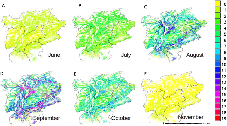
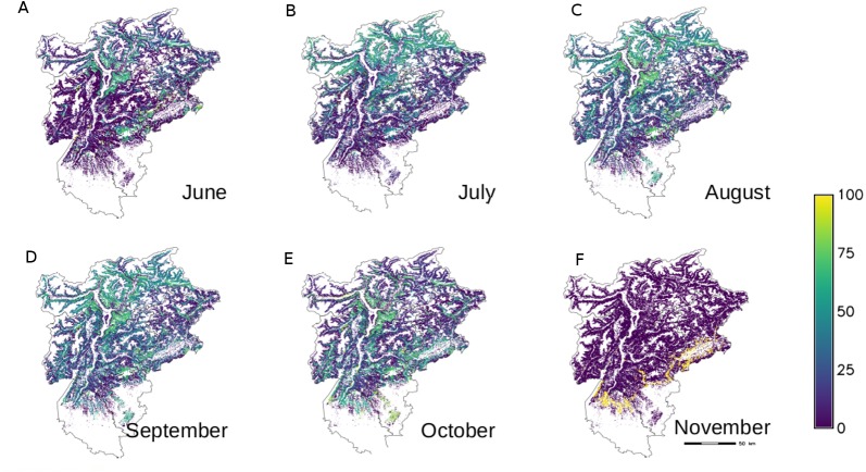
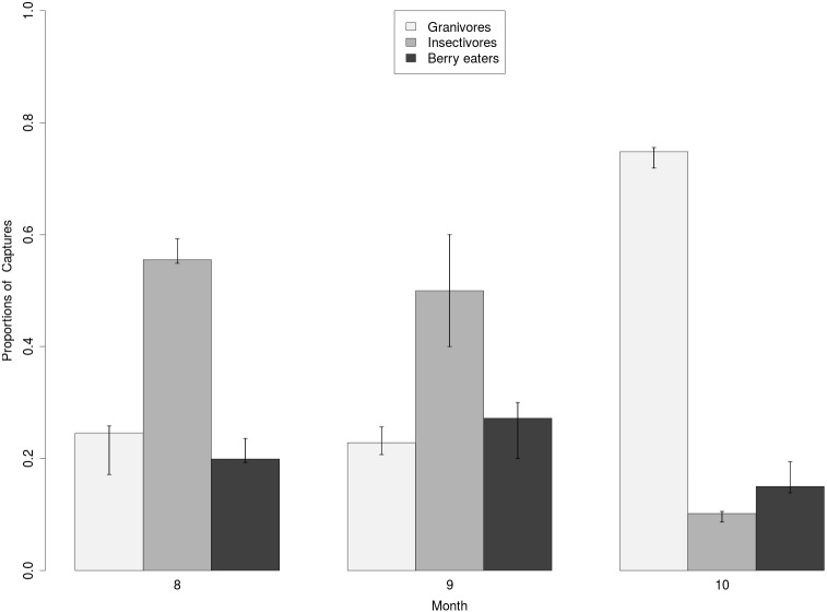
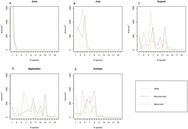
Bird migration is a widely studied phenomenon, however many factors that influence migratory flows remain unknown or poorly understood. Food availability en route is particularly important for many species and can affect their migration success, pattern and timing but this relationship has not been addressed at a wide scale due to the lack of spatial models of food availability on the terrain. This work presents a GIS-database approach that combines spatial and non-spatial ecological information in order to map fruit availability from vegetation over time in the SE Alps, an important node of European migratory routes. We created a unique database that contains information on the presence and periods of fructification of 52 wild plants carrying berries and a series of original cartographic themes. The presence and coverage of the plant species was modelled with the geo-statistical method of the Gaussian Kernel, which was validated against the ground truth of field sampling data with a correct classification power above 80% in most cases. The highest fruit availability in the study area during September and October co-occurs with the peak of captures of berry eating birds. The maps created and distributed along this work can be useful to address more detailed studies about stopover sites as well as the spatial ecology of other fruit eating animals.
鸟类迁徙是一个被广泛研究的现象,然而,许多影响迁徙流动的因素仍然未知或了解甚少。沿途的食物供应对许多物种尤为重要,可能会影响它们的迁徙成功率、模式和时间,但由于缺乏地形上食物供应的空间模型,这种关系尚未在大范围内得到探讨。这项研究提出了一种地理信息系统(GIS)数据库方法,该方法结合了空间和非空间生态信息,以便绘制欧洲迁徙路线重要节点——东南阿尔卑斯山地区随时间变化的植被果实可获取情况。我们创建了一个独特的数据库,其中包含52种结浆果野生植物的结果实存在情况和时期的信息,以及一系列原始的制图主题。利用高斯核的地质统计学方法对植物物种的存在和覆盖情况进行建模,在大多数情况下,该方法通过与实地采样数据的地面实况进行验证,正确分类能力超过80%。研究区域内9月和10月果实可获取量最高的时期与食浆果鸟类捕获量的峰值同时出现。这项研究中创建并发布的地图有助于开展关于中途停歇地以及其他食果动物空间生态学的更详细研究。