Planetary Science Institute, 1700 East Fort Lowell Road, Suite 106, Tucson, AZ, 85719-2395, USA.
Department of Hydrology & Atmospheric Sciences, University of Arizona, Tucson, AZ, 85721, USA.
Sci Rep. 2019 Feb 25;9(1):4045. doi: 10.1038/s41598-019-39632-1.
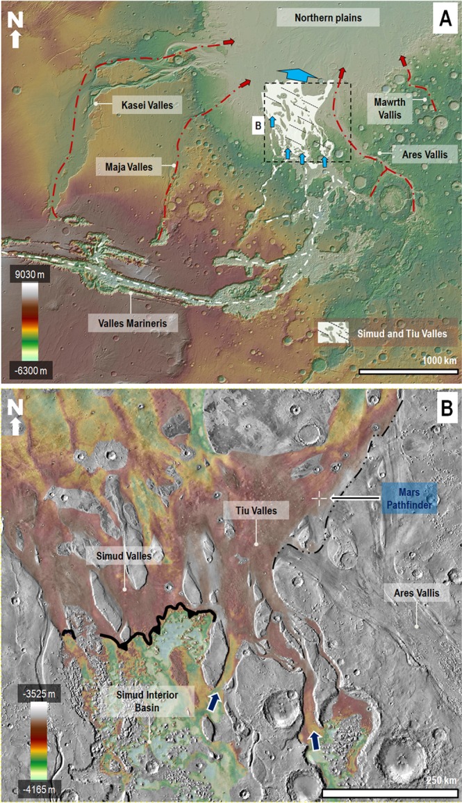
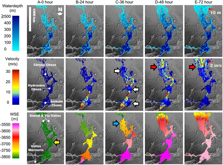
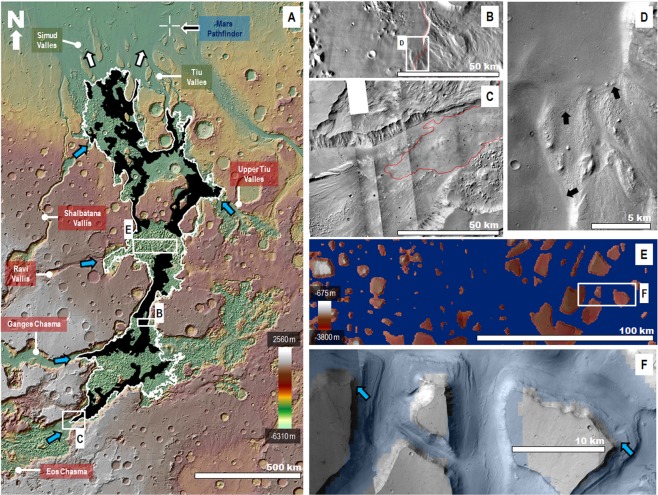
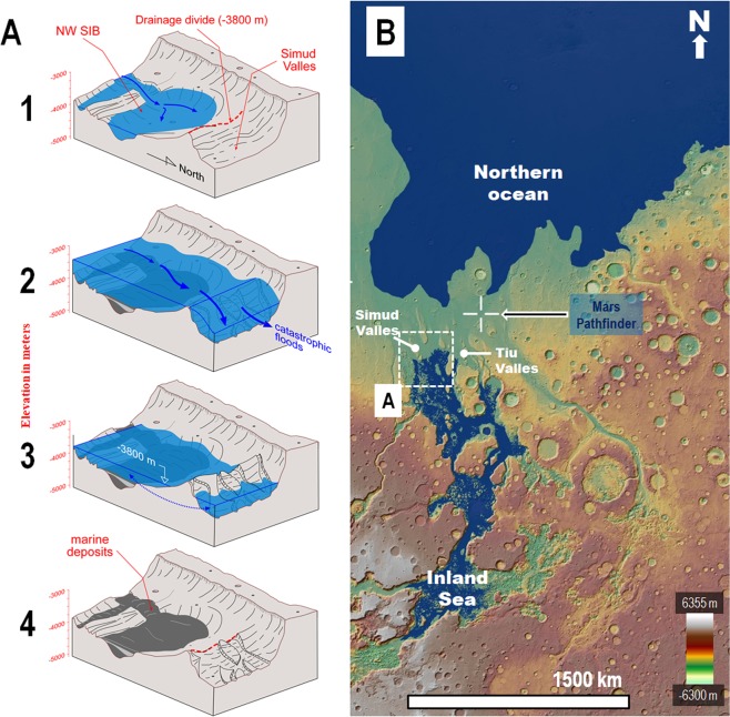
The Martian outflow channels comprise some of the largest known channels in the Solar System. Remote-sensing investigations indicate that cataclysmic floods likely excavated the channels ~3.4 Ga. Previous studies show that, in the southern circum-Chryse region, their flooding pathways include hundreds of kilometers of channel floors with upward gradients. However, the impact of the reversed channel-floor topography on the cataclysmic floods remains uncertain. Here, we show that these channel floors occur within a vast basin, which separates the downstream reaches of numerous outflow channels from the northern plains. Consequently, floods propagating through these channels must have ponded, producing an inland sea, before reaching the northern plains as enormous spillover discharges. The resulting paleohydrological reconstruction reinterprets the 1997 Pathfinder landing site as part of a marine spillway, which connected the inland sea to a hypothesized northern plains ocean. Our flood simulation shows that the presence of the sea would have permitted the propagation of low-depth floods beyond the areas of reversed channel-floor topography. These results explain the formation at the landing site of possible fluvial features indicative of flow depths at least an order of magnitude lower than those apparent from the analyses of orbital remote-sensing observations.
火星外流河道是太阳系中已知的最大的河道之一。遥感调查表明,这些河道很可能是在 34 亿年前由灾难性洪水冲刷形成的。先前的研究表明,在南方的“环形赫斯区”,洪水的路径包括数百公里长的具有向上坡度的河道底部。然而,河道底部地形的反转对灾难性洪水的影响仍不确定。在这里,我们表明这些河道底部位于一个巨大的盆地内,该盆地将众多外流河道的下游与北部平原分隔开来。因此,通过这些河道传播的洪水必须在到达北部平原形成巨大的溢出排放之前先蓄水形成一个内陆海。由此产生的古水文学重建将 1997 年“探路者”着陆点重新解释为一个海洋溢洪道的一部分,该溢洪道将内陆海与假设中的北部平原海洋连接起来。我们的洪水模拟表明,海洋的存在将允许低深度洪水在河道底部地形反转的区域之外传播。这些结果解释了着陆点可能形成的河流特征,这些特征表明水流深度至少比轨道遥感观测分析所显示的要低一个数量级。