Christensen Craig William, Hayashi Masaki, Bentley Laurence R
Department of Geoscience, University of Calgary, Calgary, Alberta Canada.
Norwegian Geotechnical Institute, Oslo, Norway.
Hydrogeol J. 2020;28(5):1871-1890. doi: 10.1007/s10040-020-02153-7. Epub 2020 May 4.
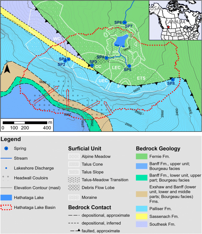
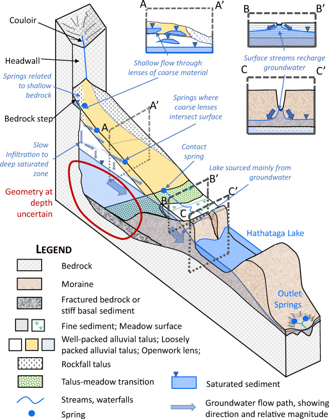
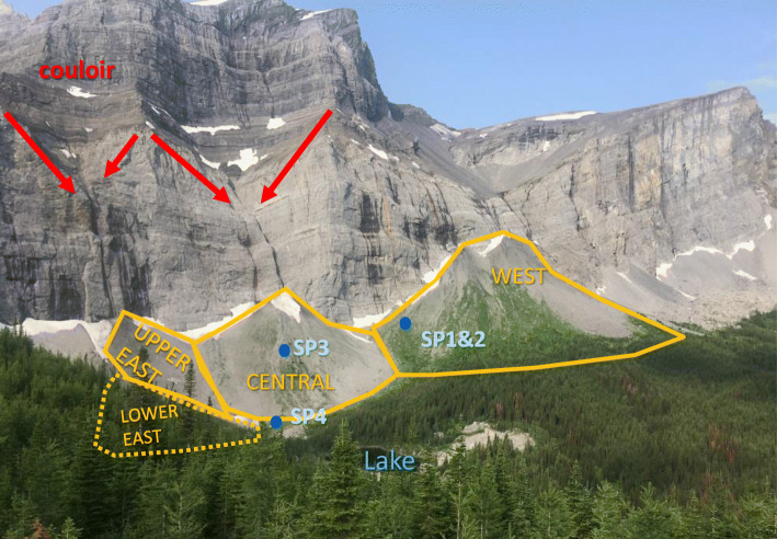
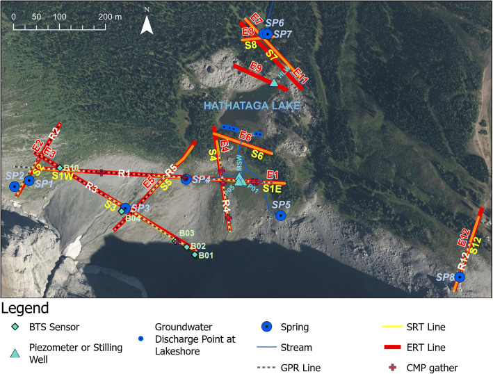
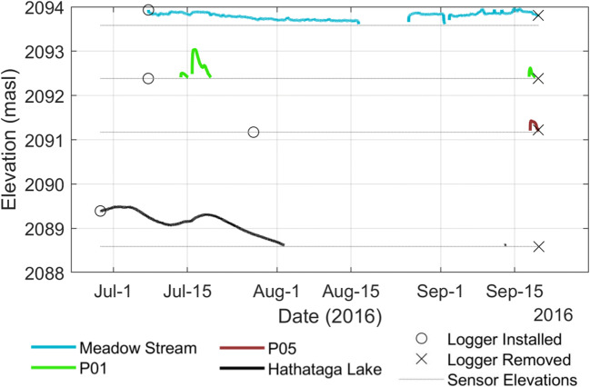
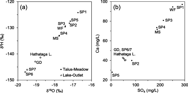
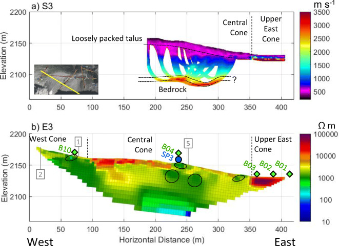
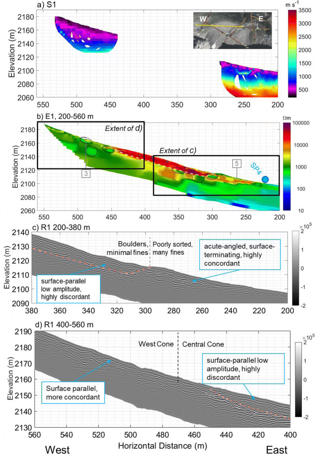
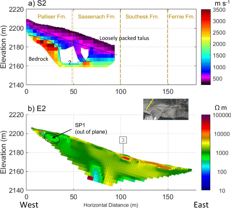
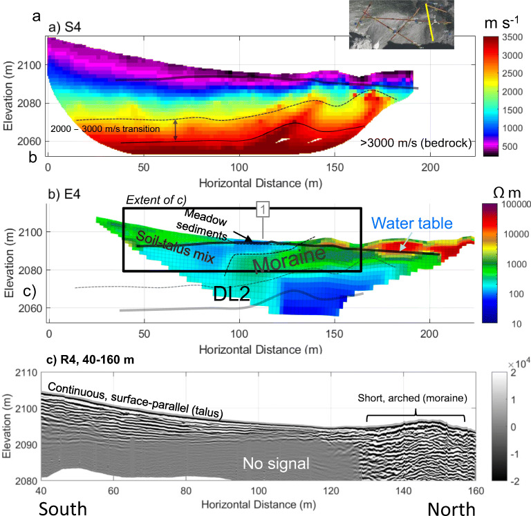
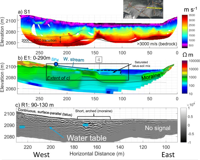
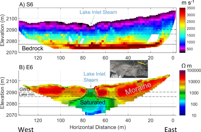
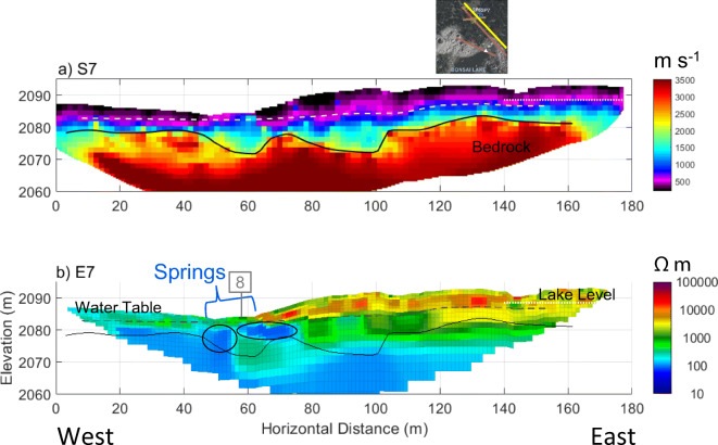
Groundwater storage in alpine regions is essential for maintaining baseflows in mountain streams. Recent studies have shown that common alpine landforms (e.g., talus and moraine) have substantial groundwater storage capacity, but the hydrogeological connectivity between individual landforms has not been understood. This study characterizes the hydrogeology of an alpine cirque basin in the Canadian Rocky Mountains that contains typical alpine landforms (talus, meadow, moraines) and hydrological features (tarn, streams, and springs). Geological, hydrological, and hydrochemical observations were used to understand the overall hydrogeological setting of the study basin, and three different geophysical methods (electrical resistivity tomography, seismic refraction tomography, and ground penetrating radar) were used to characterize the subsurface structure and connectivity, and to develop a hydrogeological conceptual model. Geophysical imaging shows that the talus is typically 20-40 m thick and highly heterogeneous. The meadow sediments are only up to 11 m thick but are part of a 30-40-m-thick accumulation of unconsolidated material that fills a bedrock overdeepening (i.e. a closed, subglacial basin). A minor, shallow groundwater system feeds springs on the talus and streams on the meadow, whereas a deep system in the moraine supplies most of the water to the basin outlet springs, thereby serving as a 'gate keeper' of the basin. Although the hydrologic functions of the talus in this study are substantially different from other locations, primarily due to differences in bedrock lithology and geomorphic processes, the general conceptual framework developed in this study is expected to be applicable to other alpine regions.
高山地区的地下水储存对于维持山间溪流的基流至关重要。最近的研究表明,常见的高山地貌(如岩屑堆和冰碛)具有相当大的地下水储存能力,但各个地貌之间的水文地质连通性尚未得到了解。本研究描述了加拿大落基山脉一个高山冰斗盆地的水文地质情况,该盆地包含典型的高山地貌(岩屑堆、草甸、冰碛)和水文特征(冰斗湖、溪流和泉水)。通过地质、水文和水化学观测来了解研究盆地的整体水文地质环境,并使用三种不同的地球物理方法(电阻率层析成像、地震折射层析成像和探地雷达)来描述地下结构和连通性,并建立一个水文地质概念模型。地球物理成像显示,岩屑堆通常厚20 - 40米,且高度不均匀。草甸沉积物厚度仅达11米,但却是填充基岩深切谷(即一个封闭的冰下盆地)的30 - 40米厚未固结物质堆积的一部分。一个较小的浅层地下水系统为岩屑堆上的泉水和草甸上的溪流供水,而冰碛中的深层系统则为盆地出口泉水提供大部分水源,从而充当盆地的“守门人”。尽管本研究中岩屑堆的水文功能与其他地区有很大不同,主要是由于基岩岩性和地貌过程的差异,但本研究建立的一般概念框架预计适用于其他高山地区。