Department of Anthropology, Binghamton University, Binghamton, NY, United States of America.
Laboratory of Evolutionary Anthropology and Health, Binghamton University, Binghamton, NY, United States of America.
PLoS One. 2020 Sep 22;15(9):e0239387. doi: 10.1371/journal.pone.0239387. eCollection 2020.
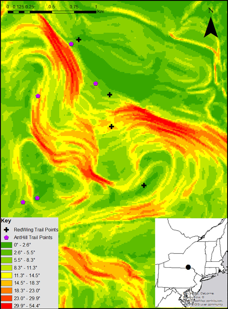
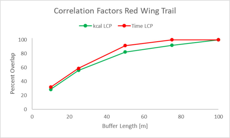
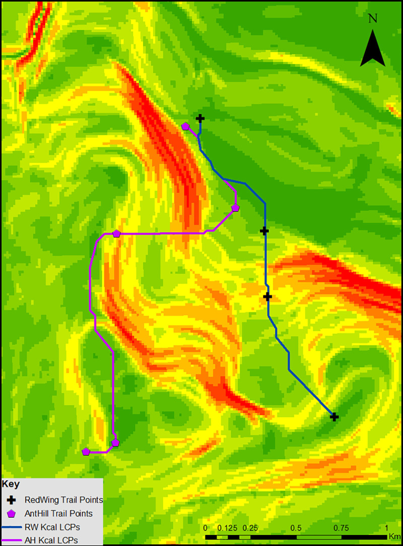
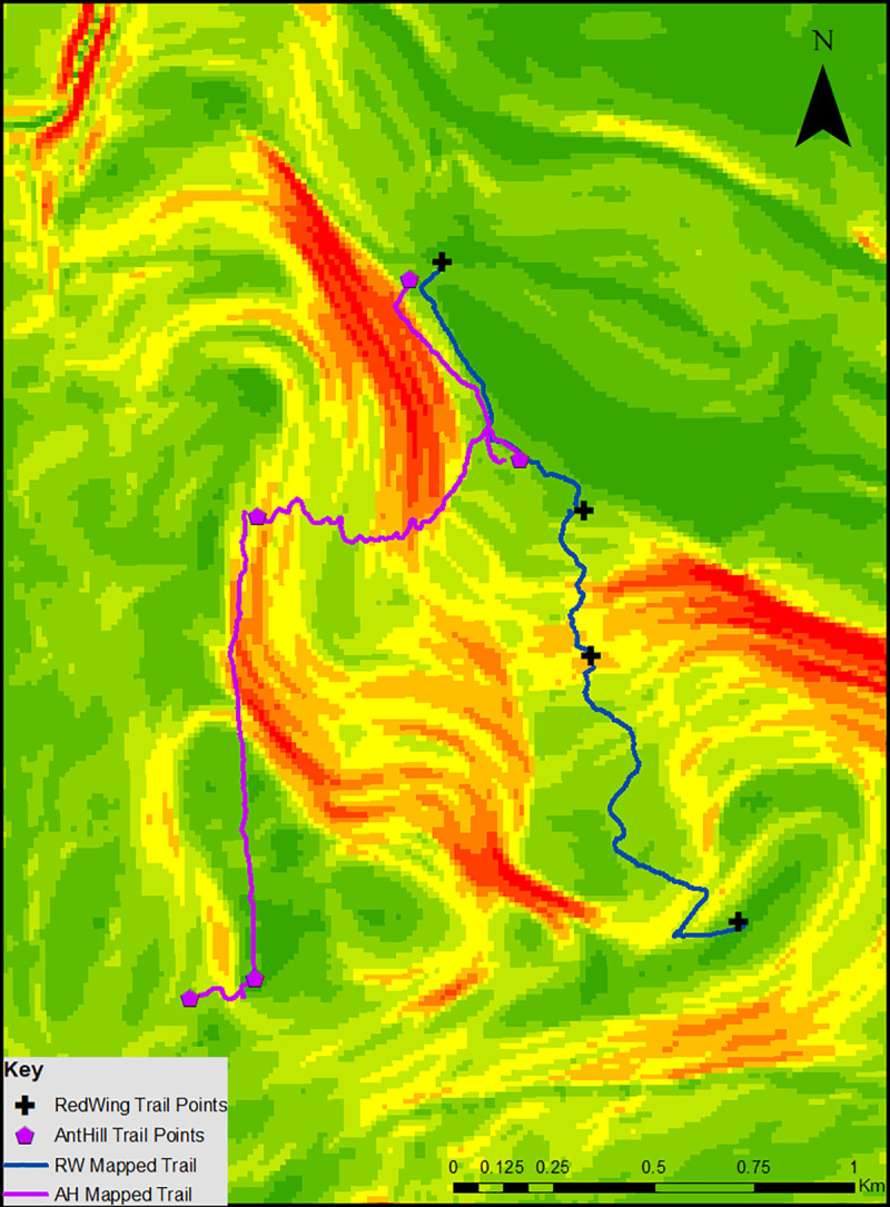
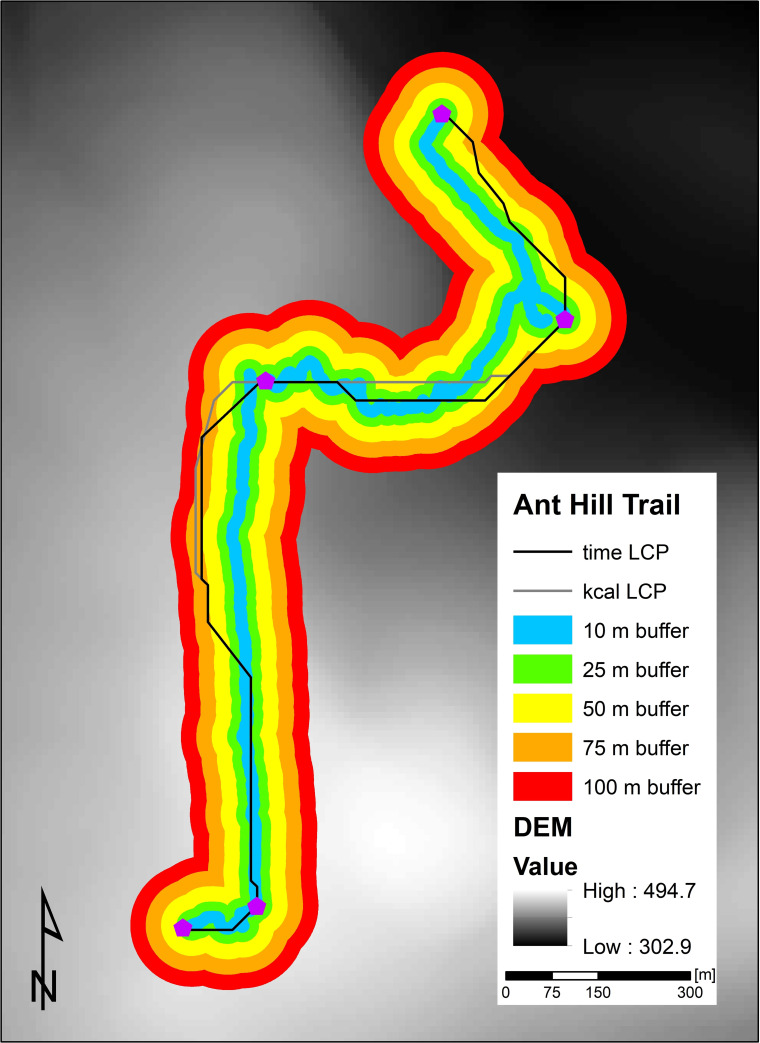
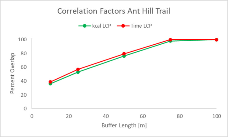
Least Cost Path (LCP) analysis allows a user to define a cost parameter through which cost of movement can be assessed using Geographical Information Systems (GIS). These analyses are commonly used to construct theoretical movement through a landscape, which has been useful for creating hypotheses concerning prehistoric archaeology and landscape genomics. However, LCP analysis is commonly employed without testing the generated LCP(s), complicating its usefulness as a methodological tool. This paper proposes a model for analyzing movement in ArcGIS by using topography data to calculate slope. This slope data is then then used to calculate LCPs based on travel time and kilocalorie expenditure. LCPs were constructed in the Nature Preserve at Binghamton University, a 182-acre area that consists of wetland and mountainous terrain, and a Fitbit® Surge activity monitor was used to test the accuracy of the model's predictions. Paired sample t-tests show a lack of significant difference between calculated and walked time in our analysis (p = .953), suggesting that our model can estimate travel time between two points based solely on slope of the region. Paired sample t-tests also show a lack of significant difference between calculated and observed kilocalorie expenditure (p = .930), suggesting that our model is also capable of estimating kilocalorie expenditure associated with movement between two points. Finally, paired sample t-tests confirm that straight line distances do not reflect real movement through a terrain (p = .009), highlighting the need for alternate measures of movement when analyzing the effects of local landscape on movement. Our current model shows strength in its estimations of travel time and kilocalorie expenditure based on topography of a region-future iterations of the model need to establish the statistical similarity between our model's estimations and recorded values for walking time and kilocalorie expenditure.
最低成本路径 (LCP) 分析允许用户通过地理信息系统 (GIS) 定义成本参数来评估运动成本。这些分析通常用于构建通过景观的理论运动,这对于创建关于史前考古学和景观基因组学的假设很有用。然而,LCP 分析在没有测试生成的 LCP 的情况下经常被使用,这使其作为一种方法工具的实用性变得复杂。本文提出了一种在 ArcGIS 中分析运动的模型,该模型使用地形数据来计算坡度。然后,根据旅行时间和千卡支出,使用此坡度数据来计算 LCP。在纽约州立大学宾汉姆顿分校的自然保护区中构建了 LCP,该保护区占地 182 英亩,由湿地和山区组成,还使用 Fitbit® Surge 活动监测器来测试模型预测的准确性。配对样本 t 检验显示我们的分析中计算时间和行走时间之间没有显著差异(p =.953),这表明我们的模型可以仅根据区域的坡度来估计两点之间的旅行时间。配对样本 t 检验还显示计算出的和观察到的千卡支出之间没有显著差异(p =.930),这表明我们的模型还能够估计两点之间运动相关的千卡支出。最后,配对样本 t 检验证实直线距离不能反映实际通过地形的运动(p =.009),这突出了在分析局部景观对运动的影响时需要替代运动度量的必要性。我们当前的模型在基于区域地形的旅行时间和千卡支出估计方面表现出优势——模型的未来迭代需要建立我们模型的估计值与行走时间和千卡支出记录值之间的统计相似性。