Research Division of Geospatial Information Agency of Indonesia, Jalan Raya Bogor Km. 46, Cibinong, Bogor, Jawa Barat, 16911, Indonesia.
BMC Health Serv Res. 2020 Nov 20;20(1):1053. doi: 10.1186/s12913-020-05896-x.
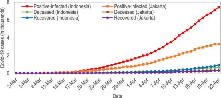
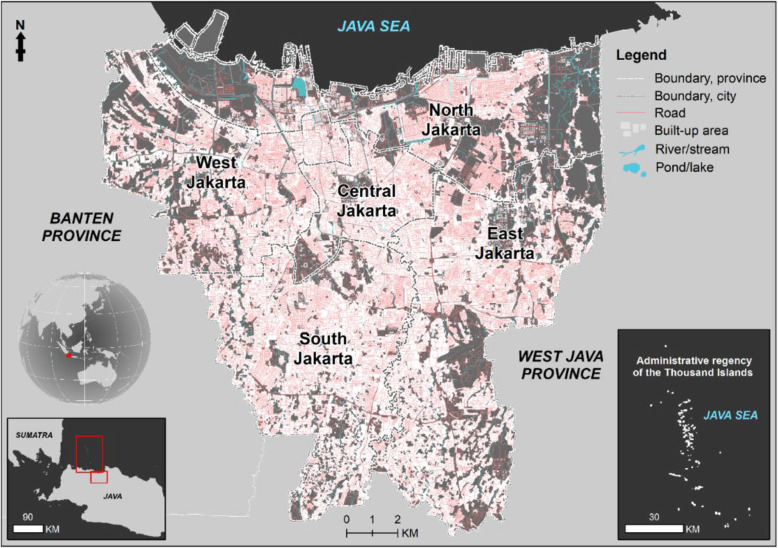
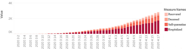
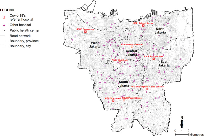
The outbreak of the novel coronavirus (COVID-19) has rapidly spread, causing million confirmed cases, thousands of deaths, and economic losses. The number of cases of COVID-19 in Jakarta is the largest in Indonesia. Furthermore, Jakarta is the capital city of Indonesia which has the densest population in the country. There is need for geospatial analysis to evaluate the demand in contrast to the capacity of Referral Hospitals and to model the spreading case of Covid-19 in order to support and organize an effective health service.
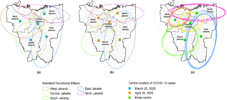
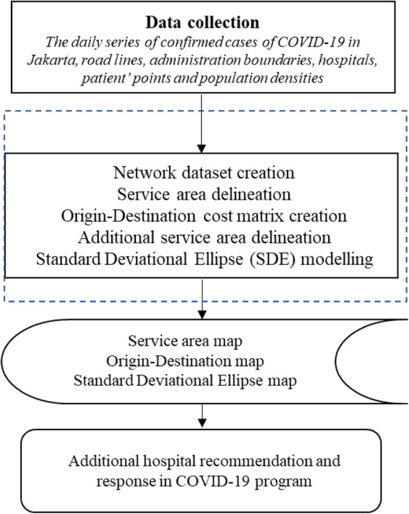
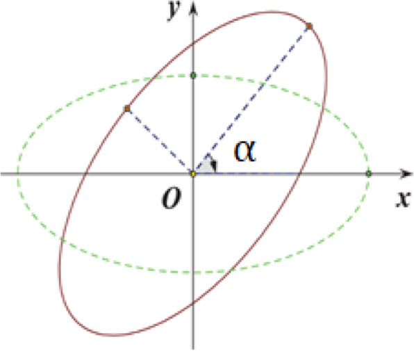
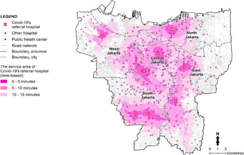
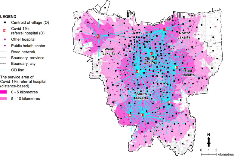
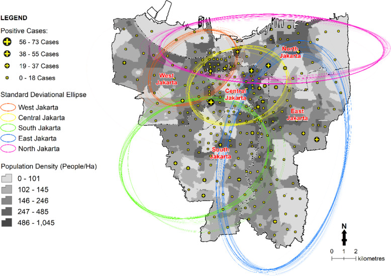
We used the data from local government publicity for COVID-19 as trusted available sources. By using the verifiable data by observation from the local government, we estimated the spatial pattern of distribution of cases to estimate the growing cases. We performed service area and Origin-Destination (OD) Cost Matrix in support to existing referral hospital, and to create Standard Deviational Ellipse (SDE) model to determine the spatial distribution of COVID-19.
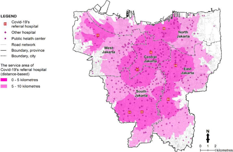
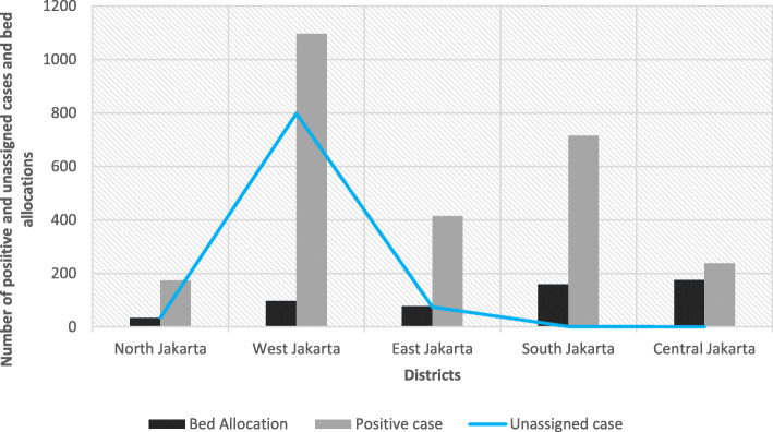
We identified more than 12.4 million people (86.7%) based on distance-based service area, live in the well served area of the referral hospital. A total 2637 positive-infected cases were identified and highly concentrated in West Jakarta (1096 cases). The results of OD cost matrix in a range of 10 km show a total 908 unassigned cases from 24 patient's centroid which was highly concentrated in West Jakarta.
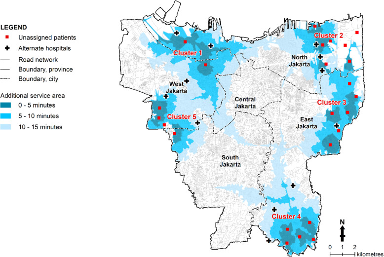
Our results indicate the needs for additional referral hospitals specializing in the treatment of COVID-19 and spatial illustration map of the growth of COVID-19' case in support to the implementation of social distancing in Jakarta.
新型冠状病毒(COVID-19)的爆发迅速蔓延,导致确诊病例数百万例,数千人死亡,经济损失惨重。雅加达的 COVID-19 病例数在印度尼西亚是最多的。此外,雅加达是印度尼西亚的首都,是该国人口最密集的城市。需要进行地理空间分析,以评估与转诊医院能力相比的需求,并对 COVID-19 病例的传播情况进行建模,以支持和组织有效的卫生服务。
我们使用了地方政府对 COVID-19 的宣传数据,这些数据是可信的可用来源。通过使用地方政府可观察到的可核实数据,我们估计了病例分布的空间模式,以估计增长病例。我们进行了服务区和目的地(OD)成本矩阵,以支持现有转诊医院,并创建标准偏差椭圆(SDE)模型来确定 COVID-19 的空间分布。
我们根据基于距离的服务区确定了超过 1240 万人(86.7%)居住在转诊医院服务良好的地区。共发现 2637 例阳性感染病例,高度集中在西雅加达(1096 例)。在 10 公里范围内的 OD 成本矩阵的结果显示,共有 908 例未分配的病例来自 24 个患者质心,高度集中在西雅加达。
我们的结果表明,需要额外的专门治疗 COVID-19 的转诊医院,并提供 COVID-19 病例增长的空间示意图,以支持在雅加达实施社交距离。