Wesfarmers Centre of Vaccines and Infectious Diseases, Telethon Kids Institute, Nedlands, Western Australia, Australia
School of Population Health, Curtin University, Perth, Western Australia, Australia.
BMJ Open. 2021 Feb 18;11(2):e044606. doi: 10.1136/bmjopen-2020-044606.
COVID-19 has caused a global public health crisis affecting most countries, including Ethiopia, in various ways. This study maps the vulnerability to infection, case severity and likelihood of death from COVID-19 in Ethiopia.
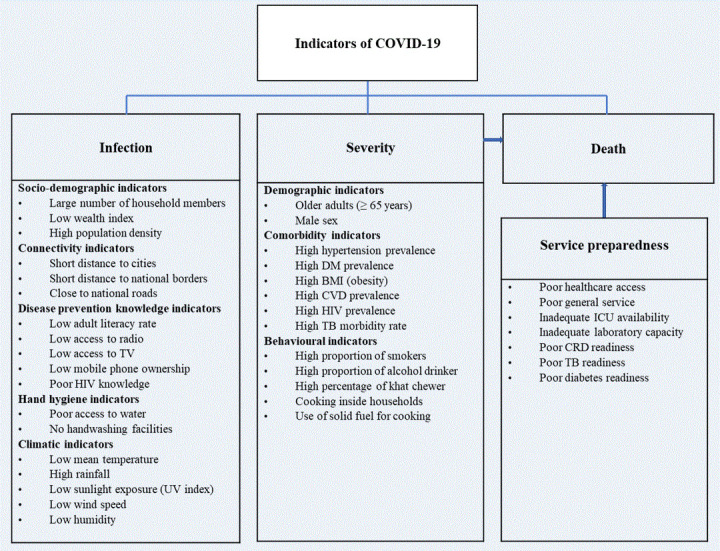
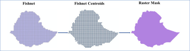
Thirty-eight potential indicators of vulnerability to COVID-19 infection, case severity and likelihood of death, identified based on a literature review and the availability of nationally representative data at a low geographic scale, were assembled from multiple sources for geospatial analysis. Geospatial analysis techniques were applied to produce maps showing the vulnerability to infection, case severity and likelihood of death in Ethiopia at a spatial resolution of 1 km×1 km.
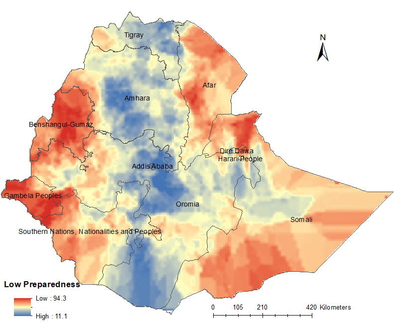
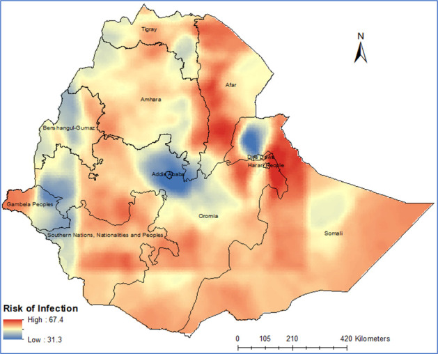
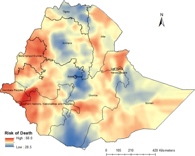
This study showed that vulnerability to COVID-19 infection is likely to be high across most parts of Ethiopia, particularly in the Somali, Afar, Amhara, Oromia and Tigray regions. The number of severe cases of COVID-19 infection requiring hospitalisation and intensive care unit admission is likely to be high across Amhara, most parts of Oromia and some parts of the Southern Nations, Nationalities and Peoples' Region. The risk of COVID-19-related death is high in the country's border regions, where public health preparedness for responding to COVID-19 is limited.
This study revealed geographical differences in vulnerability to infection, case severity and likelihood of death from COVID-19 in Ethiopia. The study offers maps that can guide the targeted interventions necessary to contain the spread of COVID-19 in Ethiopia.
COVID-19 以各种方式对包括埃塞俄比亚在内的大多数国家造成了全球公共卫生危机。本研究绘制了埃塞俄比亚 COVID-19 感染、病例严重程度和死亡可能性的脆弱性图。
根据文献综述和在低地理尺度上具有全国代表性数据的可用性,从多个来源收集了 38 个 COVID-19 感染、病例严重程度和死亡可能性脆弱性的潜在指标,用于地理空间分析。应用地理空间分析技术生成了埃塞俄比亚 COVID-19 感染、病例严重程度和死亡可能性的空间分辨率为 1km×1km 的地图。
本研究表明,埃塞俄比亚大部分地区 COVID-19 感染的脆弱性可能很高,特别是在索马里、阿法尔、阿姆哈拉、奥罗莫和提格雷地区。需要住院和重症监护病房治疗的 COVID-19 感染严重病例数量可能在阿姆哈拉、奥罗莫大部分地区和南部地区的一些地区很高民族和人民地区。在该国边境地区,COVID-19 相关死亡的风险很高,那里应对 COVID-19 的公共卫生准备工作有限。
本研究揭示了埃塞俄比亚 COVID-19 感染、病例严重程度和死亡可能性的脆弱性存在地理差异。该研究提供了地图,可以指导在埃塞俄比亚进行有针对性的干预,以遏制 COVID-19 的传播。