Liu Kang, Yin Ling, Zhang Meng, Kang Min, Deng Ai-Ping, Li Qing-Lan, Song Tie
Shenzhen Institute of Advanced Technology, Chinese Academy of Sciences, Shenzhen, 518055, People's Republic of China.
Beijing Key Laboratory of Urban Spatial Information Engineering, Beijing, 100038, People's Republic of China.
Infect Dis Poverty. 2021 Mar 25;10(1):40. doi: 10.1186/s40249-021-00824-5.
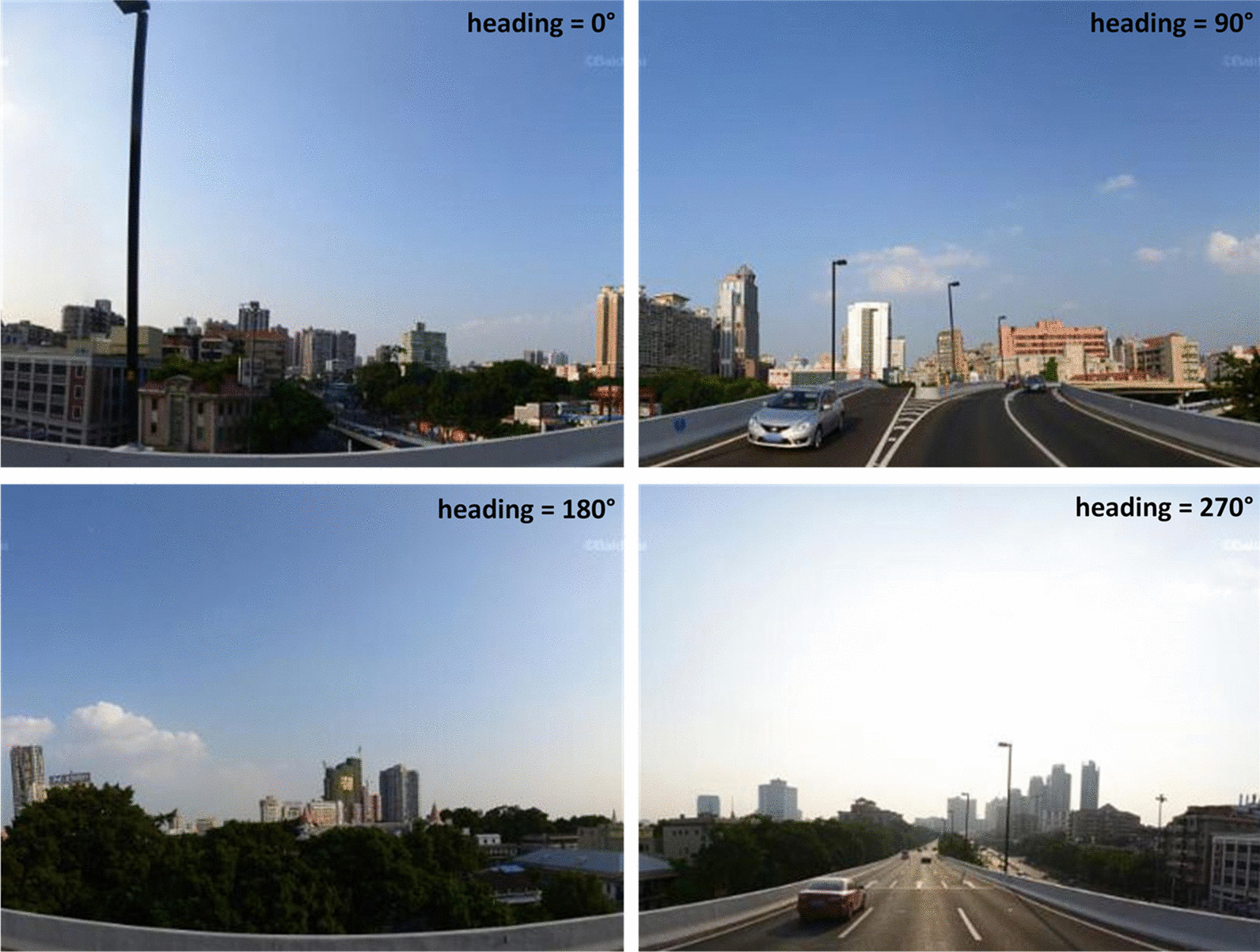
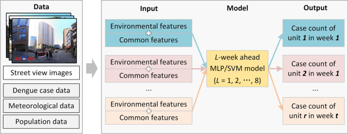
Dengue fever (DF) is a mosquito-borne infectious disease that has threatened tropical and subtropical regions in recent decades. An early and targeted warning of a dengue epidemic is important for vector control. Current studies have primarily determined weather conditions to be the main factor for dengue forecasting, thereby neglecting that environmental suitability for mosquito breeding is also an important factor, especially in fine-grained intra-urban settings. Considering that street-view images are promising for depicting physical environments, this study proposes a framework for facilitating fine-grained intra-urban dengue forecasting by integrating the urban environments measured from street-view images.
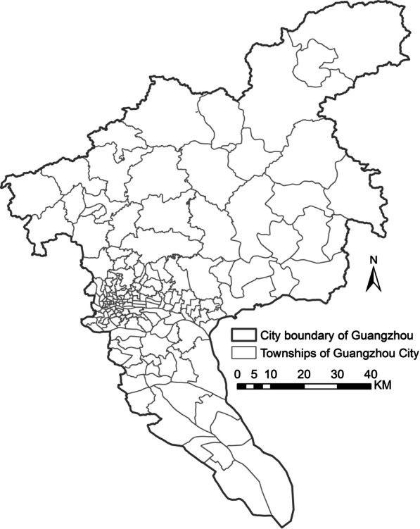
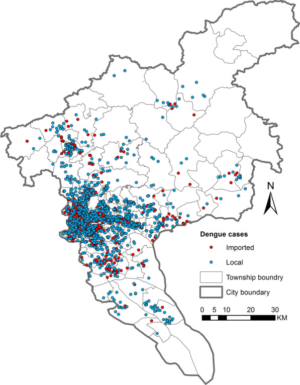
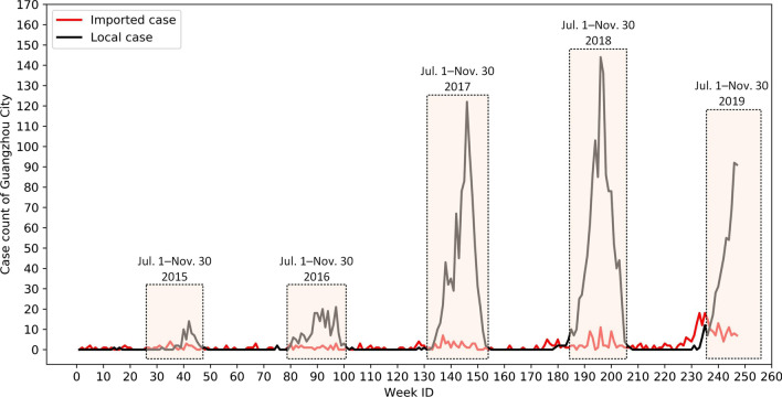
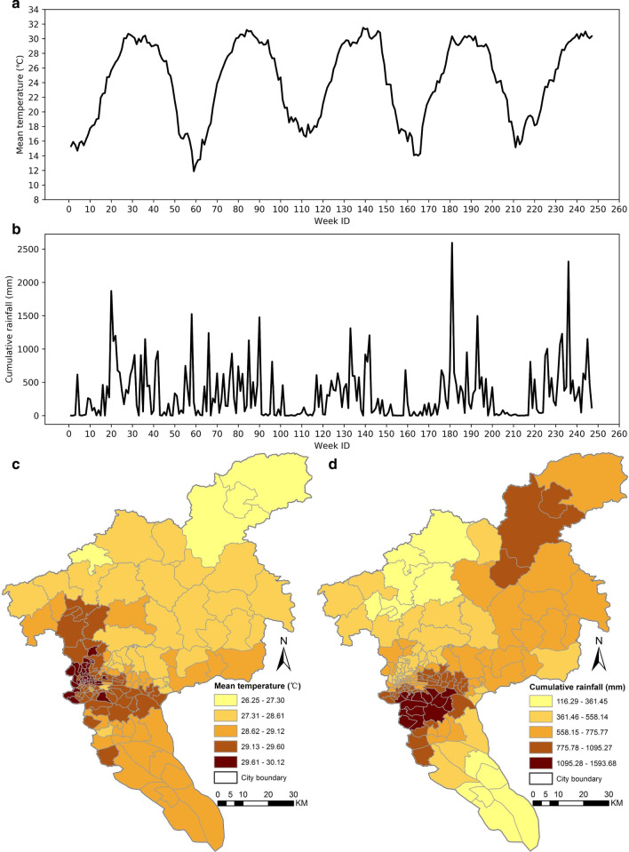
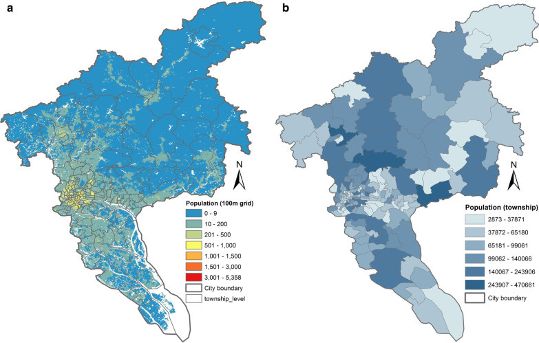
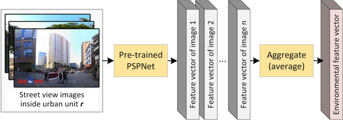
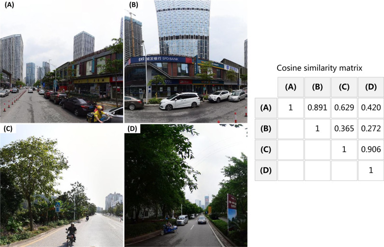
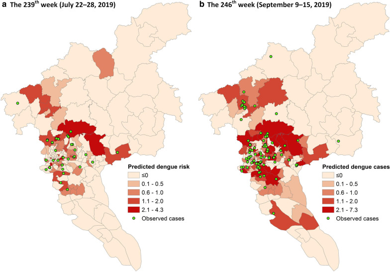
The dengue epidemic that occurred in 167 townships of Guangzhou City, China, between 2015 and 2019 was taken as a study case. First, feature vectors of street-view images acquired inside each township were extracted by a pre-trained convolutional neural network, and then aggregated as an environmental feature vector of the township. Thus, townships with similar physical settings would exhibit similar environmental features. Second, the environmental feature vector is combined with commonly used features (e.g., temperature, rainfall, and past case count) as inputs to machine-learning models for weekly dengue forecasting.
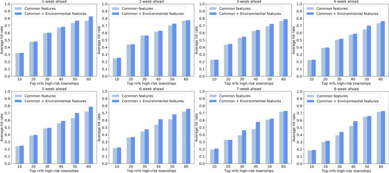
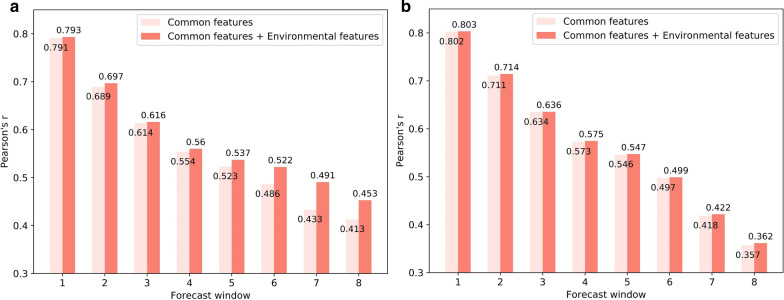
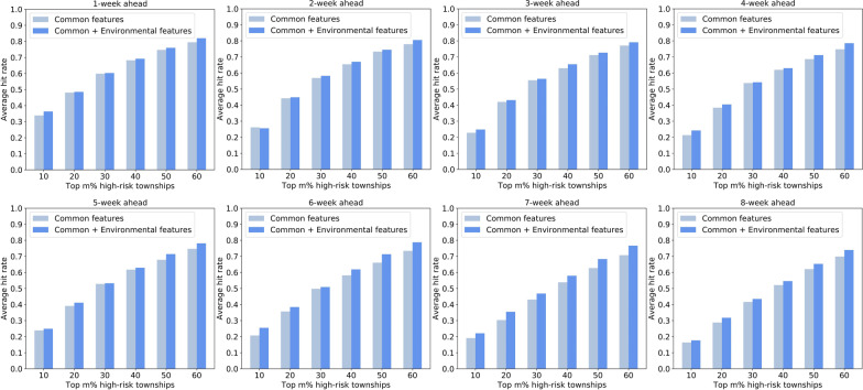
The performance of machine-learning forecasting models (i.e., MLP and SVM) integrated with and without environmental features were compared. This indicates that models integrating environmental features can identify high-risk urban units across the city more precisely than those using common features alone. In addition, the top 30% of high-risk townships predicted by our proposed methods can capture approximately 50-60% of dengue cases across the city.
Incorporating local environments measured from street view images is effective in facilitating fine-grained intra-urban dengue forecasting, which is beneficial for conducting spatially precise dengue prevention and control.
登革热是一种由蚊子传播的传染病,近几十年来一直威胁着热带和亚热带地区。登革热疫情的早期针对性预警对于病媒控制至关重要。目前的研究主要确定天气条件是登革热预测的主要因素,从而忽视了蚊子繁殖的环境适宜性也是一个重要因素,尤其是在城市内部的细粒度环境中。鉴于街景图像在描绘物理环境方面具有潜力,本研究提出了一个框架,通过整合从街景图像测量的城市环境来促进城市内部细粒度的登革热预测。
以2015年至2019年中国广州市167个乡镇发生的登革热疫情为研究案例。首先,通过预训练的卷积神经网络提取每个乡镇内部获取的街景图像的特征向量,然后聚合为该乡镇的环境特征向量。因此,具有相似物理环境的乡镇将表现出相似的环境特征。其次,将环境特征向量与常用特征(如温度、降雨量和过去的病例数)相结合,作为机器学习模型进行每周登革热预测的输入。
比较了整合和未整合环境特征的机器学习预测模型(即MLP和SVM)的性能。这表明,整合环境特征的模型比仅使用常见特征的模型能够更精确地识别全市范围内的高风险城市单元。此外,我们提出的方法预测的前30%高风险乡镇能够捕获全市约50-60%的登革热病例。
纳入从街景图像测量的当地环境有助于促进城市内部细粒度的登革热预测,这有利于进行空间精确的登革热预防和控制。