Krejtz Krzysztof, Çöltekin Arzu, Duchowski Andrew, Niedzielska Anna
SWPS University of Social Sciences and Humanities, Warsaw, Poland.
Department of Geography, University of Zürich, Switzerland.
J Eye Mov Res. 2017 Apr 3;10(2). doi: 10.16910/jemr.10.2.3.
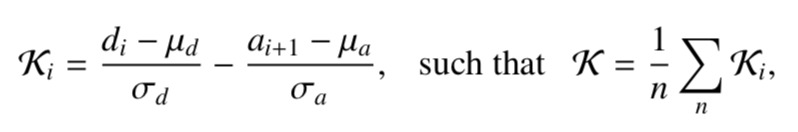
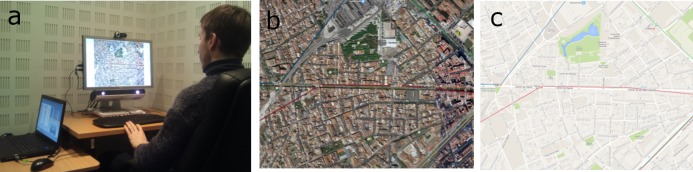
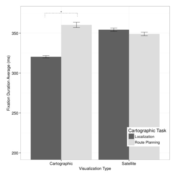
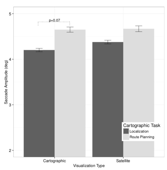
We demonstrate the use of the ambient/focal coefficient for studying the dynamics of visual behavior when performing cartographic tasks. Participants viewed a cartographic map and satellite image of Barcelona while performing a number of map-related tasks. Cartographic maps can be viewed as summary representations of reality, while satellite images are typically more veridical, and contain considerably more information. Our analysis of traditional eye movement metrics suggests that the satellite representation facilitates longer fixation durations, requiring greater scrutiny of the map. The cartographic map affords greater peripheral scanning, as evidenced by larger saccade amplitudes. Evaluation of elucidates task dependence of ambient/focal attention dynamics when working with geographic visualizations: localization progresses from ambient to focal attention; route planning fluctuates in an ambient-focalambient pattern characteristic of the three stages of route end point localization, route following, and route confirmation.
我们展示了使用环境/焦点系数来研究执行制图任务时视觉行为的动态变化。参与者在执行一些与地图相关的任务时,观看了巴塞罗那的地图和卫星图像。制图地图可被视为现实的概要表示,而卫星图像通常更逼真,且包含更多信息。我们对传统眼动指标的分析表明,卫星表示有助于延长注视持续时间,需要对地图进行更仔细的审视。制图地图能提供更大范围的周边扫描,较大的扫视幅度就证明了这一点。对……的评估阐明了在处理地理可视化时环境/焦点注意力动态对任务的依赖性:定位从环境注意力发展到焦点注意力;路线规划以路线终点定位、路线跟踪和路线确认三个阶段特有的环境-焦点-环境模式波动。