Li Jian, Liu Peirong, Wang Xinyu, Cui Hao, Ma Yurong
School of the Geo-Science & Technology, Zhengzhou University, Zhengzhou, 450001, Henan, China.
School of Water Conservancy Science & Engineering, Zhengzhou University, Zhengzhou, 450001, Henan, China.
Sci Rep. 2022 Aug 16;12(1):13840. doi: 10.1038/s41598-022-17231-x.
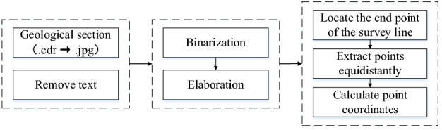
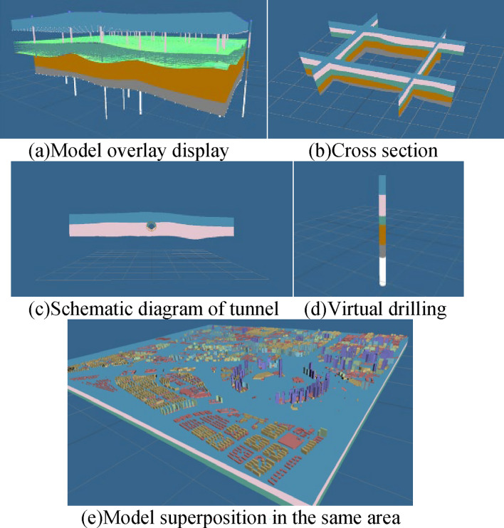
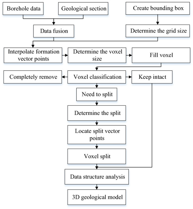
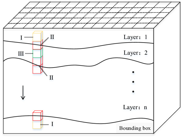
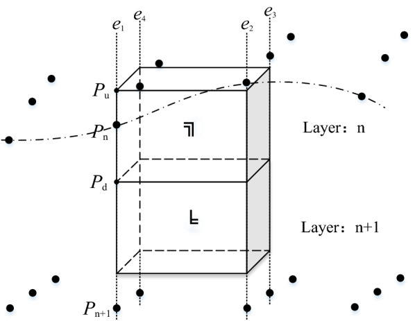
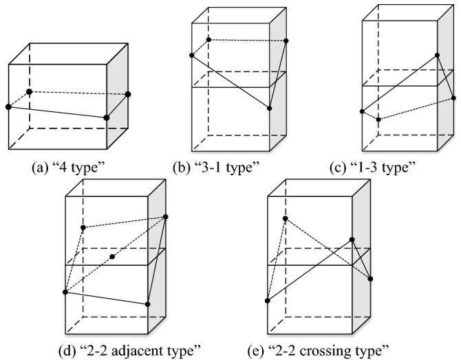
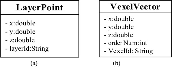
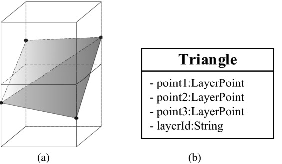
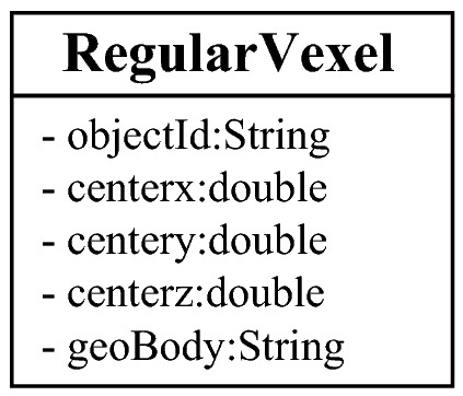
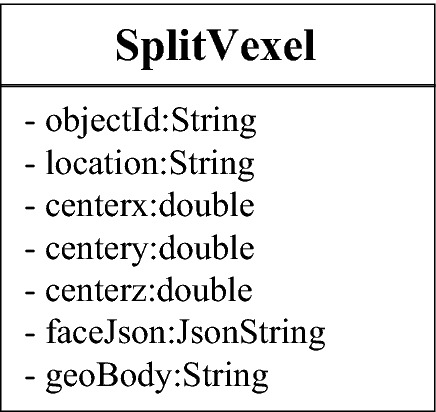
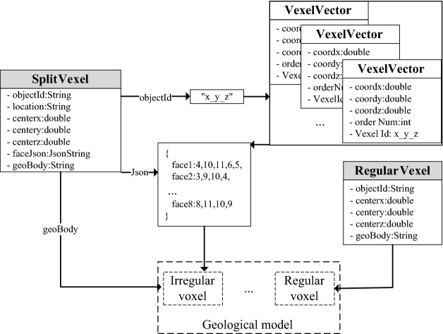
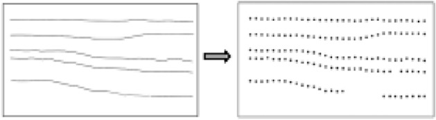
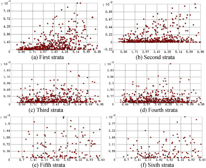
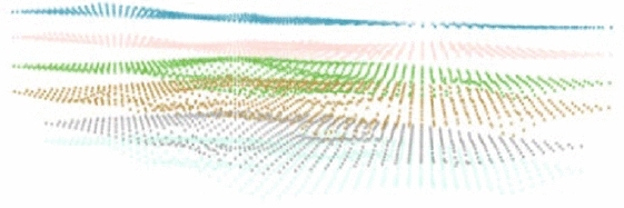
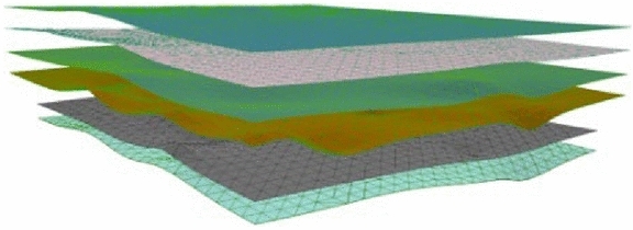
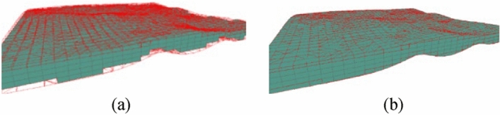
In view of the problems in traditional geological modeling methods, such as the insufficient utilization of geological survey data, the inaccurate expression of a stratigraphic model, and the large amount of model data, a 3D geological model cannot be smoothly loaded and rendered on the web end. In this paper, a 3D geological implicit modeling method of regular voxel splitting based on hierarchical interpolation data is proposed. This method first uses the boreholes and geological section data from a geological survey for data conversion and fusion, compares the applicability of different interpolation algorithms through cross-validation research, and uses the best fitting algorithm to interpolate and encrypt discrete points in the formation. Then, it constructs the regular voxels, designs five different regular voxel split types, and divides the voxels. In addition, the data structure design of the voxel split model is implemented, and the irregular voxel metadata structure is analyzed and displayed through Three.js. Using this method, based on the survey data of an area in Zhengzhou, the global workflow from data processing to model construction and visualization is demonstrated. The experimental results show that the model can integrate multisource hierarchical interpolation data; express different stratum structures accurately and smoothly, and can realize the rendering, spatial query and analysis of the internal information of a geological body in a browser.
针对传统地质建模方法存在的问题,如地质勘查数据利用不充分、地层模型表达不准确、模型数据量庞大,导致三维地质模型无法在网页端顺利加载和渲染等,本文提出一种基于分层插值数据的规则体素剖分三维地质隐式建模方法。该方法首先利用地质勘查中的钻孔和地质剖面数据进行数据转换与融合,通过交叉验证研究比较不同插值算法的适用性,采用最优拟合算法对地层中的离散点进行插值加密。然后,构建规则体素,设计五种不同的规则体素剖分类型并进行体素划分。此外,实现了体素剖分模型的数据结构设计,并通过Three.js对不规则体素元数据结构进行分析与展示。利用该方法,基于郑州某区域的勘查数据,演示了从数据处理到模型构建与可视化的全局工作流程。实验结果表明,该模型能够整合多源分层插值数据;准确、流畅地表达不同地层结构,且能在浏览器中实现地质体内部信息的渲染、空间查询与分析。