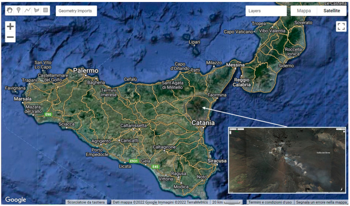
Istituto Nazionale di Geofisica e Vulcanologia, Sezione di Catania, Osservatorio Etneo, 95125 Catania, Italy.
Department of Electrical, Electronic and Computer Engineering, University of Catania, 95125 Catania, Italy.
Sensors (Basel). 2022 Oct 11;22(20):7712. doi: 10.3390/s22207712.
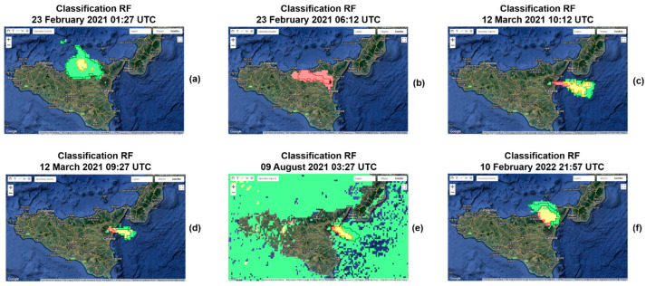
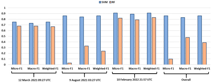
Volcanic explosive eruptions inject several different types of particles and gasses into the atmosphere, giving rise to the formation and propagation of volcanic clouds. These can pose a serious threat to the health of people living near an active volcano and cause damage to air traffic. Many efforts have been devoted to monitor and characterize volcanic clouds. Satellite infrared (IR) sensors have been shown to be well suitable for volcanic cloud monitoring tasks. Here, a machine learning (ML) approach was developed in Google Earth Engine (GEE) to detect a volcanic cloud and to classify its main components using satellite infrared images. We implemented a supervised support vector machine (SVM) algorithm to segment a combination of thermal infrared (TIR) bands acquired by the geostationary MSG-SEVIRI (Meteosat Second Generation-Spinning Enhanced Visible and Infrared Imager). This ML algorithm was applied to some of the paroxysmal explosive events that occurred at Mt. Etna between 2020 and 2022. We found that the ML approach using a combination of TIR bands from the geostationary satellite is very efficient, achieving an accuracy of 0.86, being able to properly detect, track and map automatically volcanic ash clouds in near real-time.
火山爆发会将多种不同类型的颗粒和气体喷射到大气中,从而形成和传播火山云。这些火山云可能对居住在活火山附近的人们的健康构成严重威胁,并对空中交通造成破坏。因此,人们已经投入了许多努力来监测和描述火山云。卫星红外(IR)传感器已被证明非常适合用于火山云监测任务。在这里,我们在 Google Earth Engine(GEE)中开发了一种机器学习(ML)方法,用于使用卫星红外图像检测火山云并对其主要成分进行分类。我们实施了监督支持向量机(SVM)算法,以分割由地球静止 MSG-SEVIRI(第二代气象卫星-自旋增强可见光和红外成像仪)获取的热红外(TIR)波段的组合。该 ML 算法应用于 2020 年至 2022 年间埃特纳火山发生的一些阵发性爆炸事件。我们发现,使用地球静止卫星的 TIR 波段组合的 ML 方法非常有效,准确率达到 0.86,能够在近实时自动检测、跟踪和绘制火山灰云。