Ekpa Dave Eleojo, Salubi Eunice A, Olusola Johnson Adedeji, Akintade Dare
Institute of Ecology and Environmental Studies, Obafemi Awolowo University, Ile Ife, Nigeria.
Geography and Environmental Management, Faculty of Environment, University of Waterloo, Canada.
Heliyon. 2023 Feb 26;9(3):e14005. doi: 10.1016/j.heliyon.2023.e14005. eCollection 2023 Mar.
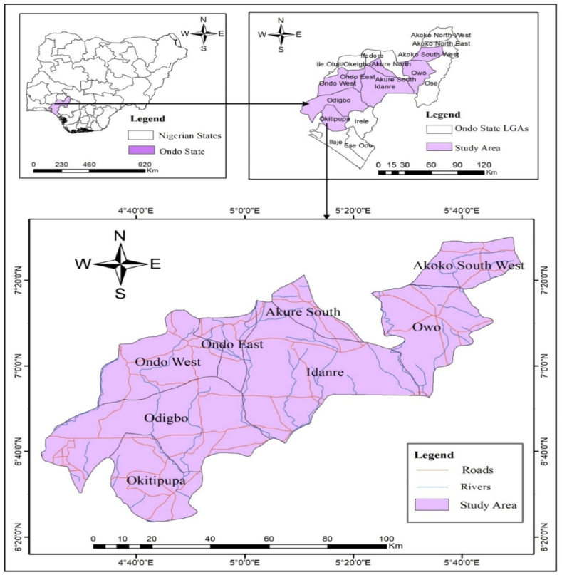
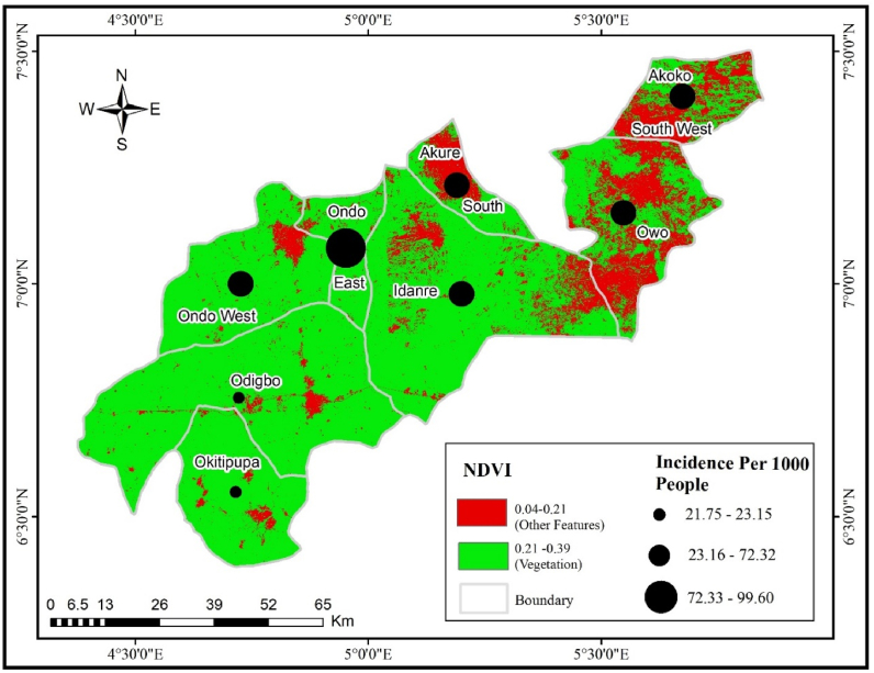
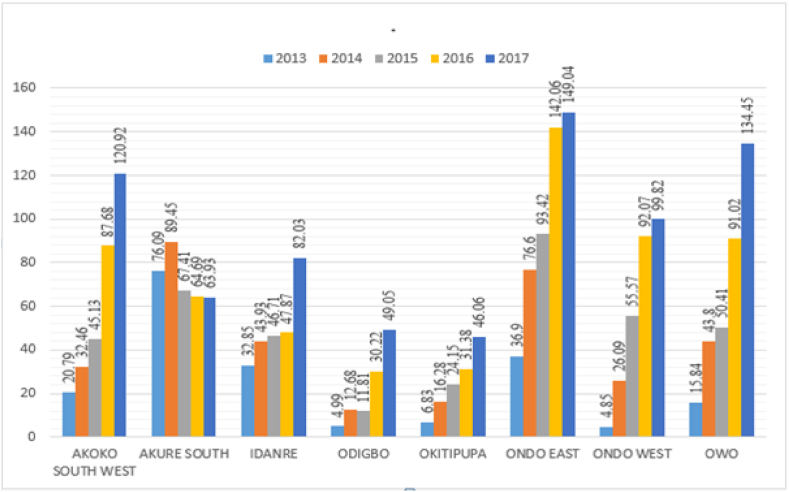
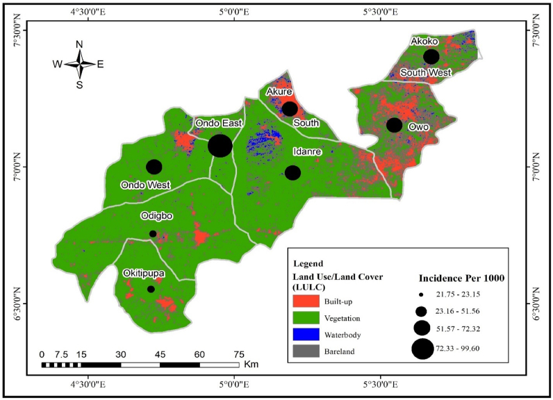
This study examined the spatio-temporal dynamics of malaria epidemiological patterns considering environmental(vegetation, water bodies, slope, elevation) and climatic factors (rainfall, temperature and relative humidity) in Ondo State, Nigeria, from 2013 to 2017 using ArcGIS 10.4 and QGIS software. The factors influencing malaria were studied using a multi-criteria analysis (Analytical Hierarchical Process-AHP). The trend analysis revealed an increase in cases over time, indicating a significant increase in the occurrence of malaria in all study areas. The most important climatic variable impacting malaria transmission in the study was temperature. Nevertheless, other environmental and climatic factors causing transmission include vegetation, water bodies, slopes, elevation, rainfall, and relative humidity. With the exception of Okitipupa, the study identified high-risk locations (vulnerable areas/hot spots) in almost all of the local government areas, while Ondo East, Akure South, Akoko South West, and Owo are the most vulnerable areas. The findings reveal that the malaria incidence is high in the developed LGAs having more towns where temperature is higher due to several anthropogenesis activities, high population and increased land-use. Thus, in-depth epidemiological studies on malaria should be undertaken in Ondo State and other regions of Nigeria considering environmental factors impacting malaria incidence as this will enable one to ascertain the major factors influencing the disease, thereby taking adequate measures to curb the increase in incidence.
本研究利用ArcGIS 10.4和QGIS软件,考察了2013年至2017年尼日利亚翁多州疟疾流行模式的时空动态,同时考虑了环境因素(植被、水体、坡度、海拔)和气候因素(降雨量、温度和相对湿度)。采用多标准分析(层次分析法-AHP)研究了影响疟疾的因素。趋势分析显示病例随时间增加,表明所有研究区域疟疾发病率显著上升。研究中影响疟疾传播的最重要气候变量是温度。然而,导致传播的其他环境和气候因素包括植被、水体、坡度、海拔、降雨量和相对湿度。除奥基蒂普帕外,研究在几乎所有地方政府区域都确定了高风险地点(脆弱地区/热点),而翁多东部、阿库雷南部、阿科科西南和奥沃是最脆弱的地区。研究结果表明,在因多种人为活动、高人口和土地利用增加而温度较高、城镇较多的发达地方政府区域,疟疾发病率较高。因此,鉴于环境因素对疟疾发病率的影响,应在翁多州和尼日利亚其他地区开展深入的疟疾流行病学研究,这将有助于确定影响该疾病的主要因素,从而采取适当措施遏制发病率上升。