International Centre for Integrated Mountain Development (ICIMOD), Islamabad, Pakistan.
Smart Sensing for Climate and Development, Center for Geographical Information System, University of the Punjab, Lahore, Pakistan.
Sci Rep. 2023 Mar 14;13(1):4240. doi: 10.1038/s41598-023-30347-y.
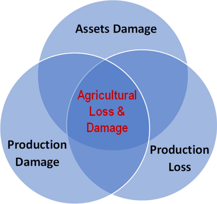
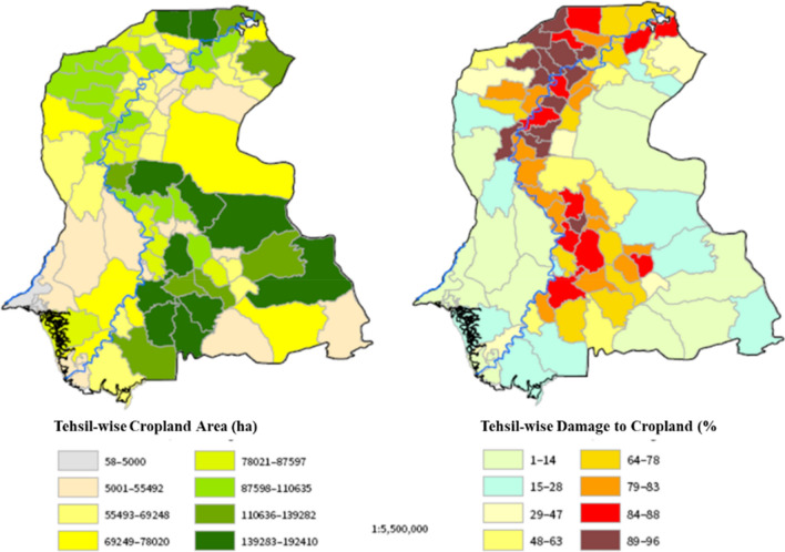
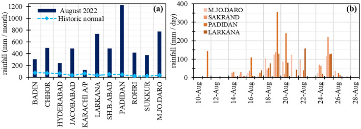
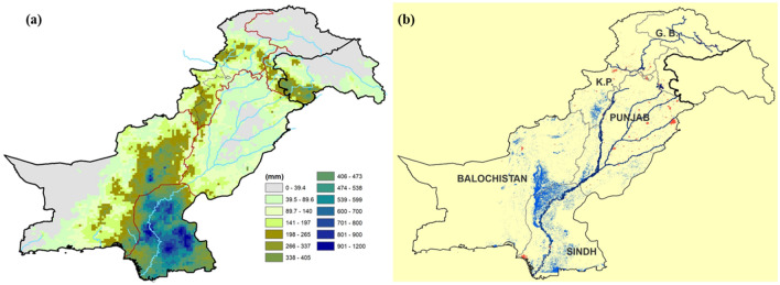
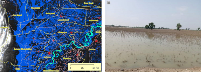
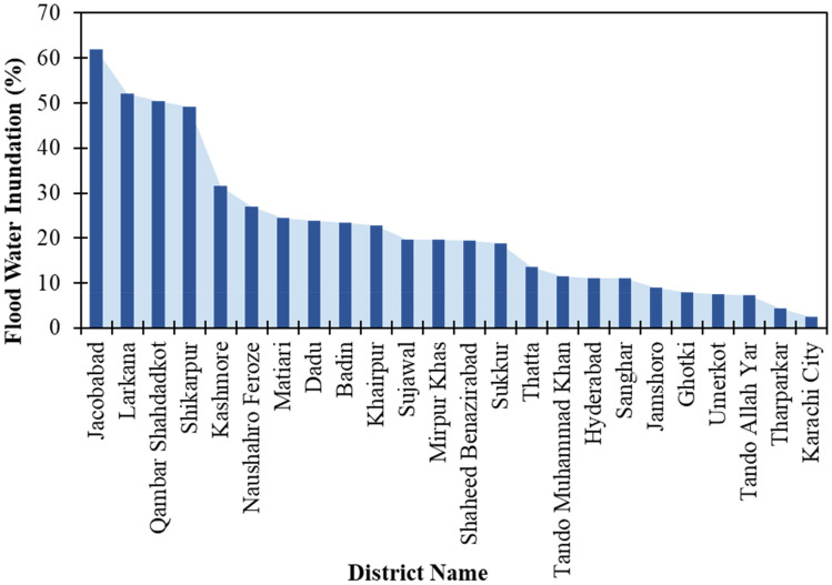
In August 2022, one of the most severe floods in the history of Pakistan was triggered due to the exceptionally high monsoon rainfall. It has affected ~ 33 million people across the country. The agricultural losses in the most productive Indus plains aggravated the risk of food insecurity in the country. As part of the loss and damage (L&D) assessment methodologies, we developed an approach for evaluating crop-specific post-disaster production losses based on multi-sensor satellite data. An integrated assessment was performed using various indicators derived from pre- and post-flood images of Sentinel-1 (flood extent mapping), Sentinel-2 (crop cover), and GPM (rainfall intensity measurements) to evaluate crop-specific losses. The results showed that 2.5 million ha (18% of Sindh's total area) was inundated out of which 1.1 million ha was cropland. The remainder of crop damage came from the extreme rainfall downpour, flash floods and management deficiencies. Thus approximately 57% (2.8 million ha) of the cropland was affected out of the 4.9 million ha of agricultural area in Sindh. The analysis indicated expected production losses of 88% (3.1 million bales), 80% (1.8 million tons), and 61% (10.5 million tons) for cotton, rice, and sugarcane. This assessment provided useful tools to evaluate the L&D of agricultural production and to develop evidence-based policies enabling post-flood recovery, rehabilitation of people and restoration of livelihood.
2022 年 8 月,由于季风降雨量异常高,巴基斯坦历史上最严重的洪灾之一爆发,影响了全国约 3300 万人。在生产力最高的印度河流域平原,农业损失加剧了该国粮食不安全的风险。作为损失和损害(L&D)评估方法的一部分,我们开发了一种基于多传感器卫星数据评估灾后特定作物生产损失的方法。使用来自洪水前后的 Sentinel-1(洪水范围测绘)、Sentinel-2(作物覆盖)和 GPM(降雨强度测量)的各种指标进行综合评估,以评估特定作物的损失。结果表明,有 250 万公顷(信德省总面积的 18%)被淹没,其中 110 万公顷为耕地。其余的作物损失来自极端降雨倾盆、山洪和管理不善。因此,信德省 490 万公顷农业区中,约有 57%(280 万公顷)的耕地受到影响。分析表明,棉花、水稻和甘蔗的预期产量损失分别为 88%(310 万包)、80%(180 万吨)和 61%(1050 万吨)。该评估提供了有用的工具来评估农业生产的 L&D,并制定基于证据的政策,以实现洪灾后的恢复、人民的康复和生计的恢复。