Fatema Kaniz, Joy Md Ashikur Rahman, Amin F M Rezvi, Sarkar Showmitra Kumar
Department of Urban and Regional Planning, Khulna University of Engineering & Technology (KUET), Khulna 9203, Bangladesh.
Heliyon. 2023 Feb 23;9(3):e13966. doi: 10.1016/j.heliyon.2023.e13966. eCollection 2023 Mar.
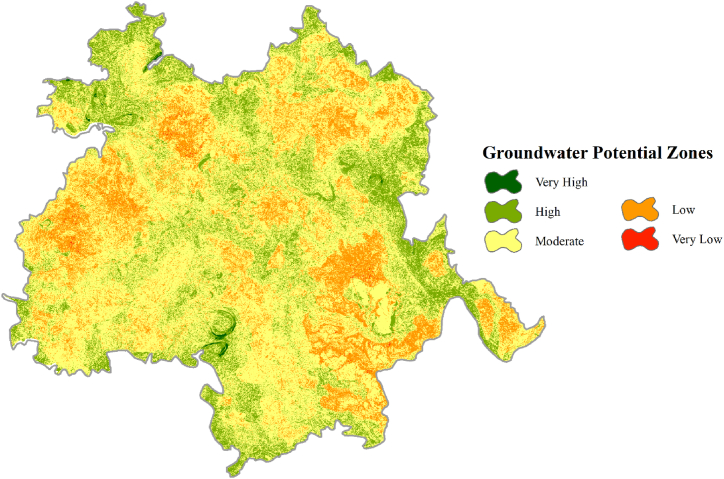
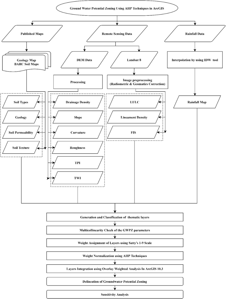
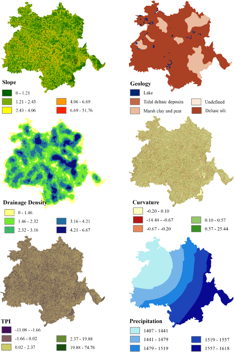
The global groundwater crisis is a perplexing issue, and for its resolution, it is of the utmost importance for delineating groundwater potential zones. This research aims to create a precise groundwater potential map for Bangladesh's Jashore district by combining geospatial approach and an analytical hierarchy process. Fourteen parameters, namely, lineament density, drainage density, land use and land cover, slope, curvature, topographic position index, topographic wetness index, rainfall, geology, roughness, fractional impervious surface, topsoil texture, soil permeability, and general soil types, were considered for the study after an extensive literature review. The weights of these parameters were determined using an analytical hierarchy process, and the scores of each sub-parameter were assigned based on published literature. The final groundwater potential map was then generated using the weighted overlay analysis tool in ArcGIS 10.3 and categorized into five classes. The analysis reveals that very high, high, moderate, low, and very low groundwater potential zones cover 3.96 km (0.16%), 444.75 km (17.72%), 1615.51 km (64.37%), 441.79 km (17.60%), and 3.59 km (0.14%) of the study area, respectively. The map removal sensitivity analysis shows that geology is the most significant element in groundwater potential zoning, followed by land use and land cover (LULC), slope, and topsoil texture as moderately sensitive elements. Since the groundwater potentiality zones of the study region are clearly delineated, this research may be valuable for implementing an appropriate water resource management strategy.
全球地下水危机是一个复杂的问题,为解决这一问题,划定地下水潜力区至关重要。本研究旨在通过结合地理空间方法和层次分析法,为孟加拉国杰索尔地区创建精确的地下水潜力图。在广泛查阅文献后,本研究考虑了14个参数,即线性构造密度、排水密度、土地利用和土地覆盖、坡度、曲率、地形位置指数、地形湿度指数、降雨量、地质、粗糙度、不透水表面分数、表层土壤质地、土壤渗透率和一般土壤类型。使用层次分析法确定这些参数的权重,并根据已发表的文献为每个子参数赋值。然后使用ArcGIS 10.3中的加权叠加分析工具生成最终的地下水潜力图,并将其分为五类。分析表明,极高、高、中、低和极低地下水潜力区分别占研究区域的3.96平方公里(0.16%)、444.75平方公里(17.72%)、1615.51平方公里(64.37%)、441.79平方公里((17.60%)和3.59平方公里(0.14%)。地图去除敏感性分析表明,地质是地下水潜力分区中最重要的因素,其次是土地利用和土地覆盖(LULC)、坡度和表层土壤质地,它们是中等敏感因素。由于研究区域的地下水潜力区已明确划定,本研究对于实施适当的水资源管理策略可能具有重要价值。