School of Engineering, Pontificia Universidad Javeriana Bogota, Cra. 7 No. 40-62, Bogota 110231, Colombia.
The OMICAS Alliance, Pontificia Universidad Javeriana, Cali 760031, Colombia.
Sensors (Basel). 2023 Jun 26;23(13):5917. doi: 10.3390/s23135917.
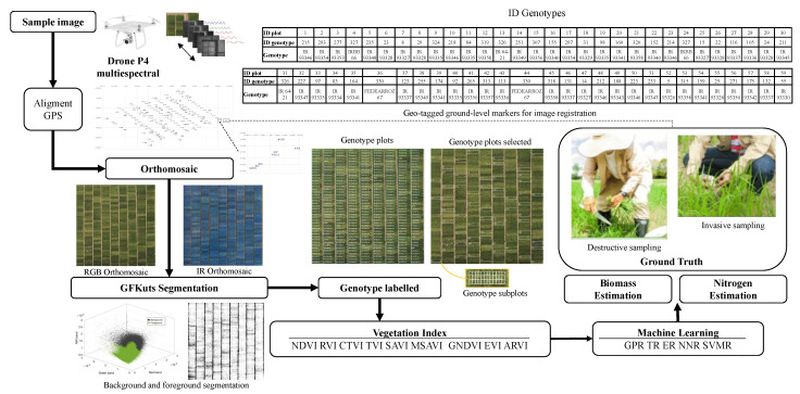
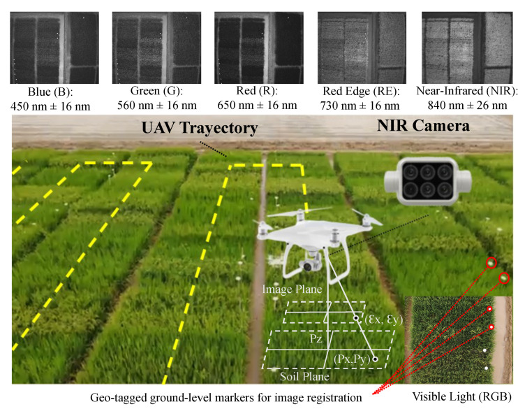
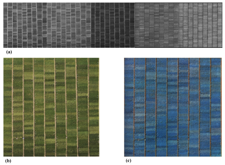
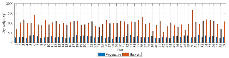
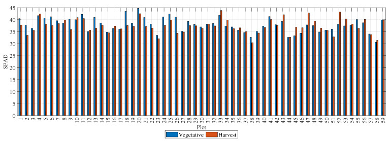
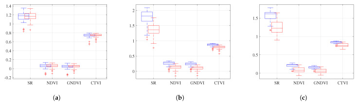
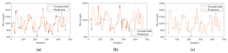
The use of Unmanned Aerial Vehicle (UAV) images for biomass and nitrogen estimation offers multiple opportunities for improving rice yields. UAV images provide detailed, high-resolution visual information about vegetation properties, enabling the identification of phenotypic characteristics for selecting the best varieties, improving yield predictions, and supporting ecosystem monitoring and conservation efforts. In this study, an analysis of biomass and nitrogen is conducted on 59 rice plots selected at random from a more extensive trial comprising 400 rice genotypes. A UAV acquires multispectral reflectance channels across a rice field of subplots containing different genotypes. Based on the ground-truth data, yields are characterized for the 59 plots and correlated with the Vegetation Indices (VIs) calculated from the photogrammetric mapping. The VIs are weighted by the segmentation of the plants from the soil and used as a feature matrix to estimate, via machine learning models, the biomass and nitrogen of the selected rice genotypes. The genotype IR 93346 presented the highest yield with a biomass gain of 10,252.78 kg/ha and an average daily biomass gain above 49.92 g/day. The VIs with the highest correlations with the ground-truth variables were NDVI and SAVI for wet biomass, GNDVI and NDVI for dry biomass, GNDVI and SAVI for height, and NDVI and ARVI for nitrogen. The machine learning model that performed best in estimating the variables of the 59 plots was the Gaussian Process Regression (GPR) model with a correlation factor of 0.98 for wet biomass, 0.99 for dry biomass, and 1 for nitrogen. The results presented demonstrate that it is possible to characterize the yields of rice plots containing different genotypes through ground-truth data and VIs.
利用无人机 (UAV) 图像进行生物质和氮素估算为提高水稻产量提供了多种机会。UAV 图像提供了有关植被特性的详细、高分辨率的视觉信息,使人们能够识别表型特征,从而选择最佳品种,提高产量预测,并支持生态系统监测和保护工作。在这项研究中,对从包含 400 个水稻基因型的更广泛试验中随机选择的 59 个水稻小区进行了生物质和氮素分析。UAV 在包含不同基因型的子小区的稻田中获取多光谱反射率通道。根据地面真值数据,对 59 个小区进行产量特征描述,并与从摄影测量制图中计算出的植被指数 (VI) 相关联。对植物从土壤中进行分割并对 VI 进行加权,将其作为特征矩阵,通过机器学习模型来估算所选水稻基因型的生物质和氮素。基因型 IR 93346 的产量最高,生物量增加了 10,252.78kg/ha,平均日生物量增加超过 49.92g/天。与地面真值变量相关性最高的 VI 是湿生物量的 NDVI 和 SAVI、干生物量的 GNDVI 和 NDVI、高度的 GNDVI 和 SAVI 以及氮的 NDVI 和 ARVI。在估算 59 个小区变量方面表现最好的机器学习模型是高斯过程回归 (GPR) 模型,其湿生物量的相关系数为 0.98,干生物量为 0.99,氮为 1。结果表明,通过地面真值数据和 VI 可以对包含不同基因型的水稻小区的产量进行特征描述。