Wang Ming, She Anqi, Chang Hao, Cheng Feifei, Yang Heming
Network Information Center, Jilin Normal University, Siping, 136000, China.
Human Resource Department, Jilin Normal University, Siping, 136000, China.
Sci Rep. 2024 Mar 27;14(1):7313. doi: 10.1038/s41598-024-57408-0.
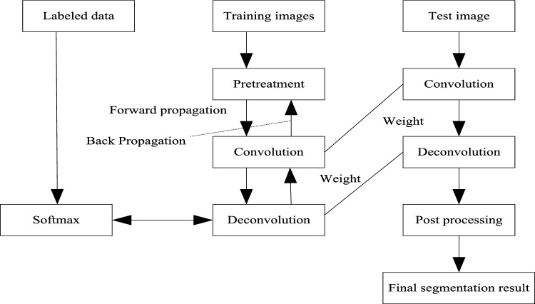
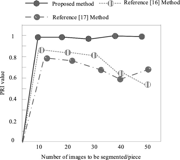
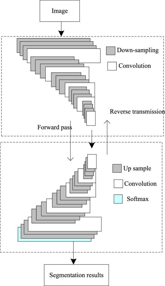
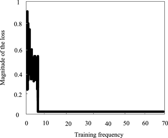
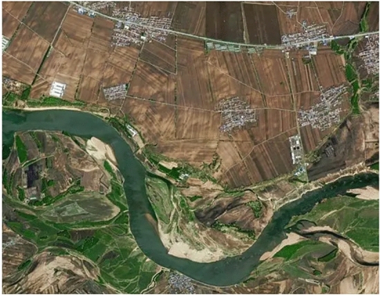
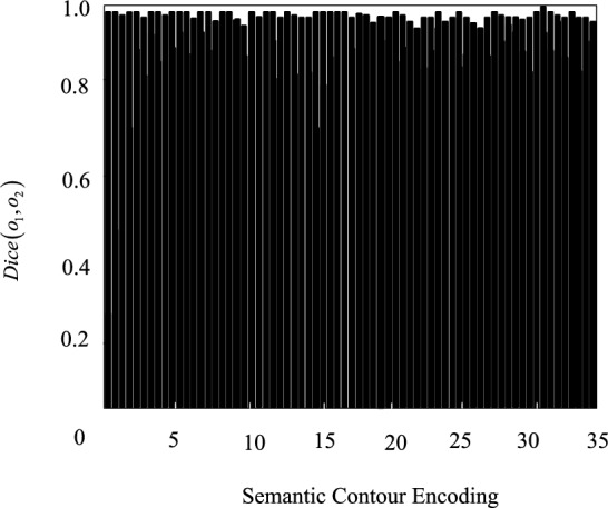
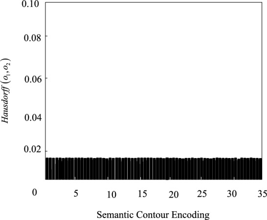
The imbalance of land cover categories is a common problem. Some categories appear less frequently in the image, while others may occupy the vast majority of the proportion. This imbalance can lead the classifier to tend to predict categories with higher frequency of occurrence, while the recognition effect on minority categories is poor. In view of the difficulty of land cover remote sensing image multi-target semantic classification, a semantic classification method of land cover remote sensing image based on depth deconvolution neural network is proposed. In this method, the land cover remote sensing image semantic segmentation algorithm based on depth deconvolution neural network is used to segment the land cover remote sensing image with multi-target semantic segmentation; Four semantic features of color, texture, shape and size in land cover remote sensing image are extracted by using the semantic feature extraction method of remote sensing image based on improved sequential clustering algorithm; The classification and recognition method of remote sensing image semantic features based on random forest algorithm is adopted to classify and identify four semantic feature types of land cover remote sensing image, and realize the semantic classification of land cover remote sensing image. The experimental results show that after this method classifies the multi-target semantic types of land cover remote sensing images, the average values of Dice similarity coefficient and Hausdorff distance are 0.9877 and 0.9911 respectively, which can accurately classify the multi-target semantic types of land cover remote sensing images.
土地覆盖类别不均衡是一个常见问题。某些类别在图像中出现的频率较低,而其他类别可能占据了绝大部分比例。这种不均衡会导致分类器倾向于预测出现频率较高的类别,而对少数类别识别效果较差。针对土地覆盖遥感图像多目标语义分类的困难,提出了一种基于深度反卷积神经网络的土地覆盖遥感图像语义分类方法。该方法利用基于深度反卷积神经网络的土地覆盖遥感图像语义分割算法对土地覆盖遥感图像进行多目标语义分割;采用基于改进的顺序聚类算法的遥感图像语义特征提取方法提取土地覆盖遥感图像中颜色、纹理、形状和大小四个语义特征;采用基于随机森林算法的遥感图像语义特征分类识别方法对土地覆盖遥感图像的四个语义特征类型进行分类识别,实现土地覆盖遥感图像的语义分类。实验结果表明,该方法对土地覆盖遥感图像多目标语义类型进行分类后,Dice相似系数和豪斯多夫距离的平均值分别为0.9877和0.9911,能够准确地对土地覆盖遥感图像多目标语义类型进行分类。