Medici Camilla, Del Soldato Matteo, Fibbi Gabriele, Bini Lorenzo, Confuorto Pierluigi, Mannori Gaddo, Mucci Alessandra, Pellegrineschi Vania, Bianchini Silvia, Raspini Federico, Casagli Nicola
Earth Sciences Department, University of Firenze, Via La Pira, 4, 50121, Firenze, Italy.
Largo San Biagio 149, 51100, Pistoia, Italy.
Sci Rep. 2024 Aug 2;14(1):17950. doi: 10.1038/s41598-024-67725-z.
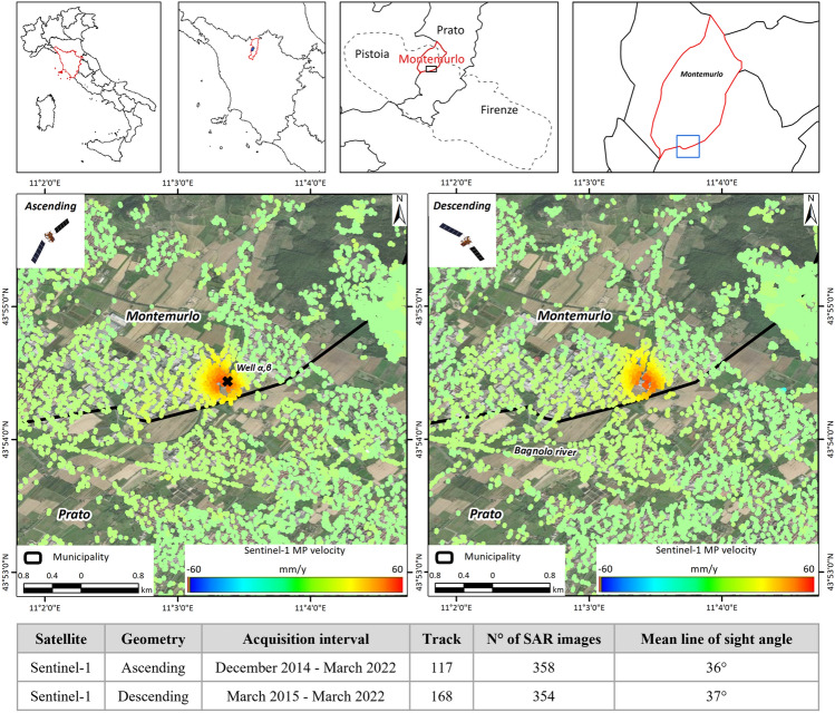
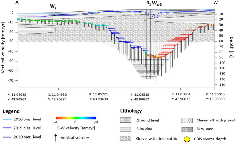
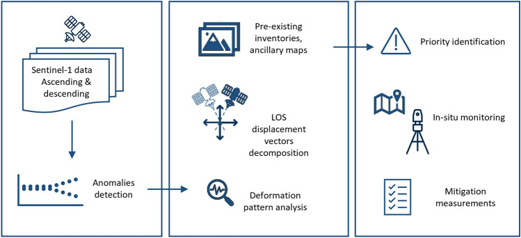
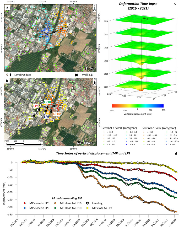
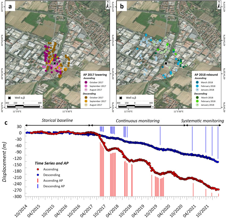
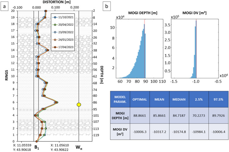
Spaceborne-based monitoring for environmental purposes has become a well-established practice. The recent progress of synthetic aperture radar (SAR) sensors, including through the European Space Agency's (ESA) Sentinel-1 constellation, has enabled the scientific community to identify and monitor several geohazards, including subsidence ground deformations. A case study in the Tuscany Region, Italy, highlights the effectiveness of interferometric synthetic aperture radar (InSAR) in detecting abrupt increases in ground deformation rates in an industrial area of Montemurlo municipality. In this case, InSAR data enabled prompt identification of the phenomenon, supporting the authorities in charge of environmental management to thoroughly investigate the situation. First, an on-site validation was performed via field surveys confirming the presence of cracks and fissures on some edifices. Further analysis, including water pumping rates, settlement gauge and topographic levelling, corroborated the InSAR data's findings regarding vertical deformation. Integration of collected data allowed for spatial identification and assessment of the subsidence bowl and its source depth recognized by the remote sensing data. The Montemurlo case offers a procedural guideline for managing abrupt accelerations, identified by InSAR data in subsidence-prone areas due to fluid overexploitation. In fact, these data proved useful in helping local authorities responsible for hydrogeomorphological risk management. With the exacerbation of deformation issues in subsidence-prone regions due to climate change, early detection and monitoring of such phenomena are increasingly crucial, with InSAR data playing a central role in achieving this goal.
基于太空的环境监测已成为一种成熟的做法。合成孔径雷达(SAR)传感器的最新进展,包括通过欧洲航天局(ESA)的哨兵-1星座,使科学界能够识别和监测包括地面沉降变形在内的几种地质灾害。意大利托斯卡纳地区的一个案例研究突出了干涉合成孔径雷达(InSAR)在检测蒙特穆罗市工业区地面变形率突然增加方面的有效性。在这种情况下,InSAR数据能够迅速识别该现象,支持负责环境管理的当局彻底调查情况。首先,通过实地调查进行了现场验证,确认了一些建筑物上存在裂缝。进一步的分析,包括抽水率、沉降仪和地形水准测量,证实了InSAR数据关于垂直变形的发现。整合收集到的数据可以对沉降盆地及其源深度进行空间识别和评估,这是遥感数据所识别出来的。蒙特穆罗案例为管理因流体过度开采而在沉降易发地区由InSAR数据识别出的突然加速沉降提供了一个程序指南。事实上,这些数据被证明有助于负责水文地貌风险管理的地方当局。随着气候变化导致沉降易发地区变形问题的加剧,对此类现象的早期检测和监测变得越来越重要,InSAR数据在实现这一目标中发挥着核心作用。