Hamre Karen E S, Dismer Amber M, Kishore Nishant, Travers Anyess, McGee Kathleen, Fouché Bernadette, Désir Luccène, Holmes Kathleen, Noland Gregory S, Lemoine Jean Frantz, Chang Michelle A
Malaria Branch, Division of Parasitic Diseases and Malaria, Center for Global Health, Centers for Disease Control and Prevention, Atlanta, Georgia.
CDC Foundation, Atlanta, Georgia.
Am J Trop Med Hyg. 2024 Aug 13;111(4):770-779. doi: 10.4269/ajtmh.23-0891. Print 2024 Oct 2.
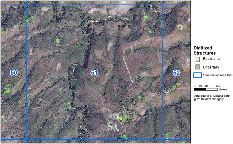
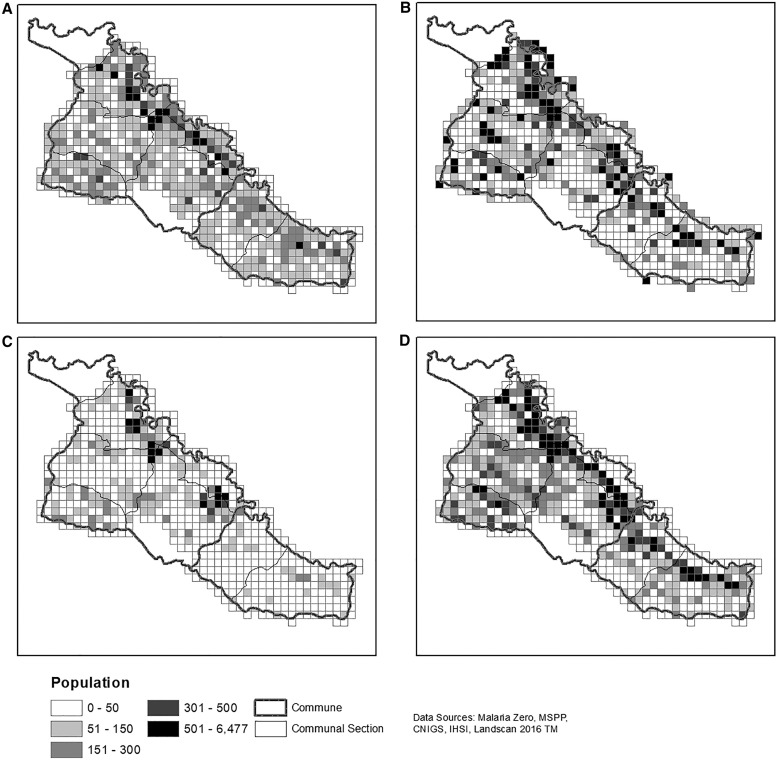
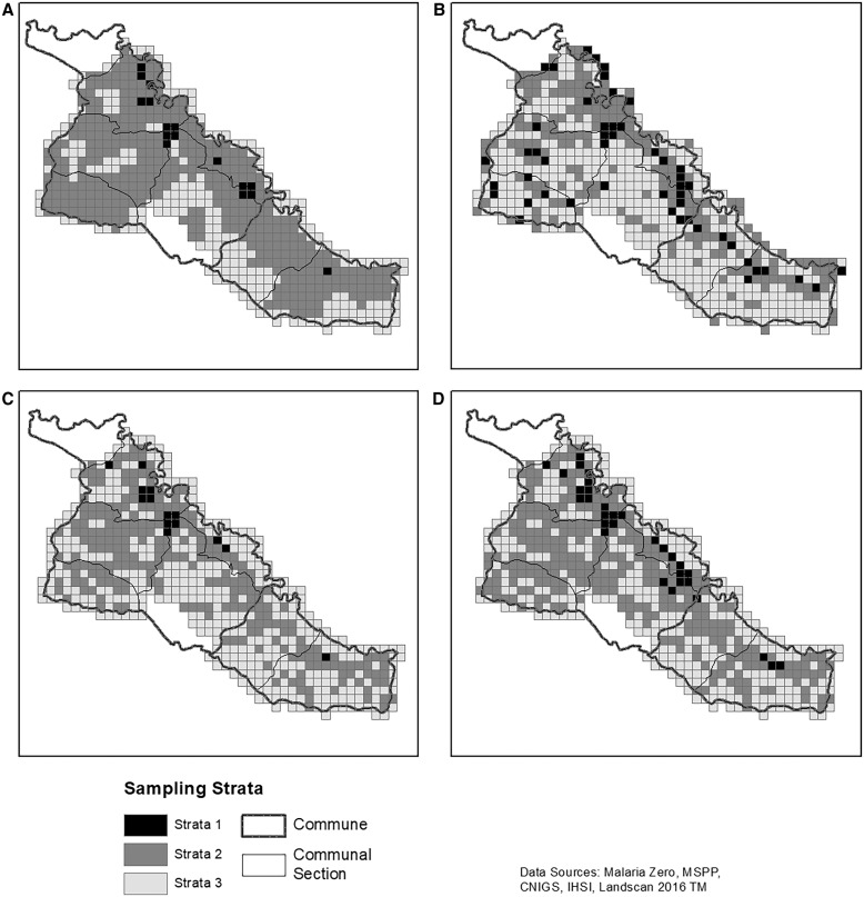
The Ministry of Public Health and Population in Haiti is committed to malaria elimination. In 2017, we used novel methods to conduct a census, monitor progress, and return to sampled households (HH) before a cross-sectional survey in La Chapelle and Verrettes communes in Artibonite department ("the 2017 Artibonite HH census"). Geospatial PDFs with digitized structures and basemaps were loaded onto tablets. Enumerators captured GPS coordinates and details of each HH and points of interest. The census used 1 km2 enumeration areas (EAs) to draw a representative sample. Three remote sampling frames were compared with the 2017 Artibonite HH census. First, 2003 census EAs with 2012 population estimates from the Haitian Institute of Statistics and Informatics were standardized to the study EAs. The second sampling frame used the 2016 LandScanTM population estimates and study EAs. The third sampling frame used structures ≥3 m2 manually digitized using Maxar satellite images. In each study EA, 70% of structures were estimated to be inhabited with 4.5 persons/HH. The census identified 33,060 inhabited HHs with an estimated population of 121,593 and 6,126 points of interest. Using daily coverage maps and including digitized structures were novel methods that improved the census quality. Manual digitization was closest to the census sampling frame results with 30,514 digitized structures in the study area. The LandScanTM method performed better in urban areas; however, it produced the highest number of HHs to sample. If a census is not possible, when feasible, remotely digitizing structures and estimating occupancy may provide a close estimate.
海地公共卫生与人口部致力于消除疟疾。2017年,我们采用新方法在阿蒂博尼特省拉沙佩勒和韦雷特公社进行了一次人口普查,监测进展情况,并在横断面调查前回访抽样家庭(HH)(“2017年阿蒂博尼特家庭普查”)。带有数字化结构和底图的地理空间PDF文件被加载到平板电脑上。普查员记录了每个家庭和兴趣点的GPS坐标及详细信息。此次普查使用1平方公里的普查区(EA)来抽取具有代表性的样本。将三个远程抽样框架与2017年阿蒂博尼特家庭普查进行了比较。首先,根据海地统计与信息研究所2012年的人口估计数对2003年普查的普查区进行标准化处理,使其与研究普查区一致。第二个抽样框架使用了2016年的LandScanTM人口估计数和研究普查区。第三个抽样框架使用了通过Maxar卫星图像手动数字化的面积≥3平方米的建筑。在每个研究普查区,估计70%的建筑有人居住,每户平均4.5人。此次普查共识别出33060个有人居住的家庭,估计人口为121593人,以及6126个兴趣点。使用每日覆盖地图并纳入数字化建筑是提高普查质量的新方法。手动数字化方法最接近普查抽样框架的结果,研究区域内有30514个数字化建筑。LandScanTM方法在城市地区表现更好;然而,它产生的待抽样家庭数量最多。如果无法进行普查,在可行的情况下,远程数字化建筑并估计居住情况可能会提供一个接近的估计。