Department of Earth and Space Sciences, Southern University of Science and Technology, Shenzhen, China.
Department of Geoscience and Remote Sensing, Delft University of Technology, Delft, The Netherlands.
Nature. 2024 Nov;635(8037):108-113. doi: 10.1038/s41586-024-08096-3. Epub 2024 Oct 30.
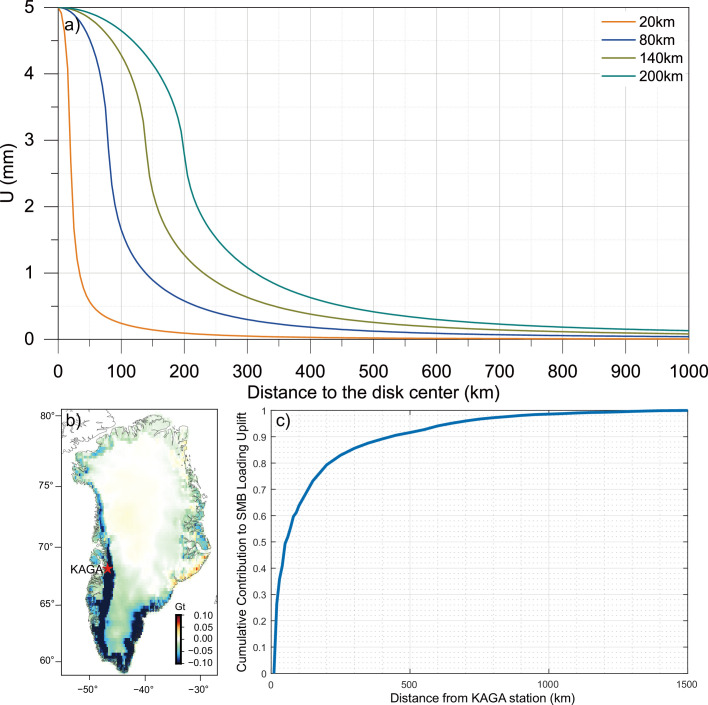
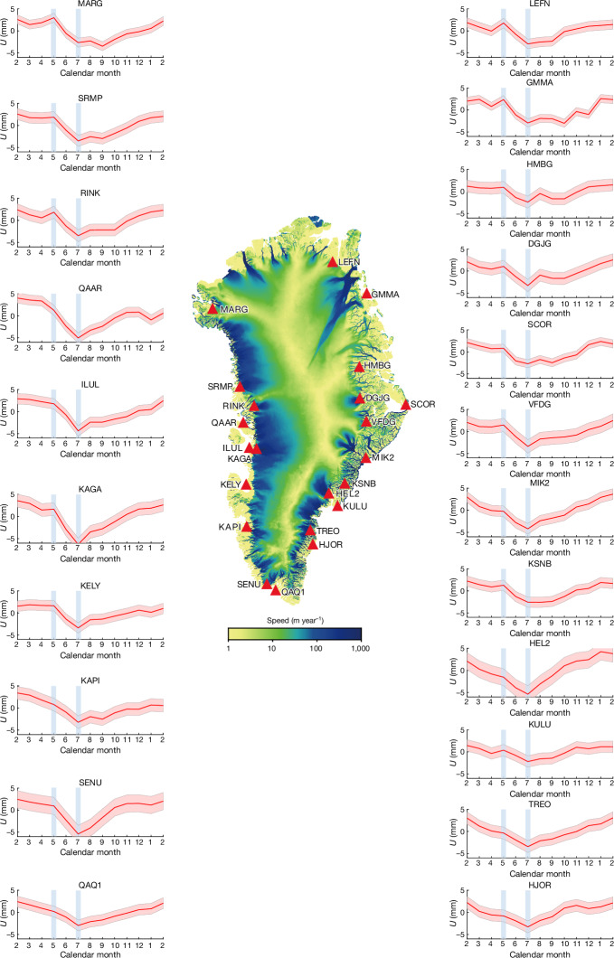
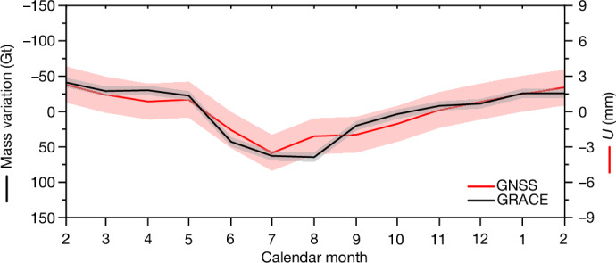
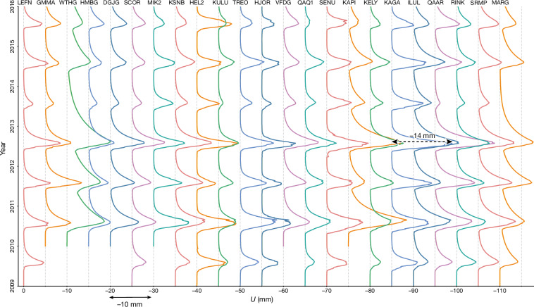
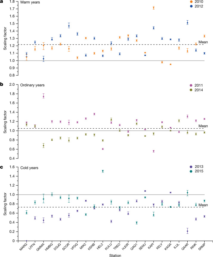
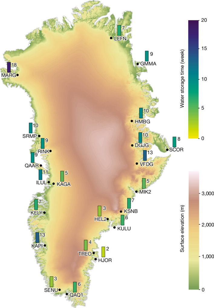
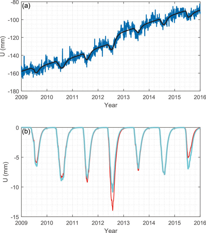
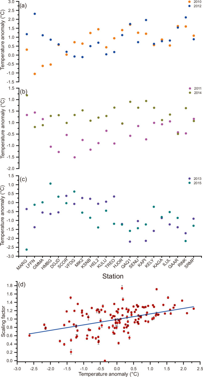
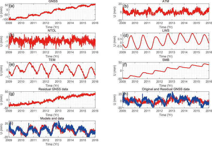
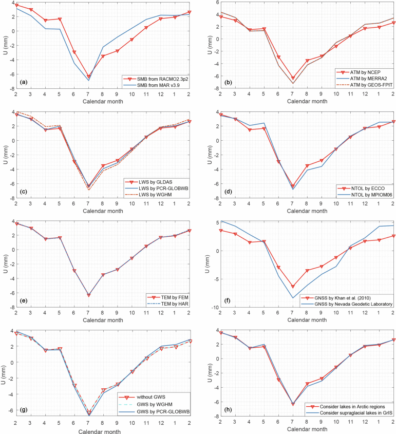
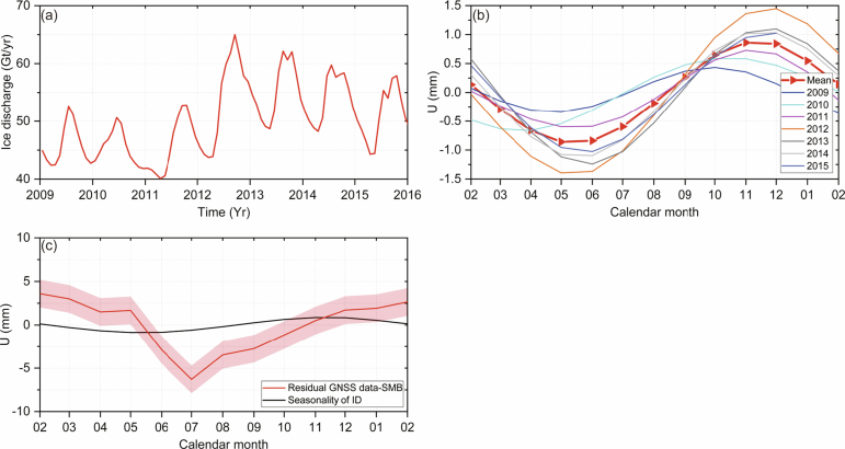
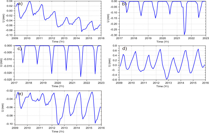
The Greenland ice sheet (GrIS) is at present the largest single contributor to global-mass-induced sea-level rise, primarily because of Arctic amplification on an increasingly warmer Earth. However, the processes of englacial water accumulation, storage and ultimate release remain poorly constrained. Here we show that a noticeable amount of the summertime meltwater mass is temporally buffered along the entire GrIS periphery, peaking in July and gradually reducing thereafter. Our results arise from quantifying the spatiotemporal behaviour of the total mass of water leaving the GrIS by analysing bedrock elastic deformation measured by Global Navigation Satellite System (GNSS) stations. The buffered meltwater causes a subsidence of the bedrock close to GNSS stations of at most approximately 5 mm during the melt season. Regionally, the duration of meltwater storage ranges from 4.5 weeks in the southeast to 9 weeks elsewhere. We also show that the meltwater runoff modelled from regional climate models may contain systematic errors, requiring further scaling of up to about 20% for the warmest years. These results reveal a high potential for GNSS data to constrain poorly known hydrological processes in Greenland, forming the basis for improved projections of future GrIS melt behaviour and the associated sea-level rise.
格陵兰冰原(GrIS)目前是导致全球质量引起的海平面上升的最大单一因素,主要是因为地球变暖导致北极放大效应。然而,冰下水积累、储存和最终释放的过程仍然受到很大限制。在这里,我们表明,大量的夏季融水质量在整个格陵兰冰原周边被暂时缓冲,在 7 月达到峰值,此后逐渐减少。我们的结果来自通过分析由全球导航卫星系统(GNSS)站测量的基岩弹性变形来量化离开格陵兰冰原的总水量的时空行为。缓冲的融水会导致 GNSS 站附近的基岩沉降,在融季最多可达约 5 毫米。在区域上,融水储存的持续时间从东南部的 4.5 周到其他地区的 9 周不等。我们还表明,从区域气候模型模拟的融水径流量可能存在系统误差,需要进一步扩大到约 20%,以适应最温暖的年份。这些结果表明,GNSS 数据有可能对格陵兰岛一些未知的水文过程进行有效约束,为改进未来格陵兰冰原融冰行为和相关海平面上升预测提供了基础。