Université de Franche-Comté, Besançon, France.
Emerg Infect Dis. 2011 Nov;17(11):2026-34. doi: 10.3201/eid1711.110170.
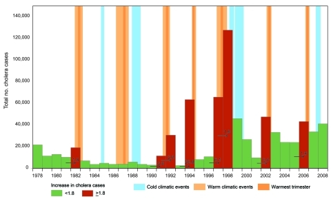
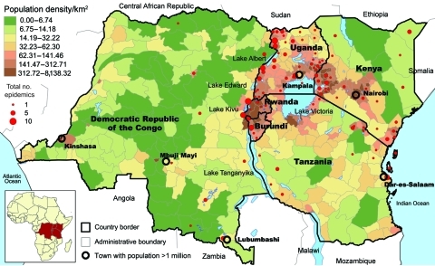
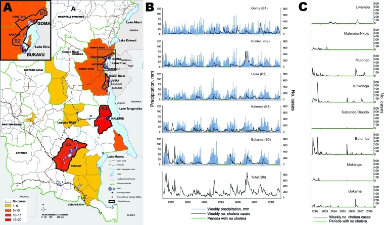
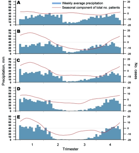
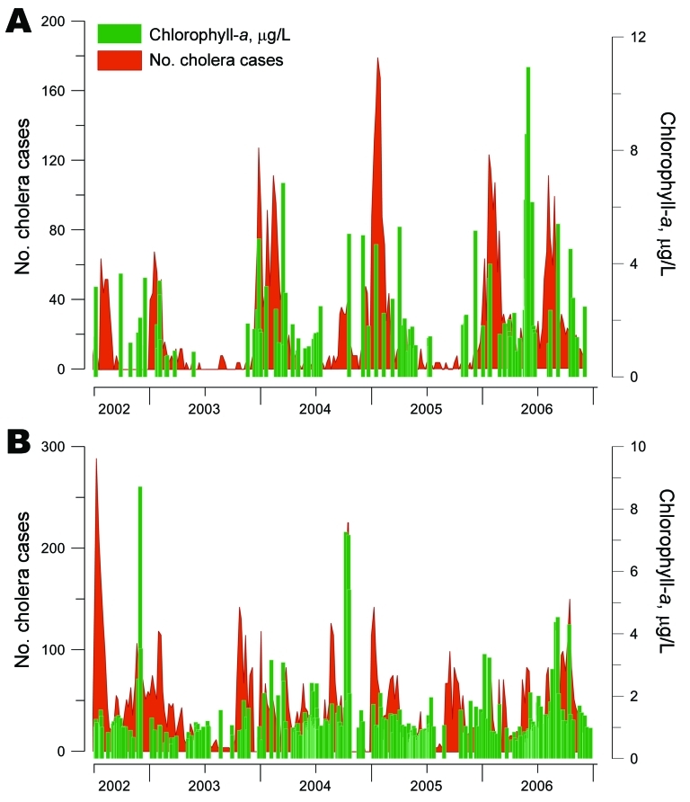
Cholera outbreaks have occurred in Burundi, Rwanda, Democratic Republic of Congo, Tanzania, Uganda, and Kenya almost every year since 1977-1978, when the disease emerged in these countries. We used a multiscale, geographic information system-based approach to assess the link between cholera outbreaks, climate, and environmental variables. We performed time-series analyses and field investigations in the main affected areas. Results showed that cholera greatly increased during El Nino warm events (abnormally warm El Ninos) but decreased or remained stable between these events. Most epidemics occurred in a few hotspots in lakeside areas, where the weekly incidence of cholera varied by season, rainfall, fluctuations of plankton, and fishing activities. During lull periods, persistence of cholera was explained by outbreak dynamics, which suggested a metapopulation pattern, and by endemic foci around the lakes. These links between cholera outbreaks, climate, and lake environments need additional, multidisciplinary study.
自 1977-1978 年以来,布隆迪、卢旺达、刚果民主共和国、坦桑尼亚、乌干达和肯尼亚几乎每年都爆发霍乱。我们使用基于多尺度地理信息系统的方法来评估霍乱爆发、气候和环境变量之间的联系。我们在主要受影响地区进行了时间序列分析和现场调查。结果表明,霍乱在厄尔尼诺暖事件(异常暖的厄尔尼诺)期间大幅增加,但在这些事件之间减少或保持稳定。大多数疫情发生在湖边的少数热点地区,那里的霍乱每周发病率随季节、降雨、浮游生物波动和渔业活动而变化。在平静期间,霍乱的持续存在可以用爆发动态来解释,这表明存在一种准种群模式,以及围绕湖泊的地方流行焦点。需要对霍乱爆发、气候和湖泊环境之间的这些联系进行进一步的多学科研究。