Department of Marine Environmental Informatics, National Taiwan Ocean University, Keelung 20224, Taiwan.
Sensors (Basel). 2011;11(8):7530-44. doi: 10.3390/s110807530. Epub 2011 Jul 29.
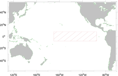
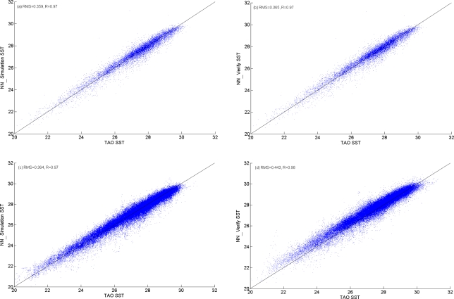
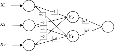
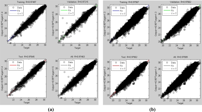
An neural network model of data mining is used to identify error sources in satellite-derived tropical sea surface temperature (SST) estimates from thermal infrared sensors onboard the Geostationary Operational Environmental Satellite (GOES). By using the Back Propagation Network (BPN) algorithm, it is found that air temperature, relative humidity, and wind speed variation are the major factors causing the errors of GOES SST products in the tropical Pacific. The accuracy of SST estimates is also improved by the model. The root mean square error (RMSE) for the daily SST estimate is reduced from 0.58 K to 0.38 K and mean absolute percentage error (MAPE) is 1.03%. For the hourly mean SST estimate, its RMSE is also reduced from 0.66 K to 0.44 K and the MAPE is 1.3%.
利用数据挖掘神经网络模型,从地球同步运行环境卫星(GOES)上的热红外传感器获取的卫星衍生热带海面温度(SST)估计中识别误差源。通过使用反向传播网络(BPN)算法,发现空气温度、相对湿度和风速变化是导致热带太平洋 GOES SST 产品误差的主要因素。该模型还提高了 SST 估计的准确性。每日 SST 估计的均方根误差(RMSE)从 0.58 K 降低到 0.38 K,平均绝对百分比误差(MAPE)为 1.03%。对于每小时平均 SST 估计,其 RMSE 也从 0.66 K 降低到 0.44 K,MAPE 为 1.3%。