Wise Daniel R, Johnson Henry M
J Am Water Resour Assoc. 2011 Oct;47(5):1110-1135. doi: 10.1111/j.1752-1688.2011.00580.x.
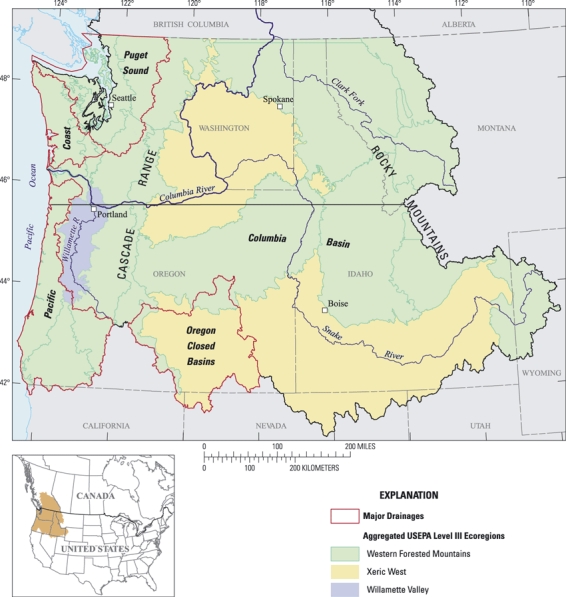
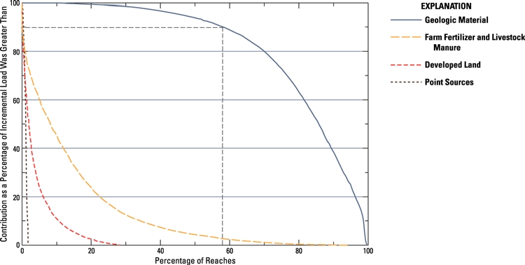
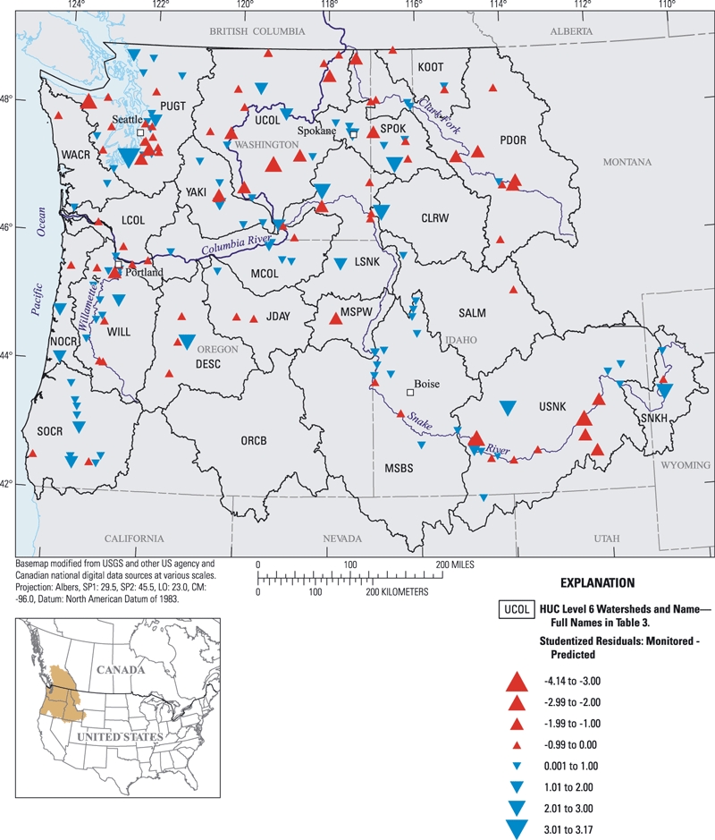
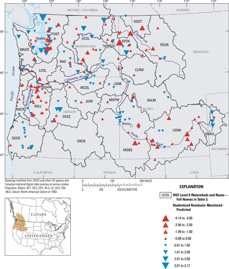
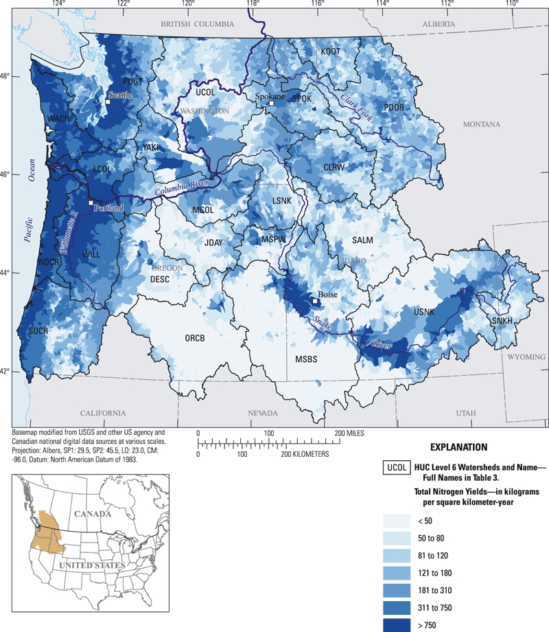
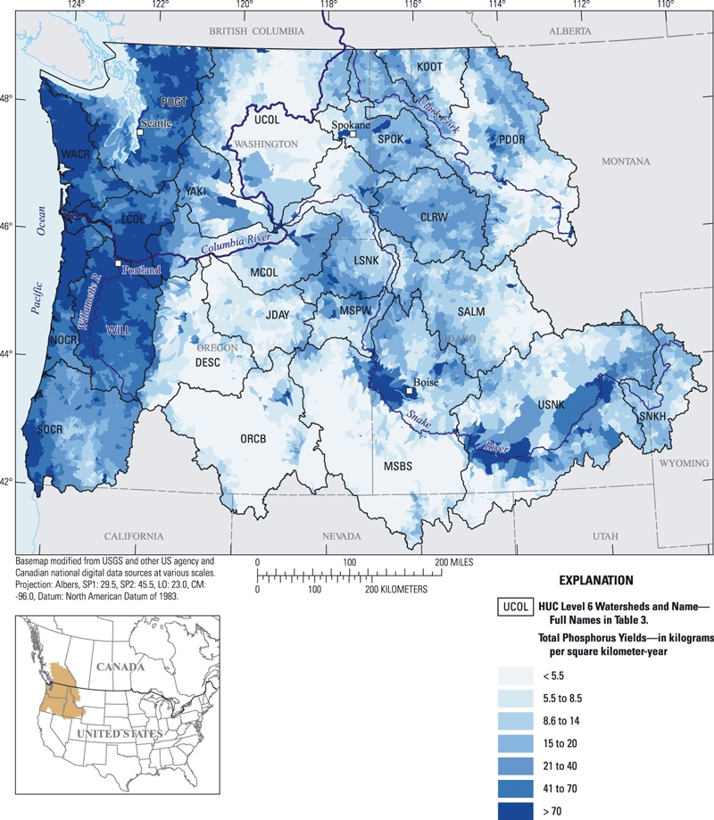
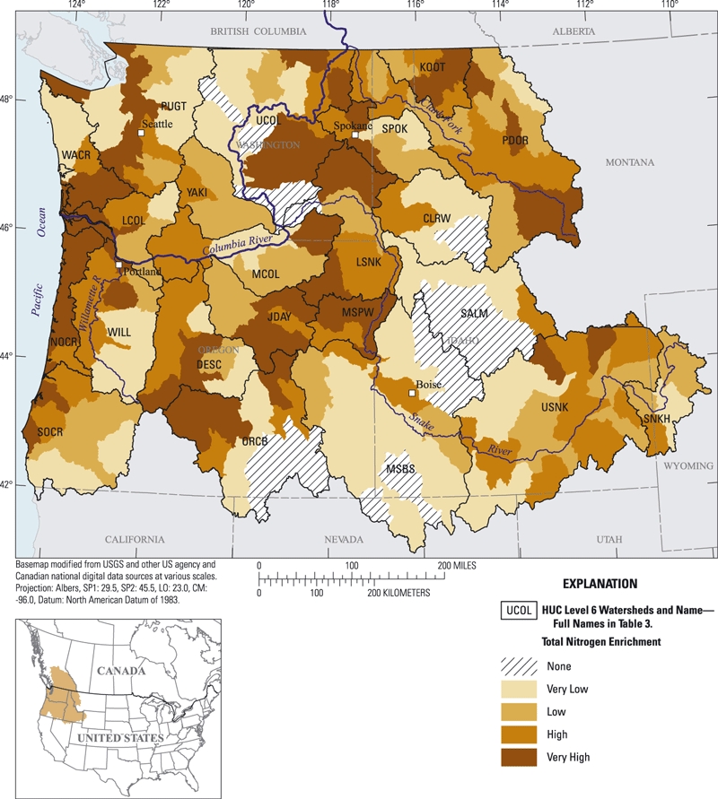
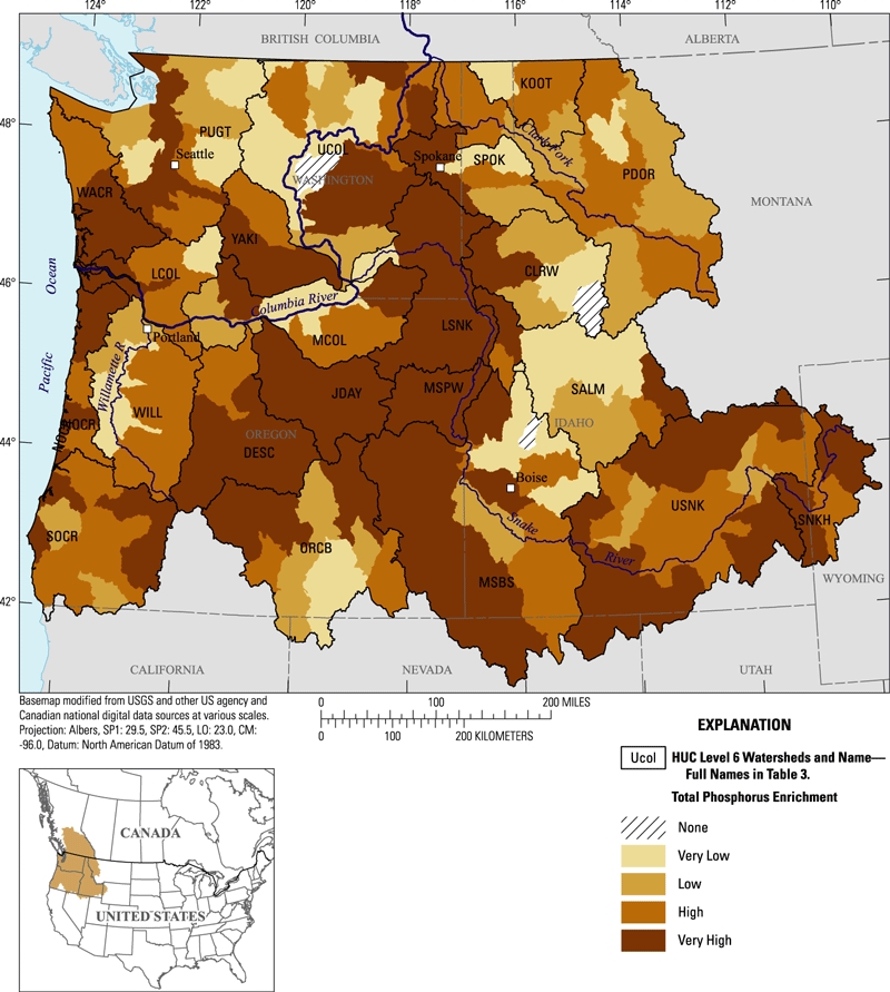
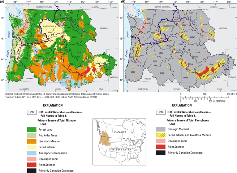
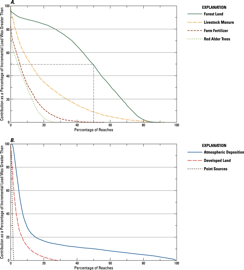
The SPAtially Referenced Regressions On Watershed attributes (SPARROW) model was used to perform an assessment of surface-water nutrient conditions and to identify important nutrient sources in watersheds of the Pacific Northwest region of the United States (U.S.) for the year 2002. Our models included variables representing nutrient sources as well as landscape characteristics that affect nutrient delivery to streams. Annual nutrient yields were higher in watersheds on the wetter, west side of the Cascade Range compared to watersheds on the drier, east side. High nutrient enrichment (relative to the U.S. Environmental Protection Agency's recommended nutrient criteria) was estimated in watersheds throughout the region. Forest land was generally the largest source of total nitrogen stream load and geologic material was generally the largest source of total phosphorus stream load generated within the 12,039 modeled watersheds. These results reflected the prevalence of these two natural sources and the low input from other nutrient sources across the region. However, the combined input from agriculture, point sources, and developed land, rather than natural nutrient sources, was responsible for most of the nutrient load discharged from many of the largest watersheds. Our results provided an understanding of the regional patterns in surface-water nutrient conditions and should be useful to environmental managers in future water-quality planning efforts.
利用流域属性空间参考回归(SPARROW)模型对美国太平洋西北地区2002年的地表水营养状况进行了评估,并确定了重要的营养源。我们的模型包括代表营养源的变量以及影响营养物质输送到溪流的景观特征。与喀斯喀特山脉东侧较干燥流域相比,西侧较湿润流域的年营养产量更高。据估计,该地区流域的营养富集程度较高(相对于美国环境保护局推荐的营养标准)。在12039个建模流域中,林地通常是总氮溪流负荷的最大来源,地质物质通常是总磷溪流负荷的最大来源。这些结果反映了这两种自然源的普遍性以及该地区其他营养源的低输入量。然而,农业、点源和已开发土地的综合输入,而非自然营养源,是许多最大流域排放的大部分营养负荷的来源。我们的结果有助于了解地表水营养状况的区域模式,对环境管理人员未来的水质规划工作应具有参考价值。