DHI Sverige AB, Drakegatan 6, 412 50, Göteborg, Sweden.
Ambio. 2013 May;42(4):447-54. doi: 10.1007/s13280-013-0396-4.
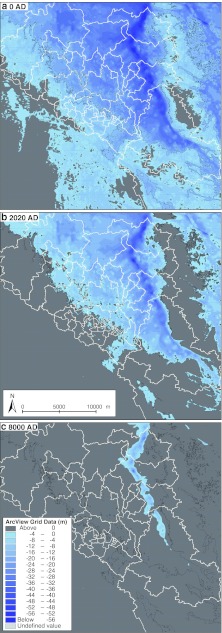
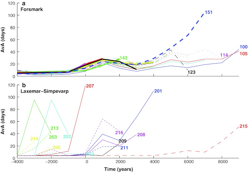
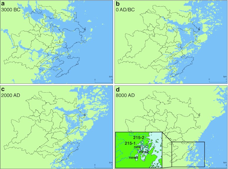
The water turnover of two coastal areas, Forsmark and Laxemar-Simpevarp, has been modeled for 13 selected years between 6500 BC and 9000 AD by utilizing information about past, present, and future bathymetry. The Forsmark area can be described as an open-ended funnel, and is analyzed with a 3D-model (MIKE 3-FM); the Laxemar area is partitioned into clusters of sub-basins treated with a discrete coupled basin model (CouBa). In all simulations, the main variation factor is the land uplift. The 3D-model domain is successively modified. For the CouBa approach the successive basin configurations are objectively deduced based on the 3D domain modifications. The average age (AvA) of the resident water relative to the open coast is generally lower for the Forsmark area. A typical progression is that the AvA values increase until a sub-basin ceases to be connected to the coastal zone. This disconnection is often preceded by a lowered AvA.
利用过去、现在和未来的水深信息,对 Forsmark 和 Laxemar-Simpevarp 两个沿海地区的水交换进行了 13 个选定年份(公元前 6500 年至公元 9000 年)的建模。 Forsmark 地区可以描述为一个无限制的漏斗,并通过 3D 模型(MIKE 3-FM)进行分析; Laxemar 地区被划分为多个子盆地集群,采用离散耦合盆地模型(CouBa)进行处理。在所有模拟中,主要的变化因素是陆地抬升。3D 模型域被逐步修改。对于 CouBa 方法,基于 3D 域的修改,客观地推导出连续的盆地配置。相对于开放海岸,居民水的平均年龄(AvA)在 Forsmark 地区通常较低。一个典型的进展是,AvA 值增加,直到一个子盆地不再与沿海区相连。这种断开通常先于 AvA 值的降低。