School of Geography, Earth and Environmental Sciences, The University of Birmingham, Birmingham, West Midlands, United Kingdom.
PLoS One. 2013 May 6;8(5):e61460. doi: 10.1371/journal.pone.0061460. Print 2013.
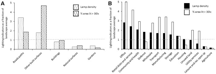
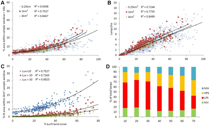
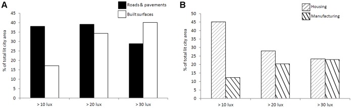
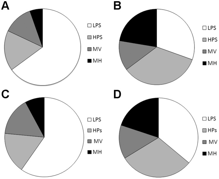
Artificial lighting is strongly associated with urbanisation and is increasing in its extent, brightness and spectral range. Changes in urban lighting have both positive and negative effects on city performance, yet little is known about how its character and magnitude vary across the urban landscape. A major barrier to related research, planning and governance has been the lack of lighting data at the city extent, particularly at a fine spatial resolution. Our aims were therefore to capture such data using aerial night photography and to undertake a case study of urban lighting. We present the finest scale multi-spectral lighting dataset available for an entire city and explore how lighting metrics vary with built density and land-use. We found positive relationships between artificial lighting indicators and built density at coarse spatial scales, whilst at a local level lighting varied with land-use. Manufacturing and housing are the primary land-use zones responsible for the city's brightly lit areas, yet manufacturing sites are relatively rare within the city. Our data suggests that efforts to address light pollution should broaden their focus from residential street lighting to include security lighting within manufacturing areas.
人工照明与城市化密切相关,其范围、亮度和光谱范围都在不断增加。城市照明的变化对城市绩效既有积极影响,也有消极影响,但人们对其特征和程度如何在城市景观中变化知之甚少。相关研究、规划和治理的一个主要障碍是缺乏城市范围内的照明数据,特别是在精细的空间分辨率下。因此,我们的目标是使用航空夜间摄影来获取此类数据,并进行城市照明的案例研究。我们展示了适用于整个城市的最精细的多光谱照明数据集,并探讨了照明指标如何随建筑密度和土地利用而变化。我们发现,在粗糙的空间尺度上,人工照明指标与建筑密度之间存在正相关关系,而在局部尺度上,照明随土地利用而变化。制造业和住宅是城市中灯光最亮的主要土地利用区,但城市内制造业用地相对较少。我们的数据表明,解决光污染的工作应该将其重点从住宅街道照明扩大到包括制造业区域内的安全照明。