Department of Geography, Simon Fraser University, Burnaby, British Columbia, Canada.
PLoS One. 2013 Dec 4;8(12):e82306. doi: 10.1371/journal.pone.0082306. eCollection 2013.
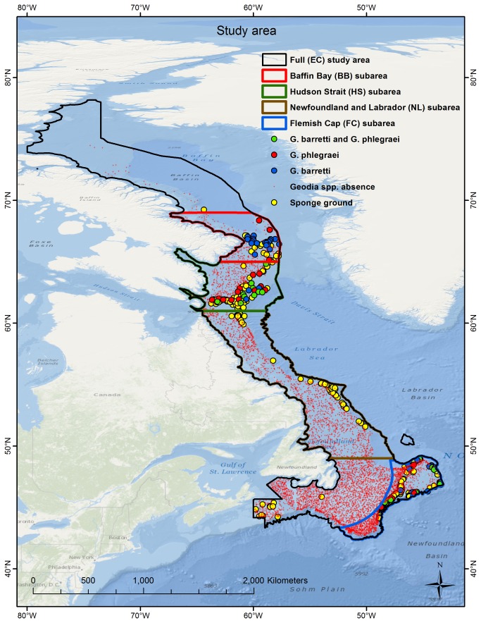
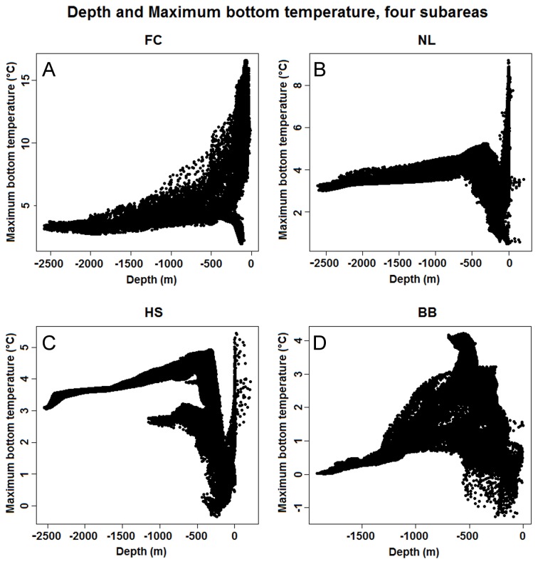
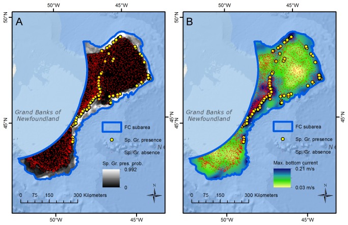
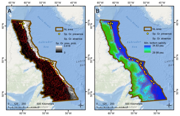
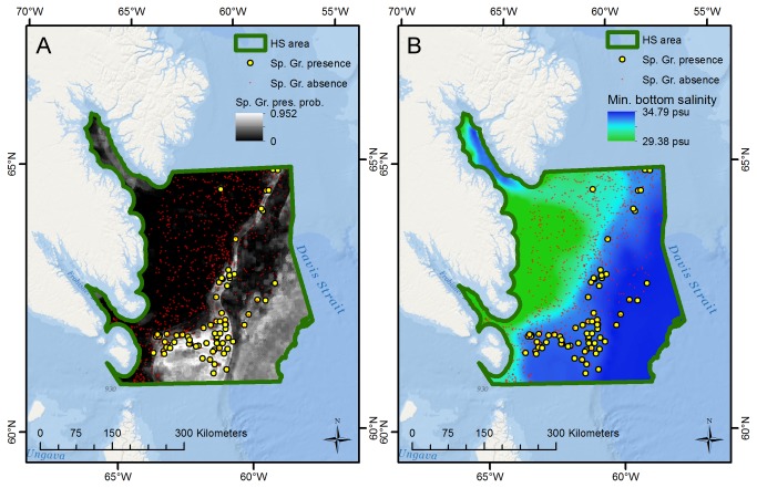
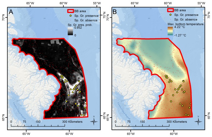
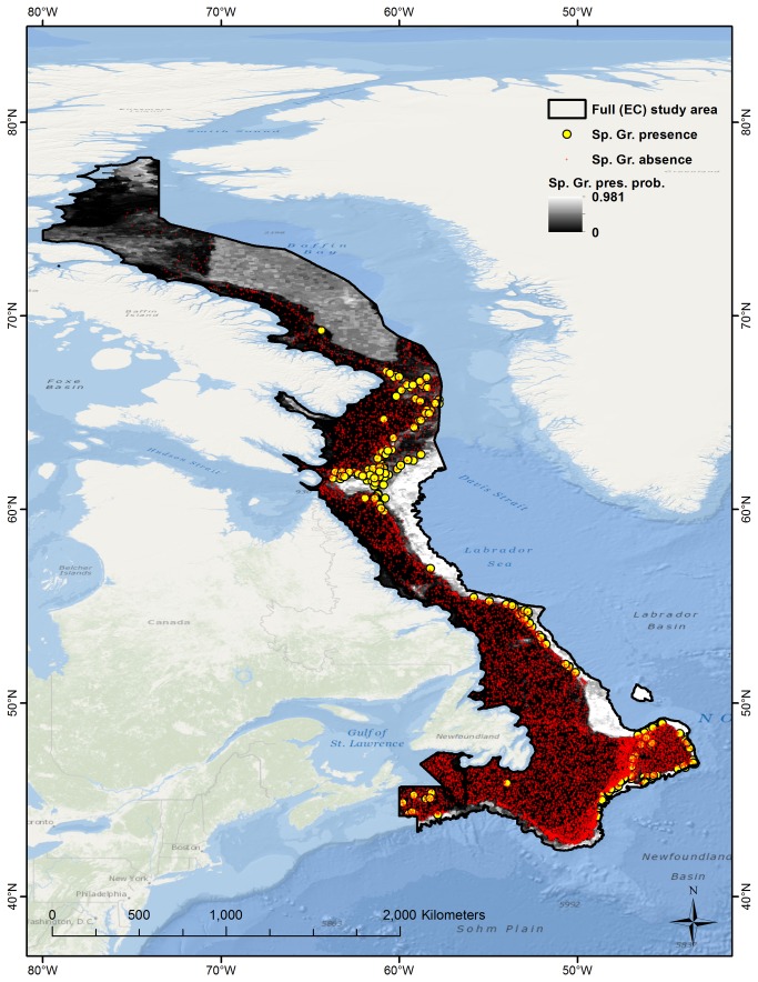
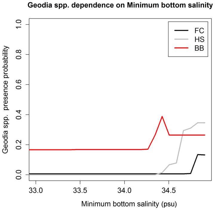
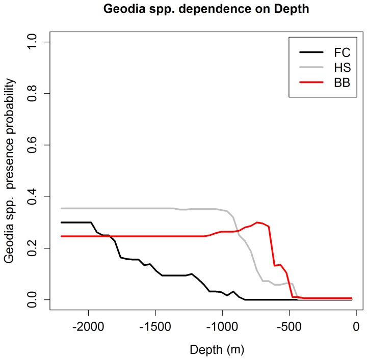
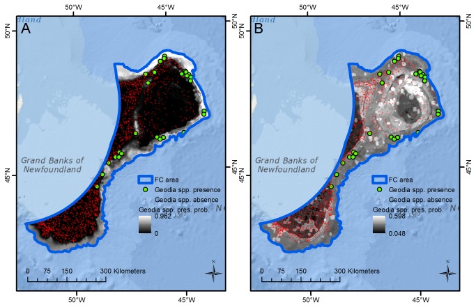
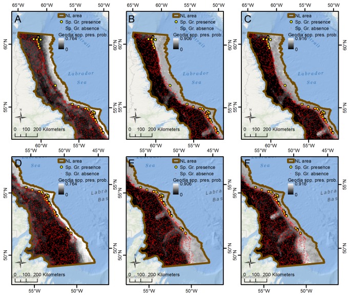
Deep-sea sponge grounds provide structurally complex habitat for fish and invertebrates and enhance local biodiversity. They are also vulnerable to bottom-contact fisheries and prime candidates for Vulnerable Marine Ecosystem designation and related conservation action. This study uses species distribution modeling, based on presence and absence observations of Geodia spp. and sponge grounds derived from research trawl catches, as well as spatially continuous data on the physical and biological ocean environment derived from satellite data and oceanographic models, to model the distribution of Geodia sponges and sponge grounds in the Northwest Atlantic. Most models produce excellent fits with validation data although fits are reduced when models are extrapolated to new areas, especially when oceanographic regimes differ between areas. Depth and minimum bottom salinity were important predictors in most models, and a Geodia spp. minimum bottom salinity tolerance threshold in the 34.3-34.8 psu range was hypothesized on the basis of model structure. The models indicated two currently unsampled regions within the study area, the deeper parts of Baffin Bay and the Newfoundland and Labrador slopes, where future sponge grounds are most likely to be found.
深海海绵场为鱼类和无脊椎动物提供了结构复杂的栖息地,并增强了当地的生物多样性。它们也容易受到底栖渔业的影响,是脆弱海洋生态系统指定和相关保护行动的主要候选对象。本研究使用物种分布模型,基于存在和不存在的观察结果,以及从研究拖网渔获物中获得的 Geodia spp. 和海绵场,以及从卫星数据和海洋学模型获得的空间连续的物理和生物海洋环境数据,来模拟西北大西洋的 Geodia 海绵和海绵场的分布。大多数模型与验证数据拟合得很好,尽管当模型外推到新的区域时,拟合度会降低,尤其是当不同区域的海洋学状态不同时。深度和最低底层盐度是大多数模型中的重要预测因子,根据模型结构,假设 Geodia spp. 的最低底层盐度耐受阈值在 34.3-34.8 psu 范围内。这些模型表明,在研究区域内有两个目前未采样的区域,即巴芬湾的较深部分和纽芬兰和拉布拉多斜坡,在这些区域,未来最有可能发现海绵场。