Louail Thomas, Lenormand Maxime, Cantu Ros Oliva G, Picornell Miguel, Herranz Ricardo, Frias-Martinez Enrique, Ramasco José J, Barthelemy Marc
1] Institut de Physique Théorique, CEA-CNRS (URA 2306), F-91191, Gif-sur-Yvette, France [2] Géographie-Cités, CNRS-Paris 1-Paris 7 (UMR 8504), 13 rue du four, FR-75006 Paris, France.
IFISC, Instituto de Física Interdisciplinar y Sistemas Complejos (CSIC-UIB), Campus Universitat de les Illes Balears, E-07122 Palma de Mallorca, Spain.
Sci Rep. 2014 Jun 13;4:5276. doi: 10.1038/srep05276.
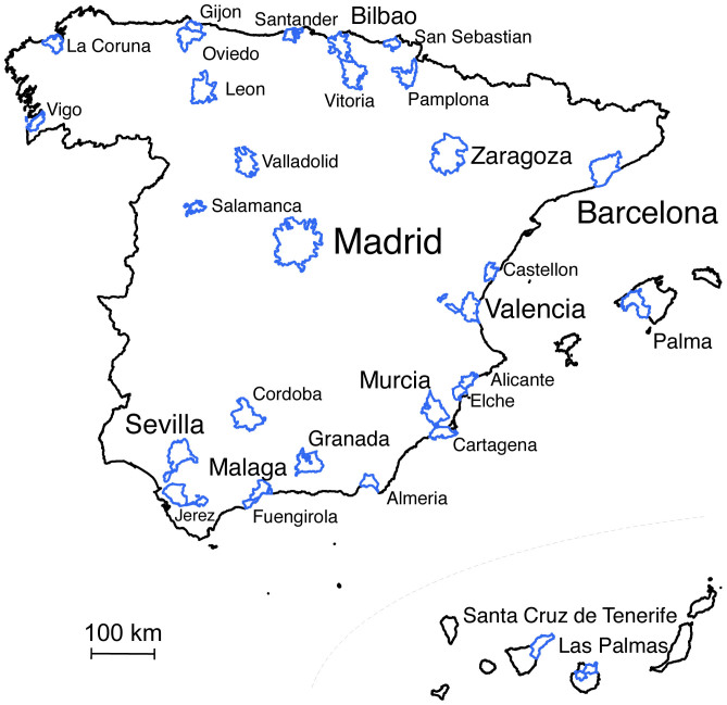
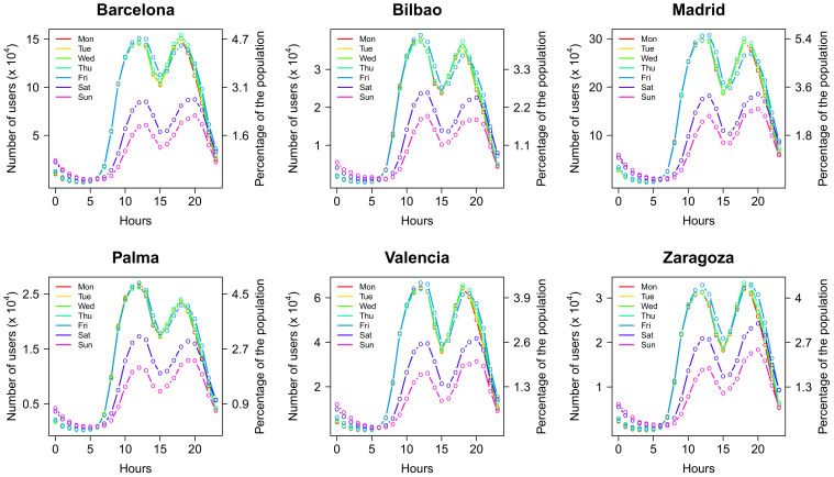
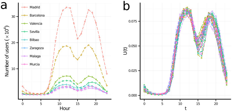
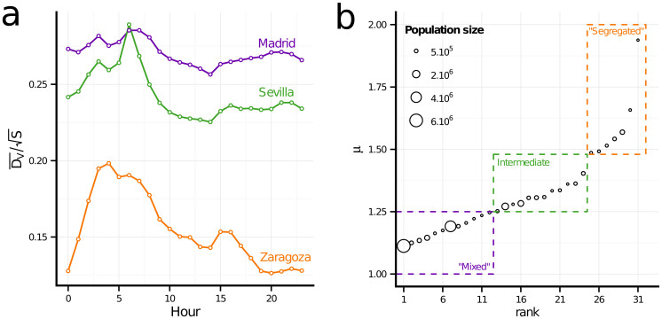
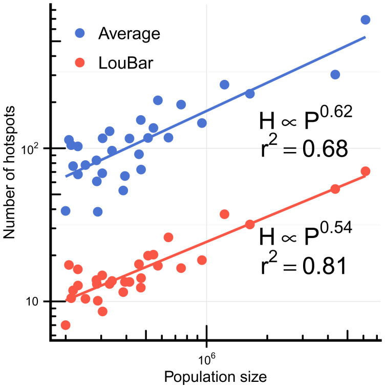
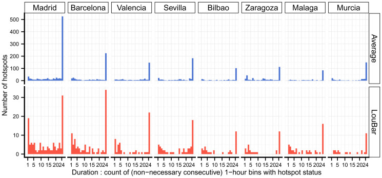
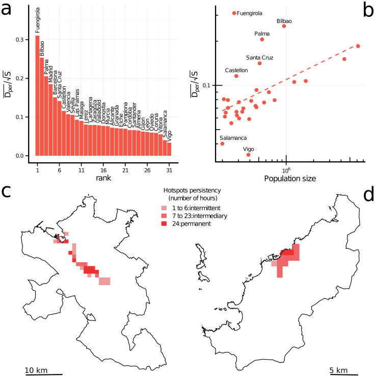
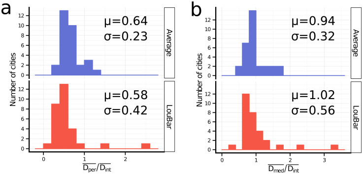
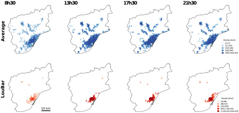
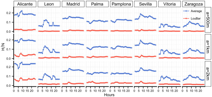
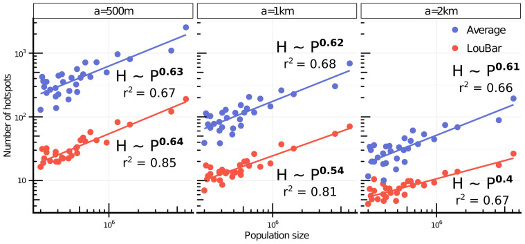
Pervasive infrastructures, such as cell phone networks, enable to capture large amounts of human behavioral data but also provide information about the structure of cities and their dynamical properties. In this article, we focus on these last aspects by studying phone data recorded during 55 days in 31 Spanish cities. We first define an urban dilatation index which measures how the average distance between individuals evolves during the day, allowing us to highlight different types of city structure. We then focus on hotspots, the most crowded places in the city. We propose a parameter free method to detect them and to test the robustness of our results. The number of these hotspots scales sublinearly with the population size, a result in agreement with previous theoretical arguments and measures on employment datasets. We study the lifetime of these hotspots and show in particular that the hierarchy of permanent ones, which constitute the 'heart' of the city, is very stable whatever the size of the city. The spatial structure of these hotspots is also of interest and allows us to distinguish different categories of cities, from monocentric and "segregated" where the spatial distribution is very dependent on land use, to polycentric where the spatial mixing between land uses is much more important. These results point towards the possibility of a new, quantitative classification of cities using high resolution spatio-temporal data.
诸如手机网络之类的普及基础设施,不仅能够收集大量人类行为数据,还能提供有关城市结构及其动态特性的信息。在本文中,我们通过研究西班牙31个城市55天内记录的手机数据,聚焦于这些最后的方面。我们首先定义一个城市扩张指数,该指数衡量一天中个体之间的平均距离如何变化,使我们能够突出不同类型的城市结构。然后我们关注热点,即城市中最拥挤的地方。我们提出一种无参数方法来检测它们并测试结果的稳健性。这些热点的数量与人口规模呈次线性比例关系,这一结果与先前关于就业数据集的理论论证和测量结果一致。我们研究这些热点的存在时间,特别表明构成城市“核心”的永久性热点的层级结构无论城市规模大小都非常稳定。这些热点的空间结构也很有趣,使我们能够区分不同类别的城市,从空间分布非常依赖土地利用的单中心和“隔离”城市,到土地利用之间空间混合更为重要的多中心城市。这些结果表明,利用高分辨率时空数据对城市进行新的定量分类是有可能的。