Senseable City Laboratory, Massachusetts Institute of Technology, Cambridge, Massachusetts, United States of America.
Sociology and Economics of Networks and Services Department, Orange Labs, Paris, France.
PLoS One. 2013 Dec 18;8(12):e81707. doi: 10.1371/journal.pone.0081707. eCollection 2013.
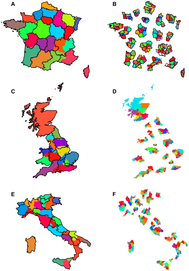
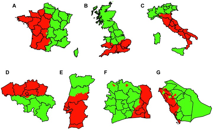
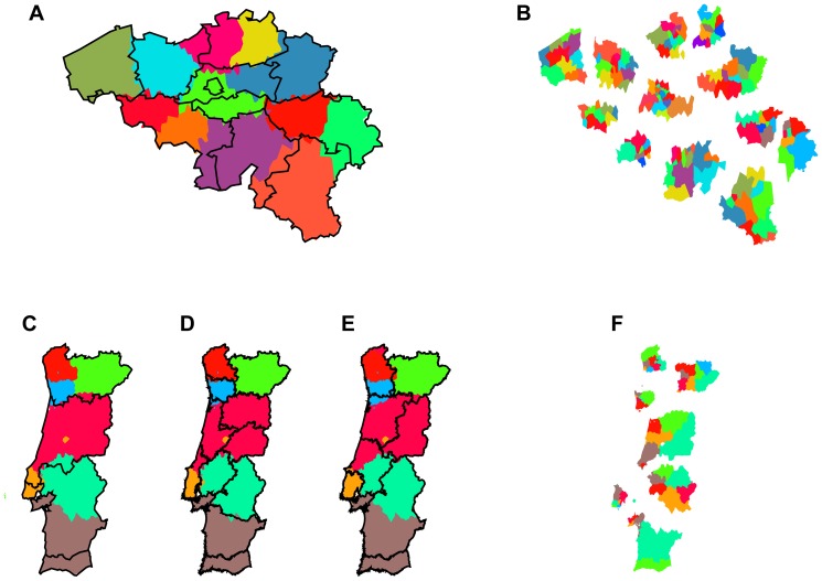
Large-scale networks of human interaction, in particular country-wide telephone call networks, can be used to redraw geographical maps by applying algorithms of topological community detection. The geographic projections of the emerging areas in a few recent studies on single regions have been suggested to share two distinct properties: first, they are cohesive, and second, they tend to closely follow socio-economic boundaries and are similar to existing political regions in size and number. Here we use an extended set of countries and clustering indices to quantify overlaps, providing ample additional evidence for these observations using phone data from countries of various scales across Europe, Asia, and Africa: France, the UK, Italy, Belgium, Portugal, Saudi Arabia, and Ivory Coast. In our analysis we use the known approach of partitioning country-wide networks, and an additional iterative partitioning of each of the first level communities into sub-communities, revealing that cohesiveness and matching of official regions can also be observed on a second level if spatial resolution of the data is high enough. The method has possible policy implications on the definition of the borderlines and sizes of administrative regions.
大规模的人类互动网络,特别是全国性的电话网络,可以通过应用拓扑社区检测算法来重新绘制地理地图。在最近关于单一区域的几项研究中,新兴区域的地理投影被认为具有两个明显的特征:第一,它们具有内聚性;第二,它们往往紧密遵循社会经济边界,并且在大小和数量上与现有政治区域相似。在这里,我们使用了一套扩展的国家和聚类指数来量化重叠,使用来自欧洲、亚洲和非洲不同规模国家的电话数据提供了大量额外的证据:法国、英国、意大利、比利时、葡萄牙、沙特阿拉伯和科特迪瓦。在我们的分析中,我们使用了已知的分割全国性网络的方法,以及对每个一级社区进行额外的迭代分割成子社区的方法,揭示了如果数据的空间分辨率足够高,在第二级也可以观察到内聚性和与官方区域的匹配。该方法可能对行政区域的边界和大小的定义具有政策意义。