Miller Jennifer R B, Jhala Yadvendradev V, Jena Jyotirmay, Schmitz Oswald J
School of Forestry & Environmental Studies, Yale University New Haven, Connecticut, 06511 ; Wildlife Institute of India Dehradun, Uttarakhand, 248001, India.
Wildlife Institute of India Dehradun, Uttarakhand, 248001, India.
Ecol Evol. 2015 Mar;5(6):1354-67. doi: 10.1002/ece3.1440. Epub 2015 Mar 2.
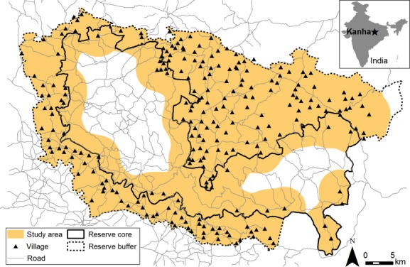
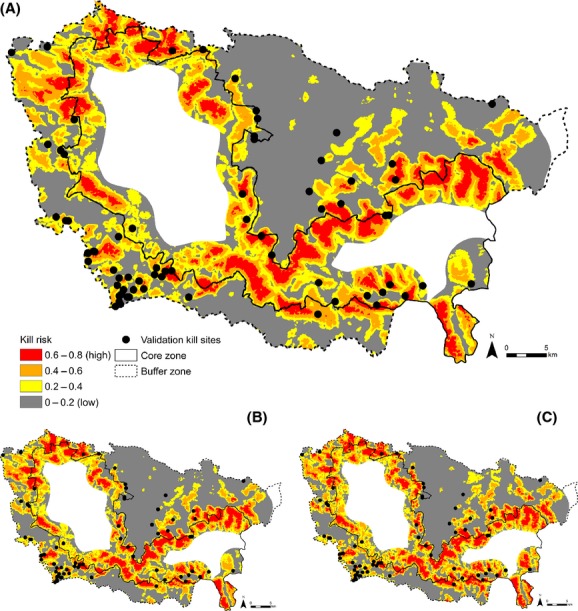
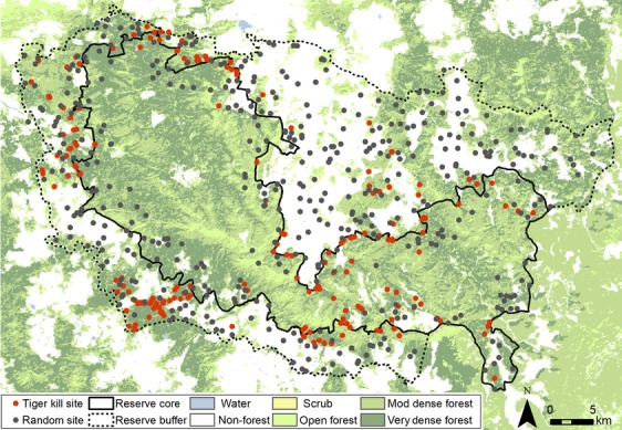
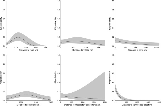
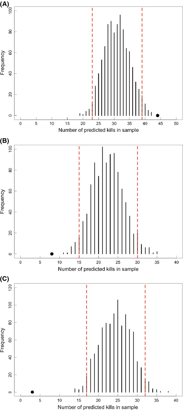
Innovative conservation tools are greatly needed to reduce livelihood losses and wildlife declines resulting from human-carnivore conflict. Spatial risk modeling is an emerging method for assessing the spatial patterns of predator-prey interactions, with applications for mitigating carnivore attacks on livestock. Large carnivores that ambush prey attack and kill over small areas, requiring models at fine spatial grains to predict livestock depredation hot spots. To detect the best resolution for predicting where carnivores access livestock, we examined the spatial attributes associated with livestock killed by tigers in Kanha Tiger Reserve, India, using risk models generated at 20, 100, and 200-m spatial grains. We analyzed land-use, human presence, and vegetation structure variables at 138 kill sites and 439 random sites to identify key landscape attributes where livestock were vulnerable to tigers. Land-use and human presence variables contributed strongly to predation risk models, with most variables showing high relative importance (≥0.85) at all spatial grains. The risk of a tiger killing livestock increased near dense forests and near the boundary of the park core zone where human presence is restricted. Risk was nonlinearly related to human infrastructure and open vegetation, with the greatest risk occurring 1.2 km from roads, 1.1 km from villages, and 8.0 km from scrubland. Kill sites were characterized by denser, patchier, and more complex vegetation with lower visibility than random sites. Risk maps revealed high-risk hot spots inside of the core zone boundary and in several patches in the human-dominated buffer zone. Validation against known kills revealed predictive accuracy for only the 20 m model, the resolution best representing the kill stage of hunting for large carnivores that ambush prey, like the tiger. Results demonstrate that risk models developed at fine spatial grains can offer accurate guidance on landscape attributes livestock should avoid to minimize human-carnivore conflict.
迫切需要创新的保护手段,以减少因人类与食肉动物冲突导致的生计损失和野生动物数量下降。空间风险建模是一种新兴的评估捕食者与猎物互动空间模式的方法,可用于减轻食肉动物对牲畜的攻击。伏击猎物的大型食肉动物在小范围内发动攻击并杀死猎物,这就需要高空间分辨率的模型来预测牲畜被捕食的热点区域。为了确定预测食肉动物接近牲畜地点的最佳分辨率,我们利用在20米、100米和200米空间分辨率下生成的风险模型,研究了印度卡纳老虎保护区内被老虎捕杀的牲畜的空间属性。我们分析了138个捕杀地点和439个随机地点的土地利用、人类活动和植被结构变量,以确定牲畜易受老虎攻击的关键景观属性。土地利用和人类活动变量对捕食风险模型有很大影响,大多数变量在所有空间分辨率下都显示出较高的相对重要性(≥0.85)。老虎捕杀牲畜的风险在茂密森林附近以及公园核心区边界附近(人类活动受限)会增加。风险与人类基础设施和开阔植被呈非线性关系,在距离道路1.2公里处、距离村庄1.1公里处和距离灌丛8.0公里处风险最高。捕杀地点的植被比随机地点更密集、更零散、更复杂,能见度更低。风险地图显示,核心区边界内以及人类主导的缓冲区的几个区域存在高风险热点。与已知捕杀情况进行验证后发现,只有20米分辨率的模型具有预测准确性,该分辨率最能代表像老虎这样伏击猎物的大型食肉动物的捕杀阶段。结果表明,高空间分辨率下开发的风险模型可为牲畜应避开的景观属性提供准确指导,以尽量减少人类与食肉动物的冲突。