Xia Jing, Cai Shunxiang, Zhang Huaxun, Lin Wen, Fan Yunzhou, Qiu Juan, Sun Liqian, Chang Bianrong, Zhang Zhijie, Nie Shaofa
Department of Epidemiology and Health Statistics, School of Public Health, Tongji Medical College, Huazhong University of Science and Technology, 430079, Wuhan, China.
Institute of parasitic disease Control, Hubei Provincial Center for Disease Control and Prevention, 430079, Wuhan, China.
Malar J. 2015 Apr 8;14:145. doi: 10.1186/s12936-015-0650-2.
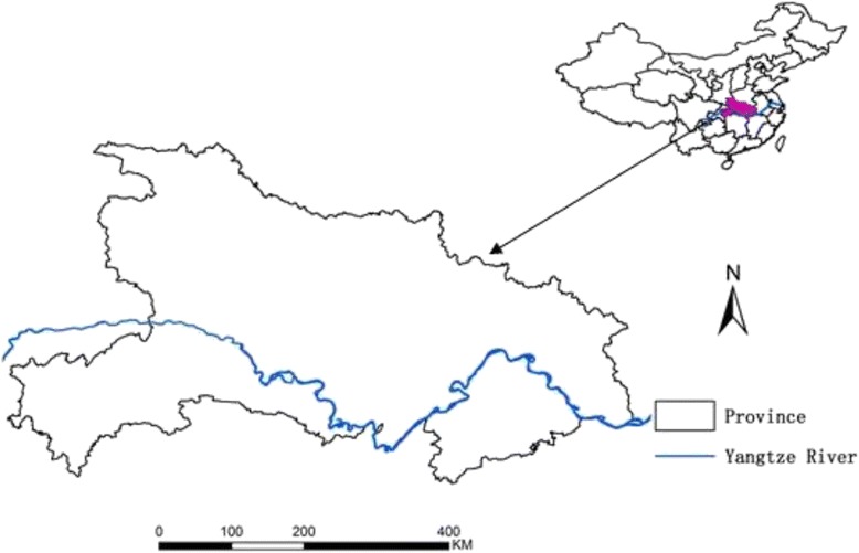
Malaria remains a public health concern in Hubei Province despite the significant decrease in malaria incidence over the past decades. Furthermore, history reveals that malaria transmission is unstable and prone to local outbreaks in Hubei Province. Thus, understanding spatial, temporal, and spatiotemporal distribution of malaria is needed for the effective control and elimination of this disease in Hubei Province.
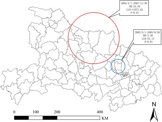
Annual malaria incidence at the county level was calculated using the malaria cases reported from 2004 to 2011 in Hubei Province. Geographical information system (GIS) and spatial scan statistic method were used to identify spatial clusters of malaria cases at the county level. Pure retrospective temporal analysis scanning was performed to detect the temporal clusters of malaria cases with high rates using the discrete Poisson model. The space-time cluster was detected with high rates through the retrospective space-time analysis scanning using the discrete Poisson model.
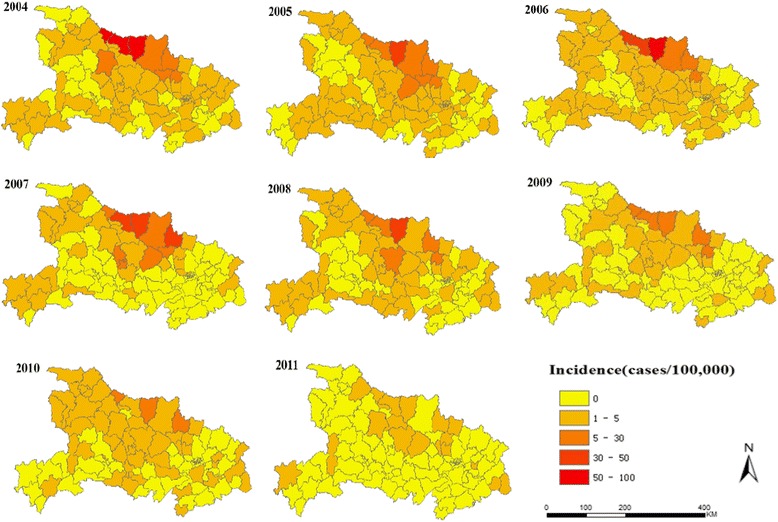
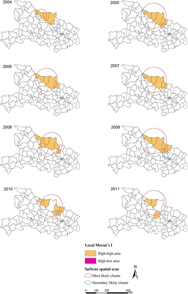
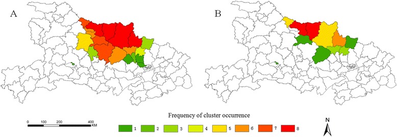
The overall malaria incidence decreased to a low level from 2004 to 2011. The purely spatial cluster of malaria cases from 2004 to 2011 showed that the disease was not randomly distributed in the study area. A total of 11 high-risk counties were determined through Local Moran's I analysis from 2004 to 2011. The method of spatial scan statistics identified different 11 significant spatial clusters between 2004 and 2011. The space-time clustering analysis determined that the most likely cluster included 13 counties, and the time frame was from April 2004 to November 2007.
The GIS application and scan statistical technique can provide means to detect spatial, temporal, and spatiotemporal distribution of malaria, as well as to identify malaria high-risk areas. This study could be helpful in prioritizing resource assignment in high-risk areas for future malaria control and elimination.
尽管在过去几十年里疟疾发病率显著下降,但湖北省的疟疾仍然是一个公共卫生问题。此外,历史记录显示,湖北省的疟疾传播不稳定,容易出现局部暴发。因此,为了在湖北省有效控制和消除这种疾病,需要了解疟疾的空间、时间和时空分布情况。
利用湖北省2004年至2011年报告的疟疾病例计算县级年度疟疾发病率。采用地理信息系统(GIS)和空间扫描统计方法识别县级疟疾病例的空间聚集情况。使用离散泊松模型进行纯回顾性时间分析扫描,以检测高发病率的疟疾病例的时间聚集情况。通过使用离散泊松模型的回顾性时空分析扫描,检测高发病率的时空聚集情况。
2004年至2011年,总体疟疾发病率降至低水平。2004年至2011年疟疾病例的纯空间聚集表明,该疾病在研究区域内并非随机分布。通过2004年至2011年的局部莫兰指数分析,共确定了11个高风险县。空间扫描统计方法在2004年至2011年期间识别出11个不同的显著空间聚集区。时空聚集分析确定,最可能的聚集区包括13个县,时间范围为2004年4月至2007年11月。
GIS应用和扫描统计技术可以提供检测疟疾空间、时间和时空分布以及识别疟疾高风险地区的手段。本研究有助于在高风险地区优先分配资源,以用于未来的疟疾控制和消除工作。