Maravi Moises E, Snyder Lauren E, McEwen L Dean, DeYoung Kathryn, Davidson Arthur J
Denver Public Health, Denver, CO, USA.
Colorado School of Public Health, University of Colorado, Aurora, CO, USA.
Biomed Inform Insights. 2017 Mar 30;9:1178222617700626. doi: 10.1177/1178222617700626. eCollection 2017.
Recent pertussis outbreaks in the United States suggest our response to local disease outbreaks (eg, vaccine-preventable ) may benefit from understanding and applying spatial analytical methods that use data from immunization information systems at a subcounty level.
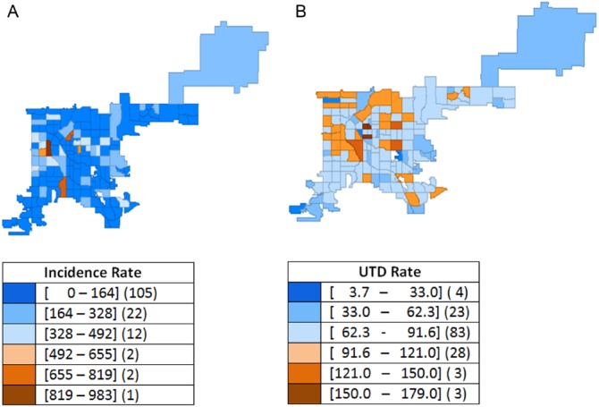
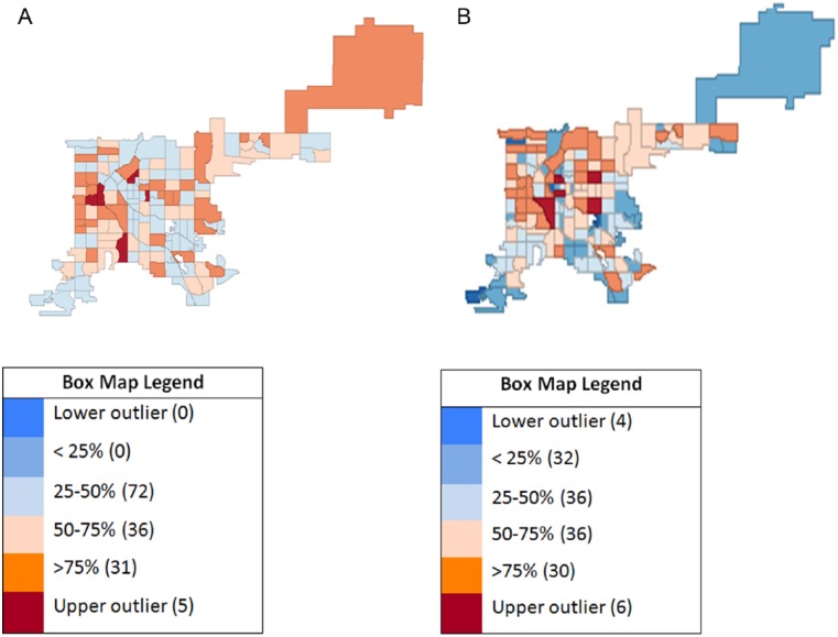
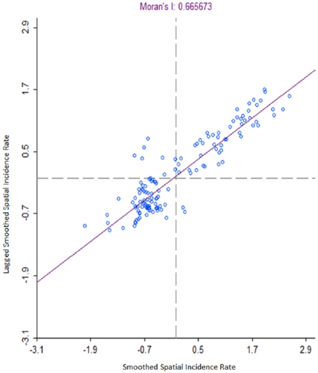
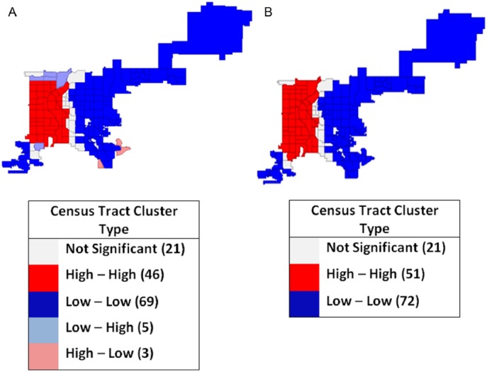
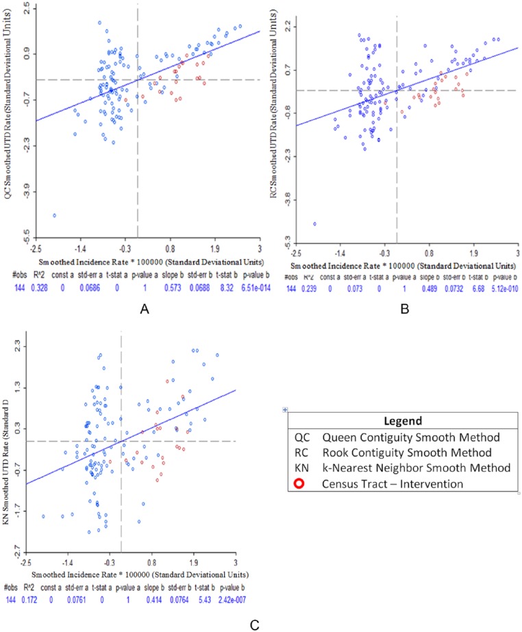
A 2012 study on Denver, CO, residents less than 19 years of age confirmed pertussis cases and immunization information system records were geocoded and aggregated to the census tract (CT) level. An algorithm assessed whether individuals were up-to-date (UTD) for pertussis vaccines. Pearson, Spearman, and Kendall correlations assessed relations between disease incidence and pertussis vaccine coverage. Using spatial analysis software, disease incidence and UTD rates were spatially weighted, and smoothed. Global and local autocorrelations based on univariate Moran's I spatial autocorrelation statistics evaluated whether a CT's rate belong to a cluster based on incidence or UTD measures.
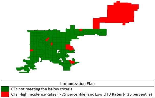
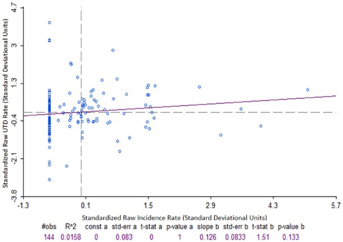
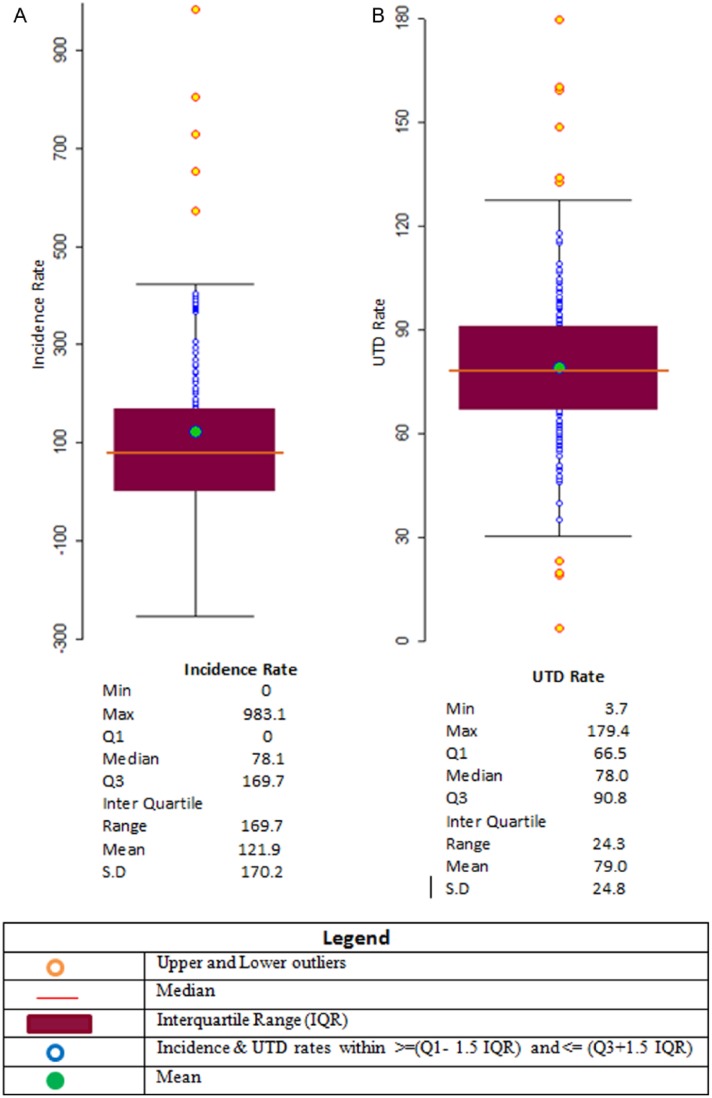
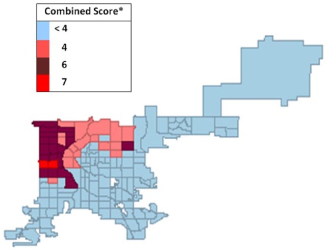
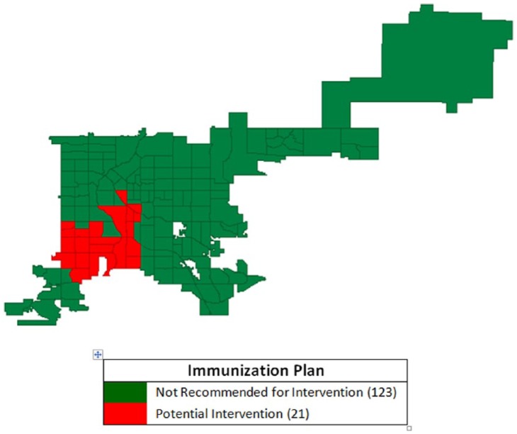
Overall disease incidence rate was 116.8/100 000. Assessment of pertussis vaccination coverage was available for 90% of the population. Among 134 672 Denver residents less than 19 years old, 103 496 (77%) were UTD for pertussis vaccines. Raw correlation coefficients showed weak relationships between incidence and immunization rates due to the presence of outliers. With geospatial and clustering analysis, estimates and correlation coefficients were improved with statistically significant Moran's I values for global and local autocorrelations rejecting the null hypothesis that incidence or UTD rates were randomly distributed. With evidence indicating the presence of clusters, smoothed and weighted disease incidence and UTD rates in 144 CTs identified 21 CTs (15%) for potential public health intervention.
Correlation of raw disease incidence and vaccine UTD rates in subcounty regions showed limited association, providing limited information for decision making. By assessing for clusters using spatial analysis methods, we identified CTs with higher incidence and lower immunization coverage for targeted public health interventions.
美国近期的百日咳疫情表明,我们对局部疾病暴发(如疫苗可预防疾病)的应对措施,可能得益于理解和应用空间分析方法,这些方法利用了县级以下层面免疫信息系统的数据。
2012年一项针对科罗拉多州丹佛市19岁以下居民确诊百日咳病例及免疫信息系统记录的研究,对这些信息进行了地理编码,并汇总到普查区(CT)层面。一种算法评估个体的百日咳疫苗接种是否及时。皮尔逊、斯皮尔曼和肯德尔相关性分析评估了疾病发病率与百日咳疫苗接种覆盖率之间的关系。使用空间分析软件,对疾病发病率和接种及时率进行空间加权和平滑处理。基于单变量莫兰指数空间自相关统计的全局和局部自相关分析,评估了一个普查区的发病率或接种及时率是否属于基于发病率或接种及时率测量的聚类。
总体疾病发病率为116.8/10万。90%的人口有百日咳疫苗接种覆盖率评估数据。在丹佛市134672名19岁以下居民中,103496人(77%)百日咳疫苗接种及时。由于存在异常值,原始相关系数显示发病率与免疫率之间的关系较弱。通过地理空间和聚类分析,估计值和相关系数得到改善,全局和局部自相关的莫兰指数值具有统计学意义,拒绝了发病率或接种及时率随机分布的原假设。有证据表明存在聚类情况,对144个普查区的疾病发病率和接种及时率进行平滑和加权处理后,确定了21个普查区(15%)进行潜在的公共卫生干预。
县级以下地区疾病发病率原始数据与疫苗接种及时率的相关性显示关联有限,为决策提供的信息有限。通过使用空间分析方法评估聚类情况,我们确定了发病率较高且免疫覆盖率较低的普查区,以便进行有针对性的公共卫生干预。