Mtui Devolent T, Lepczyk Christopher A, Chen Qi, Miura Tomoaki, Cox Linda J
Department of Natural Resources and Environmental Management, University of Hawai'i at Mānoa, Honolulu, United States of America.
Department of Geography, University of Hawai'i at Mānoa, Honolulu, United States of America.
PLoS One. 2017 Sep 28;12(9):e0185468. doi: 10.1371/journal.pone.0185468. eCollection 2017.
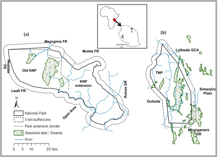
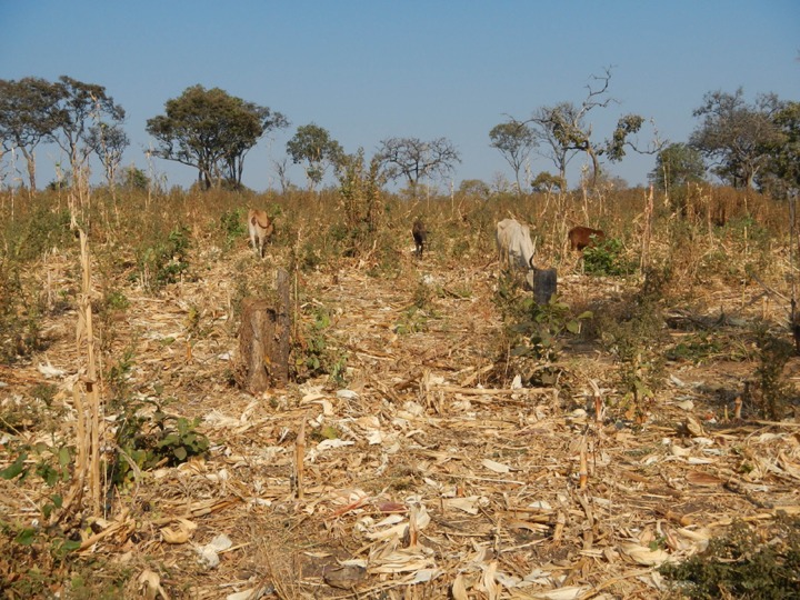
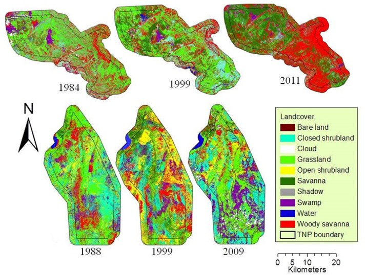
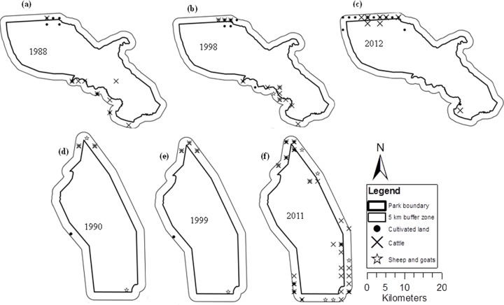
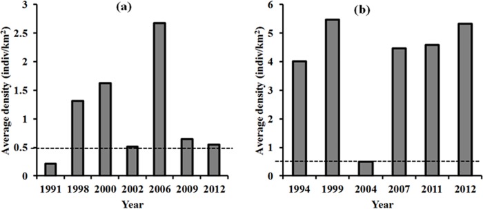
Landscape change in and around protected areas is of concern worldwide given the potential impacts of such change on biodiversity. Given such impacts, we sought to understand the extent of changes in different land-cover types at two protected areas, Tarangire and Katavi National Parks in Tanzania, over the past 27 years. Using Maximum Likelihood classification procedures we derived eight land-cover classes from Landsat TM and ETM+ images, including: woody savannah, savannah, grassland, open and closed shrubland, swamp and water, and bare land. We determined the extent and direction of changes for all land-cover classes using a post-classification comparison technique. The results show declines in woody savannah and increases in barren land and swamps inside and outside Tarangire National Park and increases in woody savannah and savannah, and declines of shrubland and grassland inside and outside Katavi National Park. The decrease of woody savannah was partially due to its conversion into grassland and barren land, possibly caused by human encroachment by cultivation and livestock. Based upon these changes, we recommend management actions to prevent detrimental effects on wildlife populations.
鉴于保护区及其周边地区的景观变化可能对生物多样性产生影响,这种变化在全球范围内都受到关注。考虑到这些影响,我们试图了解坦桑尼亚塔兰吉雷国家公园和卡塔维国家公园这两个保护区在过去27年中不同土地覆盖类型的变化程度。我们使用最大似然分类程序,从陆地卫星专题制图仪(TM)和增强型专题制图仪(ETM+)图像中得出了八个土地覆盖类别,包括:木本稀树草原、稀树草原、草地、开阔和封闭灌丛、沼泽和水域以及裸地。我们使用分类后比较技术确定了所有土地覆盖类别的变化程度和方向。结果显示,塔兰吉雷国家公园内外的木本稀树草原面积减少,裸地和沼泽面积增加;而卡塔维国家公园内外的木本稀树草原和稀树草原面积增加,灌丛和草地面积减少。木本稀树草原面积的减少部分是由于其转变为草地和裸地,这可能是由人类通过耕种和放牧的侵占造成的。基于这些变化,我们建议采取管理行动,以防止对野生动物种群产生不利影响。