Eugenio Francisco, Marcello Javier, Martin Javier, Rodríguez-Esparragón Dionisio
Instituto Oceanografía y Cambio Global (IOCAG), Universidad de Las Palmas de Gran Canaria (ULPGC), Campus Universitario de Tafira, 35017 Las Palmas de G.C., Spain.
Sensors (Basel). 2017 Nov 16;17(11):2639. doi: 10.3390/s17112639.
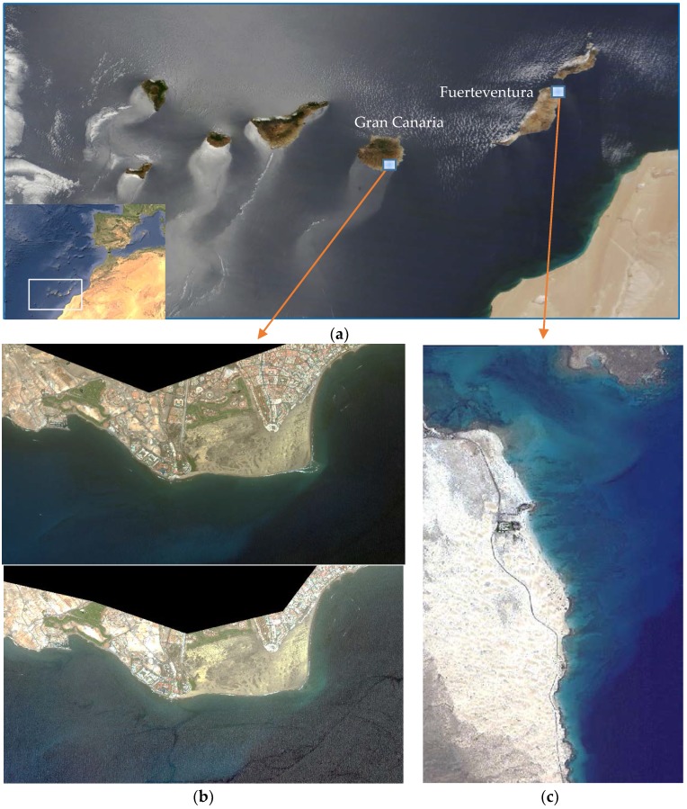
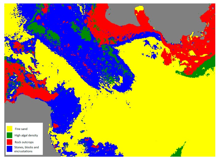
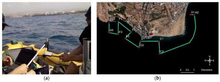
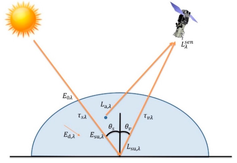
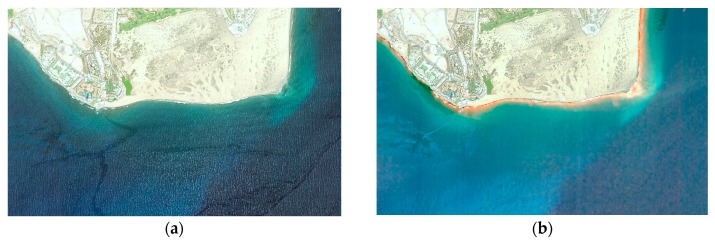
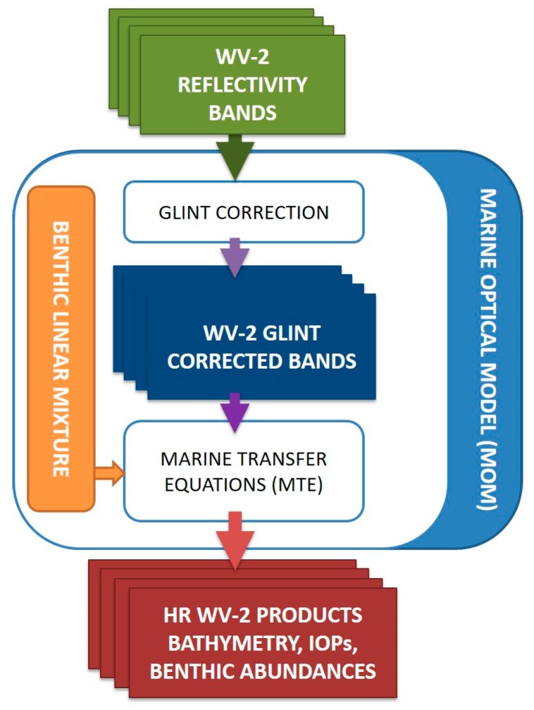
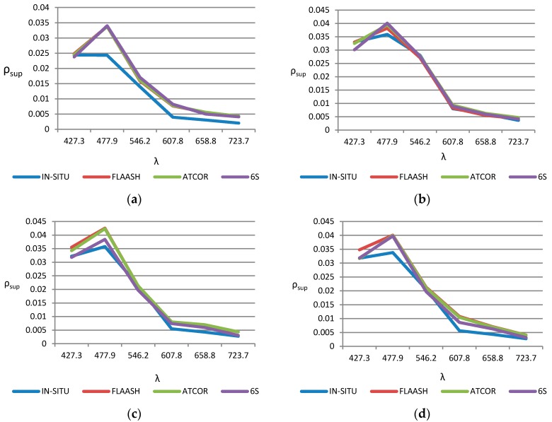
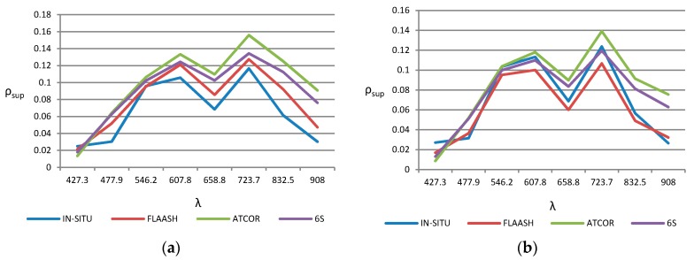
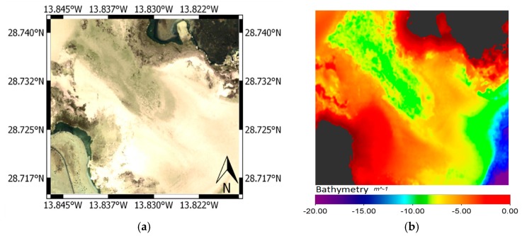
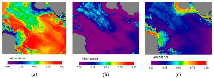
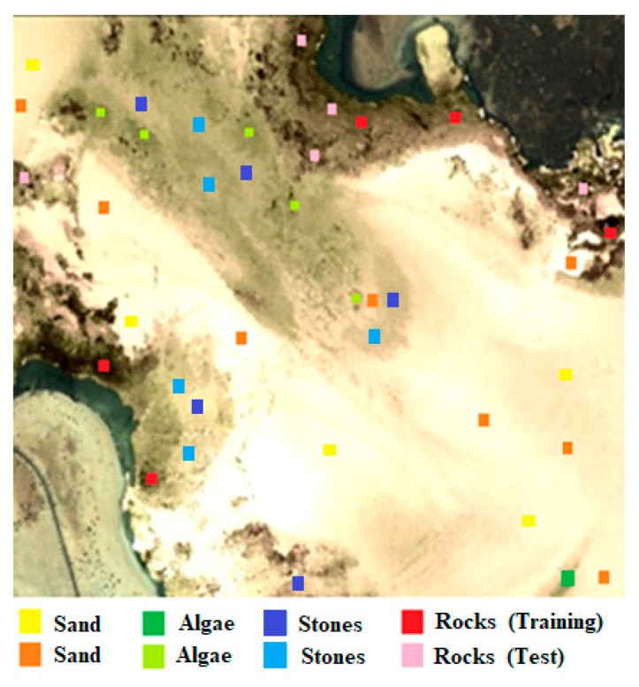
Remote multispectral data can provide valuable information for monitoring coastal water ecosystems. Specifically, high-resolution satellite-based imaging systems, as WorldView-2 (WV-2), can generate information at spatial scales needed to implement conservation actions for protected littoral zones. However, coastal water-leaving radiance arriving at the space-based sensor is often small as compared to reflected radiance. In this work, complex approaches, which usually use an accurate radiative transfer code to correct the atmospheric effects, such as FLAASH, ATCOR and 6S, have been implemented for high-resolution imagery. They have been assessed in real scenarios using field spectroradiometer data. In this context, the three approaches have achieved excellent results and a slightly superior performance of 6S model-based algorithm has been observed. Finally, for the mapping of benthic habitats in shallow-waters marine protected environments, a relevant application of the proposed atmospheric correction combined with an automatic deglinting procedure is presented. This approach is based on the integration of a linear mixing model of benthic classes within the radiative transfer model of the water. The complete methodology has been applied to selected ecosystems in the Canary Islands (Spain) but the obtained results allow the robust mapping of the spatial distribution and density of seagrass in coastal waters and the analysis of multitemporal variations related to the human activity and climate change in littoral zones.
远程多光谱数据可为监测沿海水生态系统提供有价值的信息。具体而言,基于卫星的高分辨率成像系统,如WorldView-2(WV-2),能够在空间尺度上生成信息,以实施对受保护沿海地带的保护行动。然而,与反射辐射相比,到达天基传感器的离水辐射通常较小。在这项工作中,针对高分辨率图像实施了复杂的方法,这些方法通常使用精确的辐射传输代码来校正大气效应,如FLAASH、ATCOR和6S。已使用野外光谱辐射计数据在实际场景中对它们进行了评估。在此背景下,这三种方法均取得了优异的成果,并且观察到基于6S模型的算法性能略优。最后,针对浅海海洋保护区的底栖生境绘图,提出了将所建议的大气校正与自动去闪烁程序相结合的相关应用。该方法基于在水的辐射传输模型中整合底栖类别线性混合模型。完整的方法已应用于西班牙加那利群岛的选定生态系统,但所获得的结果能够对沿海水域海草的空间分布和密度进行稳健绘图,并分析与沿海地带人类活动和气候变化相关的多时相变化。