Environmental Science Division, Argonne National Laboratory, Lemont, Illinois, United States of America.
PLoS One. 2018 Apr 3;13(4):e0195115. doi: 10.1371/journal.pone.0195115. eCollection 2018.
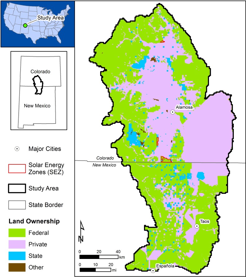
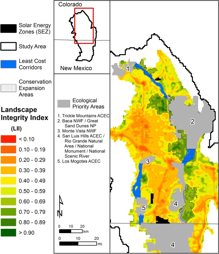
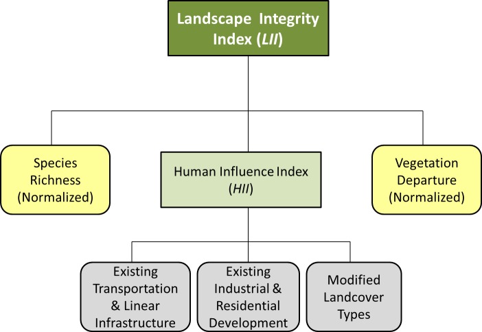
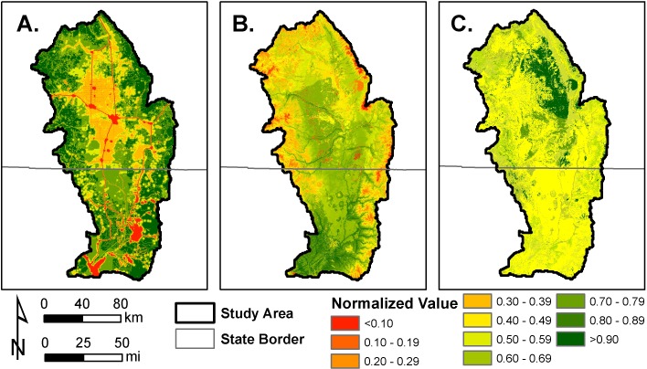
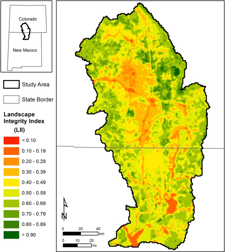
Land managers increasingly rely upon landscape assessments to understand the status of natural resources and identify conservation priorities. Many of these landscape planning efforts rely on geospatial models that characterize the ecological integrity of the landscape. These general models utilize measures of habitat disturbance and human activity to map indices of ecological integrity. We built upon these modeling frameworks by developing a Landscape Integrity Index (LII) model using geospatial datasets of the human footprint, as well as incorporation of other indicators of ecological integrity such as biodiversity and vegetation departure. Our LII model serves as a general indicator of ecological integrity in a regional context of human activity, biodiversity, and change in habitat composition. We also discuss the application of the LII framework in two related coarse-filter landscape conservation approaches to expand the size and connectedness of protected areas as regional mitigation for anticipated land-use changes.
土地管理者越来越依赖景观评估来了解自然资源的状况并确定保护重点。这些景观规划工作中有许多依赖于地理空间模型来描述景观的生态完整性。这些通用模型利用栖息地干扰和人类活动的度量来绘制生态完整性指数。我们通过利用人类足迹的地理空间数据集开发了一个景观完整性指数(LII)模型,并纳入了其他生态完整性指标,如生物多样性和植被偏离度,在此基础上进一步扩展了这些建模框架。我们的 LII 模型是人类活动、生物多样性和栖息地组成变化的区域背景下生态完整性的一般指标。我们还讨论了 LII 框架在两种相关的粗滤景观保护方法中的应用,以扩大保护区的规模和连通性,作为对预期土地利用变化的区域缓解措施。