College of Resources and Environmental Sciences, Nanjing Agricultural University, Nanjing, Jiangsu, 210095, China.
MLR Key laboratory of Saline Lake Resources and Environment, Institute of Mineral Resources, Chinese Academy of Geological Science (CAGS), Beijing, 100037, China.
Sci Rep. 2018 May 9;8(1):7331. doi: 10.1038/s41598-018-25683-3.
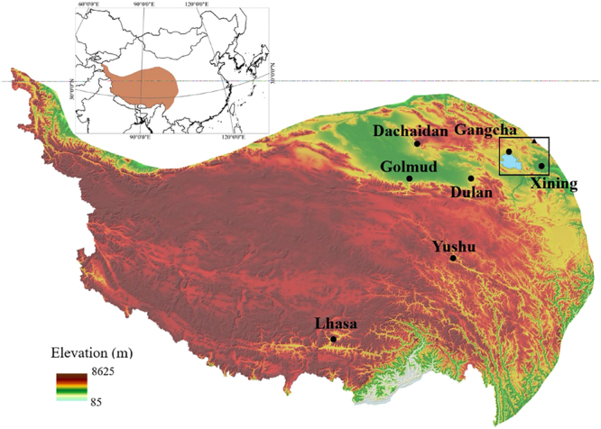
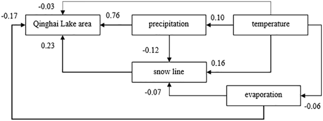
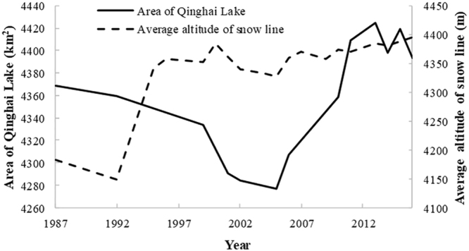
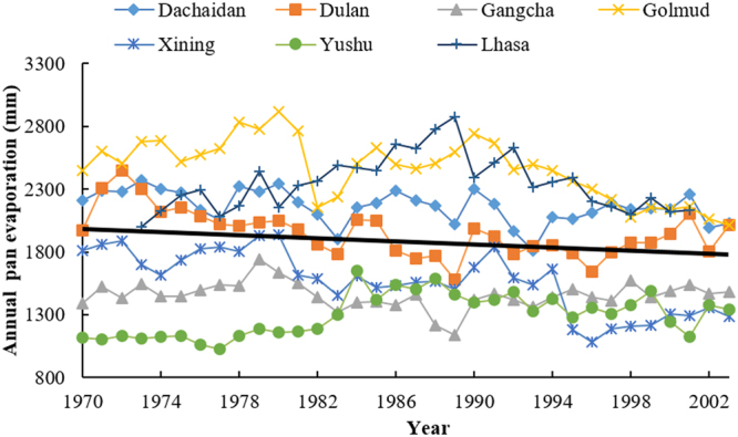
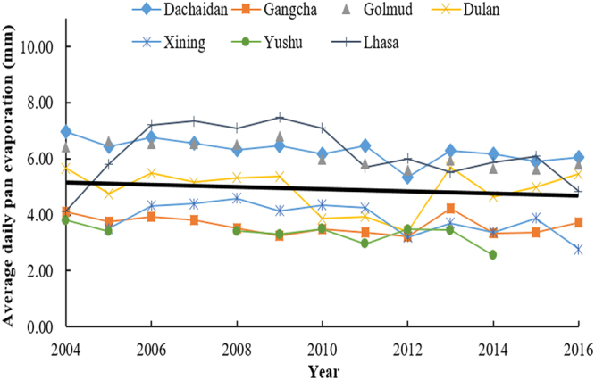
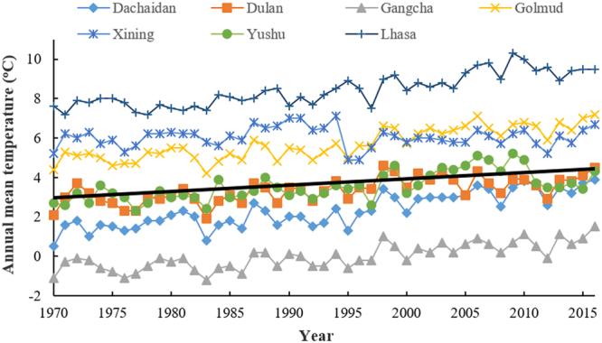
Qinghai-Tibetan Plateau is the most sensitive region to global warming on Earth. Qinghai Lake, the largest lake on the plateau, has experienced evident area variation during the past several decades. To quantify the area changes of Qinghai Lake, a satellite-based survey based on Landsat images from the 1980s to 2010s has been performed. In addition, meteorological data from all the seven available stations on Qinghai-Tibetan Plateau has been analyzed. Area of Qinghai Lake shrank ~2% during 1987-2005, and then increased ~3% from 2005-2016. Meanwhile, the average annual temperature increased 0.319 °C/10 y in the past 50 years, where the value is 0.415 °C/10 y from 2005-2016. The structural equation modeling (SEM) shows that precipitation is the primary factor influencing the area of Qinghai Lake. Moreover, temperature might be tightly correlated with precipitation, snow line, and evaporation, thereby indirectly causes alternations of the lake area. This study elucidated the significant area variation of water body on the Qinghai-Tibetan Plateau under global warming since 1980s.
青藏高原是地球上对全球变暖最敏感的地区。高原上最大的湖泊青海湖在过去几十年中经历了明显的面积变化。为了量化青海湖的面积变化,我们利用 20 世纪 80 年代至 2010 年代的 Landsat 卫星图像进行了基于卫星的调查。此外,还分析了青藏高原上所有七个可用站点的气象数据。青海湖的面积在 1987 年至 2005 年间缩小了约 2%,然后在 2005 年至 2016 年间又增加了约 3%。与此同时,过去 50 年,平均年气温以每 10 年 0.319°C 的速度上升,而 2005 年至 2016 年的上升速度为每 10 年 0.415°C。结构方程模型(SEM)表明,降水是影响青海湖面积的主要因素。此外,温度可能与降水、雪线和蒸发密切相关,从而间接导致湖泊面积的变化。本研究阐明了自 20 世纪 80 年代以来全球变暖背景下青藏高原水体的显著面积变化。