Department of Geographical Sciences, University of Maryland, College Park, MD, USA.
College of Environmental Science and Forestry, State University of New York, Syracuse, NY, USA.
Nature. 2018 Aug;560(7720):639-643. doi: 10.1038/s41586-018-0411-9. Epub 2018 Aug 8.
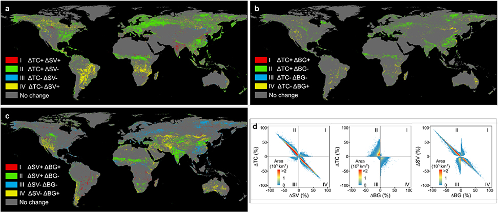
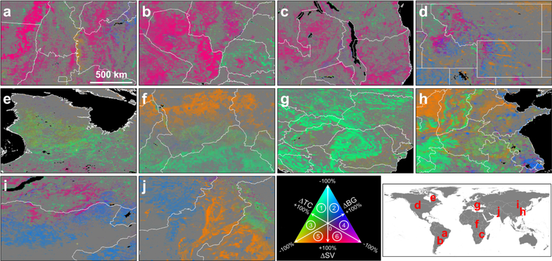
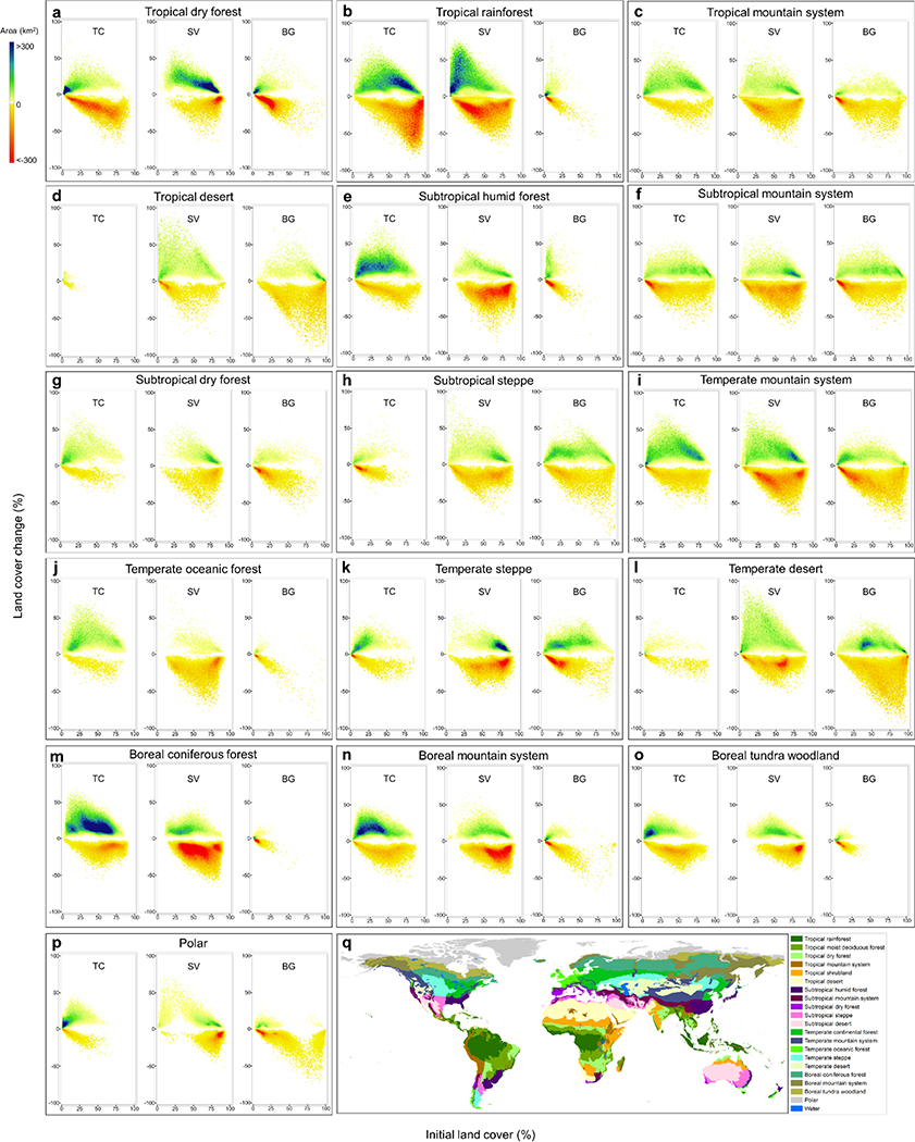
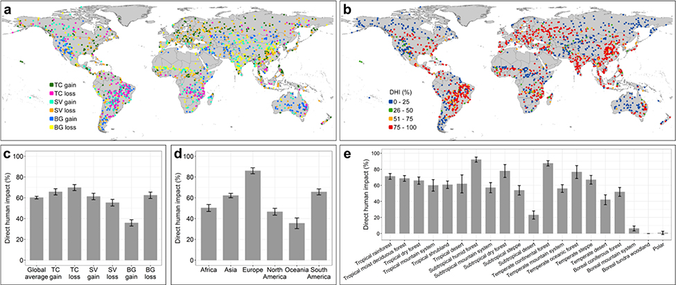
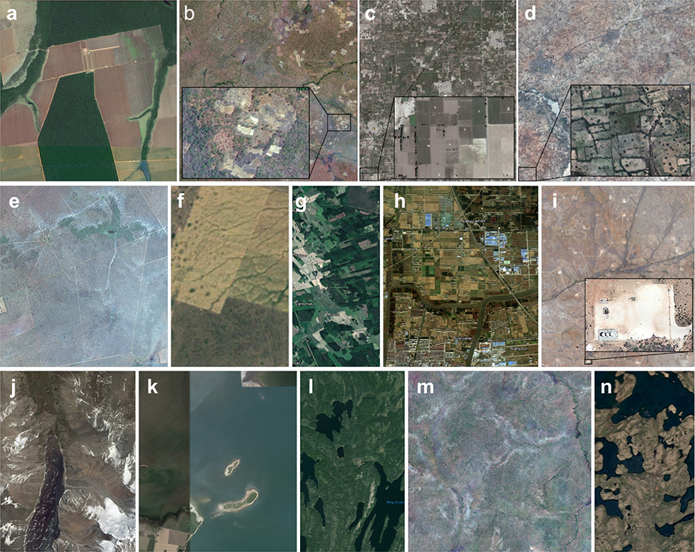
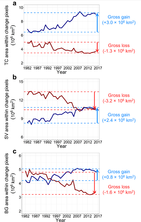
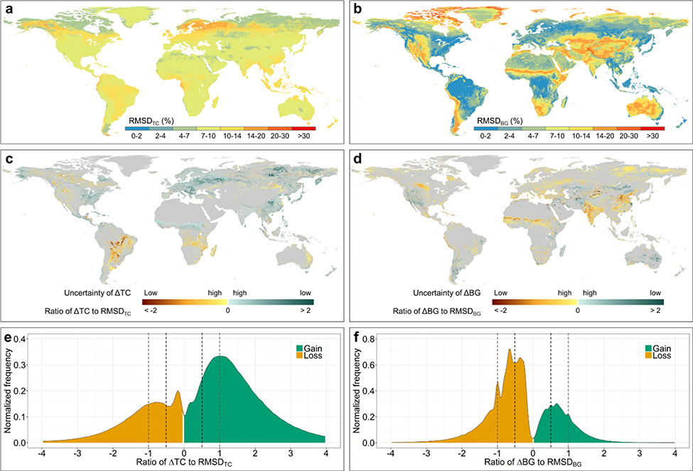
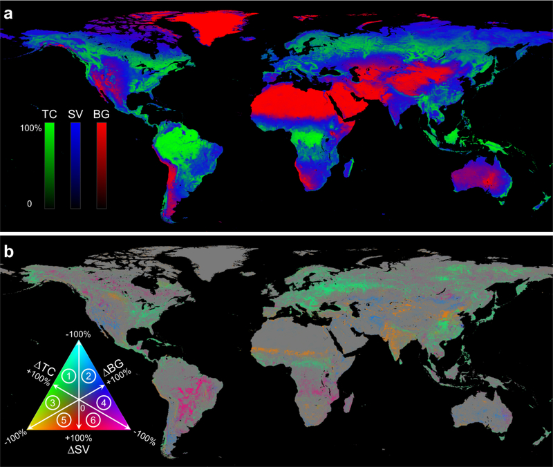
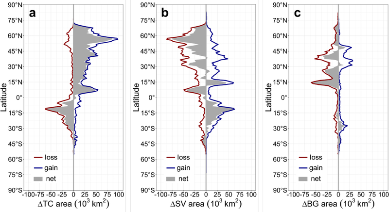
Land change is a cause and consequence of global environmental change. Changes in land use and land cover considerably alter the Earth's energy balance and biogeochemical cycles, which contributes to climate change and-in turn-affects land surface properties and the provision of ecosystem services. However, quantification of global land change is lacking. Here we analyse 35 years' worth of satellite data and provide a comprehensive record of global land-change dynamics during the period 1982-2016. We show that-contrary to the prevailing view that forest area has declined globally-tree cover has increased by 2.24 million km (+7.1% relative to the 1982 level). This overall net gain is the result of a net loss in the tropics being outweighed by a net gain in the extratropics. Global bare ground cover has decreased by 1.16 million km (-3.1%), most notably in agricultural regions in Asia. Of all land changes, 60% are associated with direct human activities and 40% with indirect drivers such as climate change. Land-use change exhibits regional dominance, including tropical deforestation and agricultural expansion, temperate reforestation or afforestation, cropland intensification and urbanization. Consistently across all climate domains, montane systems have gained tree cover and many arid and semi-arid ecosystems have lost vegetation cover. The mapped land changes and the driver attributions reflect a human-dominated Earth system. The dataset we developed may be used to improve the modelling of land-use changes, biogeochemical cycles and vegetation-climate interactions to advance our understanding of global environmental change.
土地变化是全球环境变化的原因和结果。土地利用和土地覆盖的变化极大地改变了地球的能量平衡和生物地球化学循环,导致了气候变化,并反过来影响了陆地表面特性和生态系统服务的提供。然而,全球土地变化的量化仍存在不足。在这里,我们分析了 35 年的卫星数据,并提供了 1982 年至 2016 年期间全球土地变化动态的综合记录。我们表明,与普遍认为的全球森林面积减少的观点相反,树木覆盖面积增加了 224 万平方千米(相对于 1982 年的水平增长了 7.1%)。这种总体净增长是热带地区净损失被亚热带地区净增长所抵消的结果。全球裸地覆盖面积减少了 116 万平方千米(减少了 3.1%),这主要发生在亚洲的农业地区。在所有土地变化中,60%与直接人为活动有关,40%与间接驱动因素有关,如气候变化。土地利用变化表现出区域主导地位,包括热带森林砍伐和农业扩张、温带重新造林或造林、农田集约化和城市化。在所有气候区域中,山区系统的树木覆盖面积都有所增加,许多干旱和半干旱生态系统的植被覆盖面积都有所减少。绘制的土地变化和驱动归因反映了一个以人类为主导的地球系统。我们开发的数据集可用于改进土地利用变化、生物地球化学循环和植被-气候相互作用的建模,以推进我们对全球环境变化的理解。