Baniukiewicz Magda, Dick Zachariah L, Giabbanelli Philippe J
1Department of Computer Science, Northern Illinois University, DeKalb, USA.
2Computer Science Department, Furman University, Greenville, USA.
EPJ Data Sci. 2018;7(1):39. doi: 10.1140/epjds/s13688-018-0169-1. Epub 2018 Oct 17.
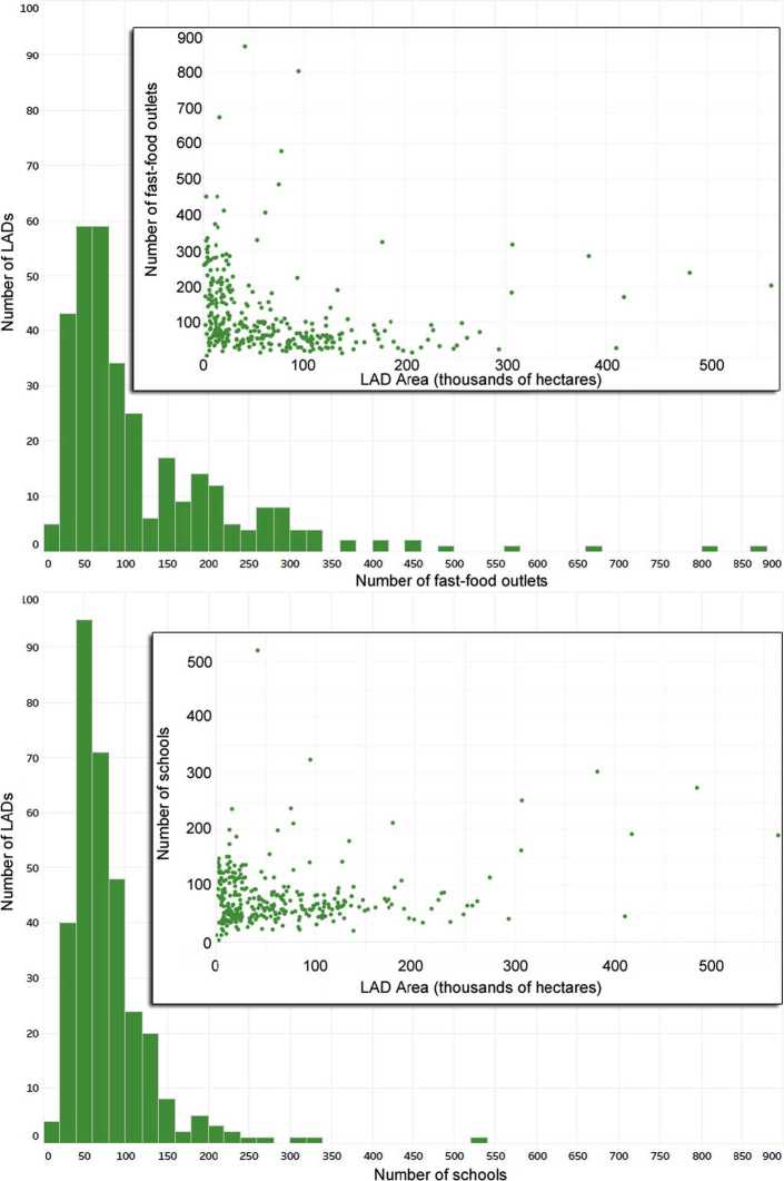
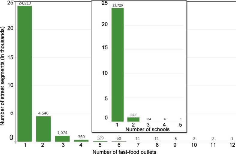
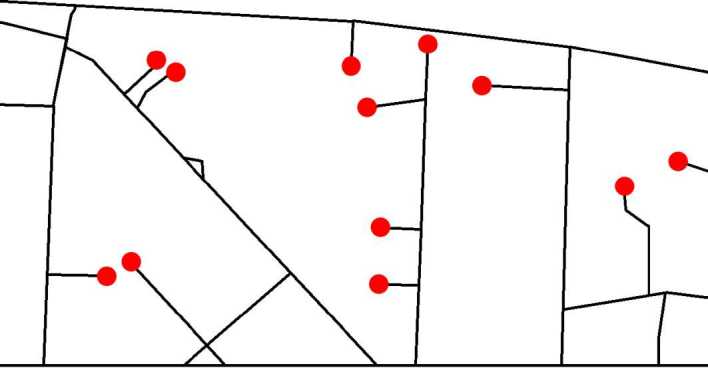
Fast-food outlets play a significant role in the nutrition of British children who get more food from such shops than the school canteen. To reduce young people's access to fast-food meals during the school day, many British cities are implementing zoning policies. For instance, cities can create buffers around schools, and some have used 200 meters buffers while others used 400 meters. But how close is too close? Using the road network is needed to precisely computing the distance between fast-food outlets (for policies limiting the concentration), or fast-food outlets and the closest school (for policies using buffers). This estimates how much of the fast-food landscape could be affected by a policy, and complementary analyses of food utilization can later translate the estimate into changes on childhood nutrition and obesity. Network analyses of retail and urban forms are typically limited to the scale of a city. However, to design national zoning policies, we need to perform this analysis at a national scale. Our study is the first to perform a nation-wide analysis, by linking large datasets (e.g., all roads, fast-food outlets and schools) and performing the analysis over a high performance computing cluster. We found a strong spatial clustering of fast-food outlets (with 80% of outlets being within 120 of another outlet), but much less clustering for schools. Results depend on whether we use the road network on the Euclidean distance (i.e. 'as the crow flies'): for instance, half of the fast-food outlets are found within 240 m of a school using an Euclidean distance, but only one-third at the same distance with the road network. Our findings are consistent across levels of deprivation, which is important to set equitable national policies. In line with previous studies (at the city scale rather than national scale), we also examined the relation between centrality and outlets, as a potential target for policies, but we found no correlation when using closeness or betweenness centrality with either the Spearman or Pearson correlation methods.
快餐店在英国儿童的营养摄入方面扮演着重要角色,这些孩子从这类店铺获取的食物比从学校食堂获取的更多。为了减少年轻人在上学日获取快餐的机会,许多英国城市正在实施分区政策。例如,城市可以在学校周围设置缓冲区,有些城市使用了200米的缓冲区,而有些则使用了400米的缓冲区。但多近才算太近呢?需要使用道路网络来精确计算快餐店之间的距离(用于限制集中程度的政策),或者快餐店与最近学校之间的距离(用于使用缓冲区的政策)。这可以估算出一项政策可能会影响多少快餐分布区域,随后对食物利用情况的补充分析可以将估算结果转化为对儿童营养和肥胖状况的改变。零售和城市形态的网络分析通常局限于城市规模。然而,要设计全国性的分区政策,我们需要在全国范围内进行这项分析。我们的研究首次通过链接大型数据集(如所有道路、快餐店和学校)并在高性能计算集群上进行分析,在全国范围内开展了此项研究。我们发现快餐店存在很强的空间集聚现象(80%的店铺彼此距离在120米以内),但学校的集聚程度要低得多。结果取决于我们是使用欧几里得距离(即“直线距离”)下的道路网络:例如,使用欧几里得距离时,一半的快餐店位于距离学校240米以内,但使用道路网络时,在相同距离内只有三分之一。我们的研究结果在不同贫困程度地区都是一致的,这对于制定公平的国家政策很重要。与之前的研究(在城市规模而非全国规模)一致,我们还研究了中心性与店铺之间的关系,将其作为政策的一个潜在目标,但当使用接近中心性或中介中心性以及斯皮尔曼或皮尔逊相关方法时,我们没有发现相关性。