Integrated Statistics, 16 Sumner Street, Woods Hole, MA, 02543, USA.
NOAA Northeast Fisheries Science Center, 166 Water Street, Woods Hole, MA, 02543, USA.
Sci Rep. 2019 Apr 9;9(1):5833. doi: 10.1038/s41598-019-42288-6.
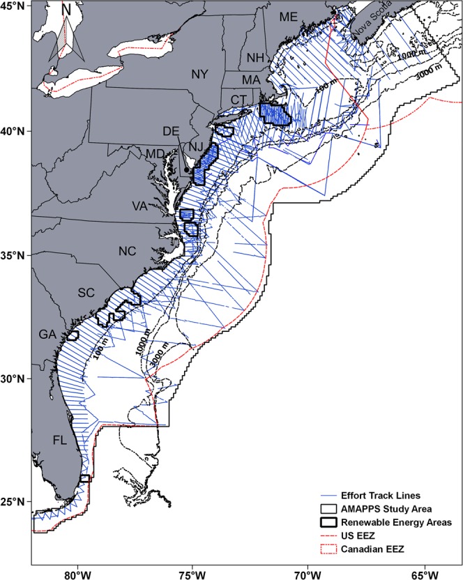
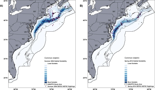
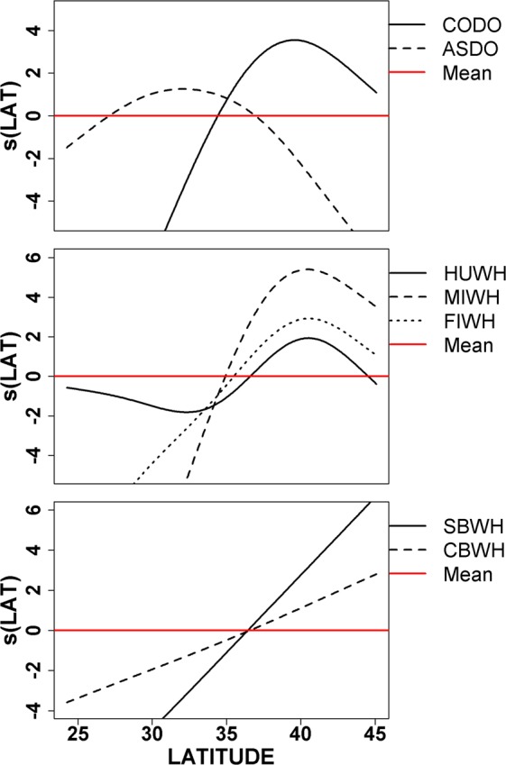
The objective of this study was to identify the main environmental covariates related to the abundance of 17 cetacean species/groups in the western North Atlantic Ocean based on generalized additive models, to establish a current habitat suitability baseline, and to estimate abundance that incorporates habitat characteristics. Habitat models were developed from dedicated sighting survey data collected by NOAA- Northeast and Southeast Fisheries Science Centers during July 2010 to August 2013. A group of 7 static physiographic characteristics and 9 dynamic environmental covariates were included in the models. For the small cetacean models, the explained deviance ranged from 16% to 69%. For the large whale models, the explained deviance ranged from 32% to 52.5%. Latitude, sea surface temperature, bottom temperature, primary productivity and distance to the coast were the most common covariates included and their individual contribution to the deviance explained ranged from 5.9% to 18.5%. The habitat-density models were used to produce seasonal average abundance estimates and habitat suitability maps that provided a good correspondence with observed sighting locations and historical sightings for each species in the study area. Thus, these models, maps and abundance estimates established a current habitat characterization of cetacean species in these waters and have the potential to be used to support management decisions and conservation measures in a marine spatial planning context.
本研究的目的是基于广义加性模型确定与北大西洋西部 17 种鲸目物种/群体丰度相关的主要环境协变量,建立当前栖息地适宜性基线,并估计包含栖息地特征的丰度。栖息地模型是根据 2010 年 7 月至 2013 年 8 月期间由美国国家海洋和大气管理局东北和东南渔业科学中心专门的目击调查数据开发的。模型中包含了一组 7 个静态地貌特征和 9 个动态环境协变量。对于小型鲸目动物模型,解释方差范围为 16%至 69%。对于大型鲸目动物模型,解释方差范围为 32%至 52.5%。纬度、海面温度、底层温度、初级生产力和到海岸的距离是最常见的协变量,它们对解释方差的单独贡献范围从 5.9%到 18.5%。栖息地密度模型用于生成季节性平均丰度估计值和栖息地适宜性图,这些图与研究区域内每种物种的观测到的目击位置和历史目击位置非常吻合。因此,这些模型、地图和丰度估计值建立了这些水域中鲸目物种的当前栖息地特征,并有可能用于支持海洋空间规划背景下的管理决策和保护措施。