Mannocci Laura, Roberts Jason J, Miller David L, Halpin Patrick N
Marine Geospatial Ecology Laboratory, Nicholas School of the Environment, Duke University, Durham, NC, 27708, U.S.A.
Integrated Statistics, 16 Sumner Street, Woods Hole, MA, 02543, U.S.A.
Conserv Biol. 2017 Jun;31(3):601-614. doi: 10.1111/cobi.12856. Epub 2017 Apr 28.
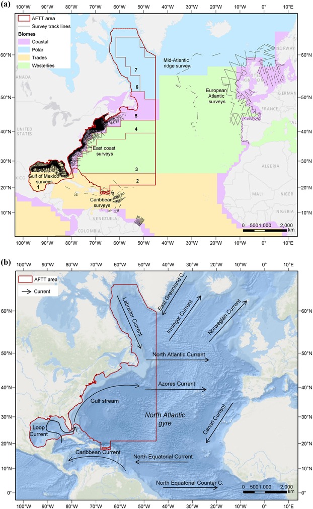
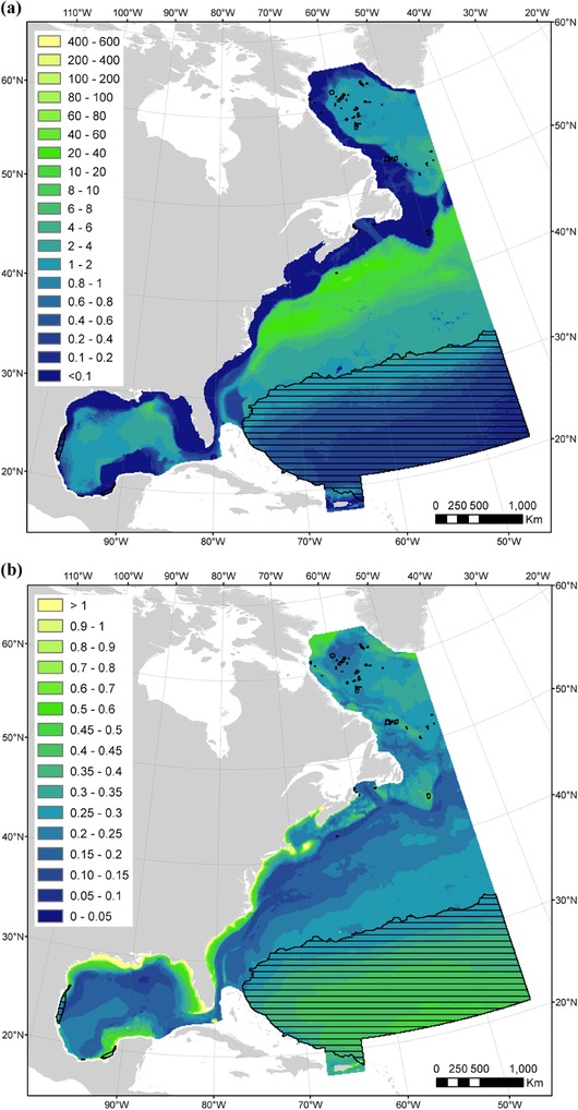
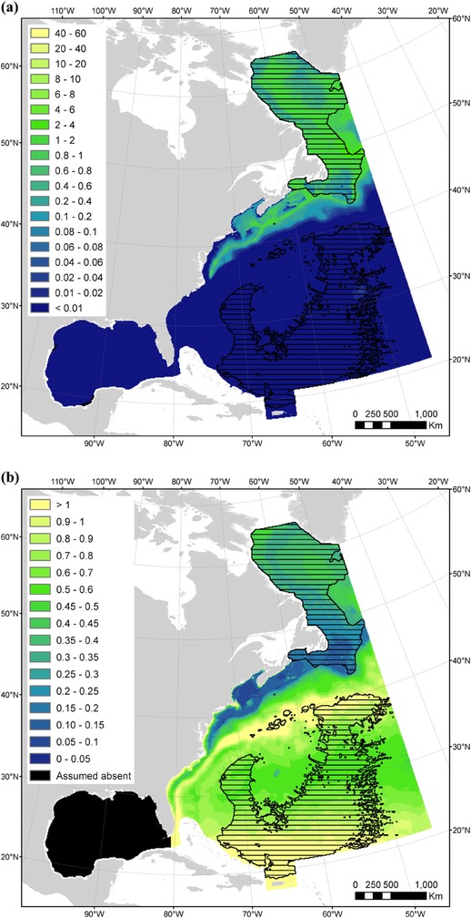
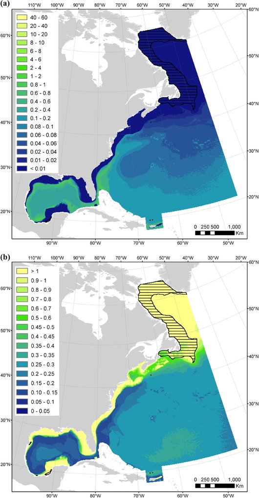
As human activities expand beyond national jurisdictions to the high seas, there is an increasing need to consider anthropogenic impacts to species inhabiting these waters. The current scarcity of scientific observations of cetaceans in the high seas impedes the assessment of population-level impacts of these activities. We developed plausible density estimates to facilitate a quantitative assessment of anthropogenic impacts on cetacean populations in these waters. Our study region extended from a well-surveyed region within the U.S. Exclusive Economic Zone into a large region of the western North Atlantic sparsely surveyed for cetaceans. We modeled densities of 15 cetacean taxa with available line transect survey data and habitat covariates and extrapolated predictions to sparsely surveyed regions. We formulated models to reduce the extent of extrapolation beyond covariate ranges, and constrained them to model simple and generalizable relationships. To evaluate confidence in the predictions, we mapped where predictions were made outside sampled covariate ranges, examined alternate models, and compared predicted densities with maps of sightings from sources that could not be integrated into our models. Confidence levels in model results depended on the taxon and geographic area and highlighted the need for additional surveying in environmentally distinct areas. With application of necessary caution, our density estimates can inform management needs in the high seas, such as the quantification of potential cetacean interactions with military training exercises, shipping, fisheries, and deep-sea mining and be used to delineate areas of special biological significance in international waters. Our approach is generally applicable to other marine taxa and geographic regions for which management will be implemented but data are sparse.
随着人类活动从国家管辖范围扩展到公海,越来越有必要考虑对栖息在这些水域的物种的人为影响。目前公海鲸类科学观测的稀缺阻碍了对这些活动在种群层面影响的评估。我们制定了合理的密度估计值,以促进对这些水域中鲸类种群人为影响的定量评估。我们的研究区域从美国专属经济区内一个经过充分调查的区域延伸到北大西洋西部一个对鲸类调查较少的大区域。我们利用现有的样线调查数据和栖息地协变量对15种鲸类分类群的密度进行建模,并将预测结果外推到调查较少的区域。我们制定模型以减少超出协变量范围的外推程度,并将其限制为对简单且可推广关系进行建模。为了评估对预测结果的置信度,我们绘制了在采样协变量范围之外进行预测的区域图,研究了替代模型,并将预测密度与无法纳入我们模型的来源的目击地图进行比较。模型结果的置信水平取决于分类群和地理区域,并突出了在环境不同地区进行额外调查的必要性。在谨慎应用的情况下,我们的密度估计可为公海的管理需求提供信息,例如量化鲸类与军事训练演习、航运、渔业和深海采矿的潜在相互作用,并用于划定国际水域中具有特殊生物学意义的区域。我们的方法通常适用于其他海洋分类群和将实施管理但数据稀少的地理区域。