Earth Observation and Geoinformatics Division, National Institute for Space Research-INPE, São José dos Campos, SP, 12227-010, Brazil.
GeoProcessing Division, Foundation for Science, Technology and Space Applications-FUNCATE, São José dos Campos, SP, 12210-131, Brazil.
Sci Rep. 2021 Jan 14;11(1):1388. doi: 10.1038/s41598-020-80809-w.
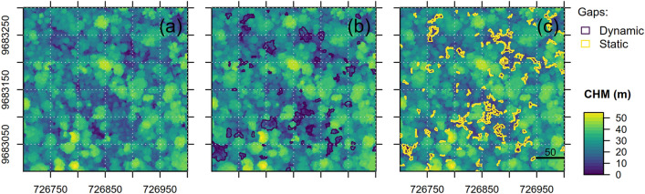
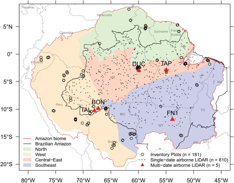
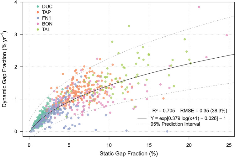
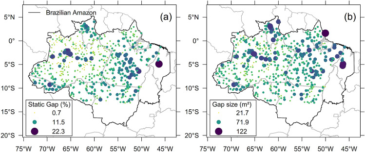
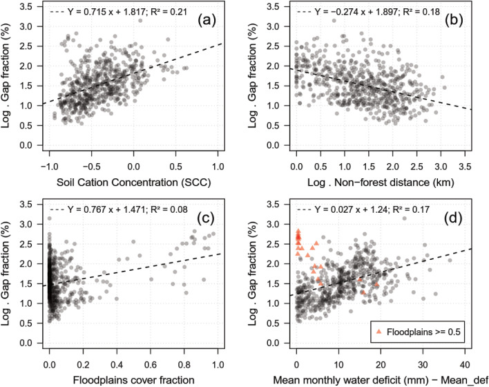
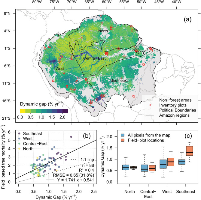
We report large-scale estimates of Amazonian gap dynamics using a novel approach with large datasets of airborne light detection and ranging (lidar), including five multi-temporal and 610 single-date lidar datasets. Specifically, we (1) compared the fixed height and relative height methods for gap delineation and established a relationship between static and dynamic gaps (newly created gaps); (2) explored potential environmental/climate drivers explaining gap occurrence using generalized linear models; and (3) cross-related our findings to mortality estimates from 181 field plots. Our findings suggest that static gaps are significantly correlated to dynamic gaps and can inform about structural changes in the forest canopy. Moreover, the relative height outperformed the fixed height method for gap delineation. Well-defined and consistent spatial patterns of dynamic gaps were found over the Amazon, while also revealing the dynamics of areas never sampled in the field. The predominant pattern indicates 20-35% higher gap dynamics at the west and southeast than at the central-east and north. These estimates were notably consistent with field mortality patterns, but they showed 60% lower magnitude likely due to the predominant detection of the broken/uprooted mode of death. While topographic predictors did not explain gap occurrence, the water deficit, soil fertility, forest flooding and degradation were key drivers of gap variability at the regional scale. These findings highlight the importance of lidar in providing opportunities for large-scale gap dynamics and tree mortality monitoring over the Amazon.
我们使用一种新的方法和大量的机载光探测和测距 (lidar) 数据集,报告了亚马逊地区大规模的林窗动态估计,包括 5 个多时相和 610 个单日期 lidar 数据集。具体来说,我们(1)比较了固定高度和相对高度方法在林窗划分中的应用,并建立了静态林窗和动态林窗(新形成的林窗)之间的关系;(2)使用广义线性模型探讨了潜在的环境/气候驱动因素对林窗发生的解释;(3)将我们的发现与 181 个实地样地的死亡率估计进行交叉相关。我们的研究结果表明,静态林窗与动态林窗显著相关,可以反映森林冠层的结构变化。此外,相对高度方法在林窗划分方面优于固定高度方法。在亚马逊地区发现了明确且一致的动态林窗空间模式,同时也揭示了从未在实地采样的区域的动态。主要模式表明,西部和东南部的林窗动态比中东部和北部高出 20-35%。这些估计与实地死亡率模式显著一致,但由于主要检测到断裂/连根拔起的死亡模式,估计值低了 60%。虽然地形预测因子不能解释林窗的发生,但水分亏缺、土壤肥力、森林洪水和退化是区域尺度上林窗变异性的关键驱动因素。这些发现强调了 lidar 在提供亚马逊地区大规模林窗动态和树木死亡率监测机会方面的重要性。