Nuclear Science and Engineering, The Colorado School of Mines, Golden, CO 80401, USA.
United States Air Force Academy, Colorado Springs, Air Force Academy, CO 80840, USA.
Sensors (Basel). 2021 Mar 21;21(6):2196. doi: 10.3390/s21062196.
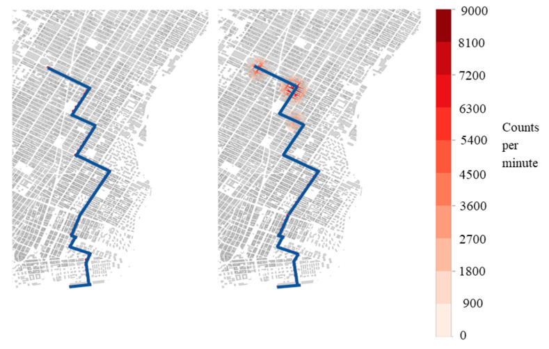
Radiation detectors installed at major ports of entry are a key component of the overall strategy to protect countries from nuclear terrorism. While the goal of deploying these systems is to intercept special nuclear material as it enters the country, no detector system is foolproof. Mobile, distributed sensors have been proposed to detect nuclear materials in transit should portal monitors fail to prevent their entry in the first place. In large metropolitan areas, a mobile distributed sensor network could be deployed using vehicle platforms such as taxis, Ubers, and Lyfts, which are already connected to communications infrastructure. However, performance and coverage that could be achieved using a network of sensors mounted on commercial passenger vehicles has not been established. Here, we evaluate how a mobile sensor network could perform in New York City using a combination of radiation transport and geographic information systems. The geographic information system is used in conjunction with OpenStreetMap data to isolate roads and construct a grid over the streets. Vehicle paths are built using pickup and drop off data from Uber, and from the New York State Department of Transportation. The results show that the time to first detection increases with source velocity, decreases with the number of mobile detectors, and reaches a plateau that depends on the strength of the source.
辐射探测器安装在主要入境口岸是保护国家免受核恐怖主义的整体战略的关键组成部分。虽然部署这些系统的目的是在特殊核材料进入该国时拦截,但没有任何探测器系统是万无一失的。已经提出了移动分布式传感器,以便在门户监视器最初未能防止核材料进入的情况下对运输中的核材料进行检测。在大都市地区,可以使用出租车、优步和来福车等车辆平台部署移动分布式传感器网络,这些车辆已经连接到通信基础设施。然而,尚未确定使用安装在商业乘用车上的传感器网络可以实现的性能和覆盖范围。在这里,我们使用辐射传输和地理信息系统的组合来评估移动传感器网络在纽约市的性能。地理信息系统与 OpenStreetMap 数据结合使用,以隔离道路并在街道上构建网格。车辆路径使用优步和纽约州运输部的接送数据构建。结果表明,首次检测到的时间随源速度的增加而增加,随移动探测器的数量的减少而减少,并达到取决于源强度的平台。