Faculty of Infectious and Tropical Diseases, London School of Hygiene and Tropical Medicine, Keppel Street, Bloomsbury, London, WCIE 7HT, UK.
Faculty of Medicine and Health Sciences, Universiti Malaysia Sabah, Kota Kinabalu, Malaysia.
Sci Rep. 2021 Jun 3;11(1):11810. doi: 10.1038/s41598-021-90893-1.
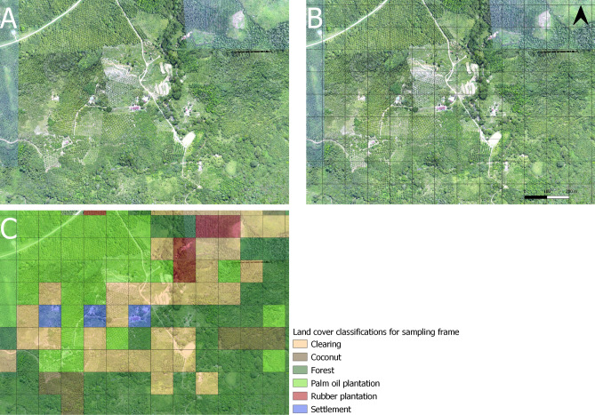
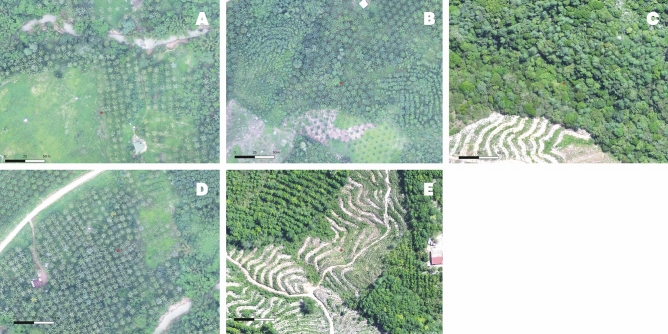
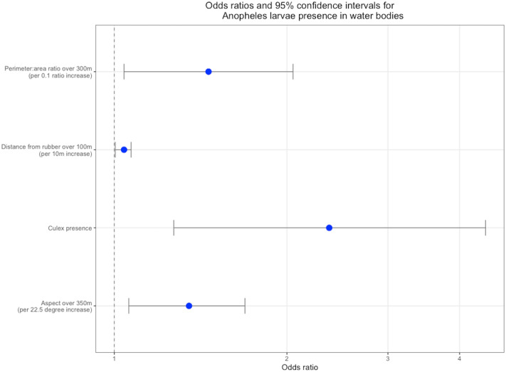
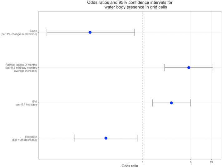
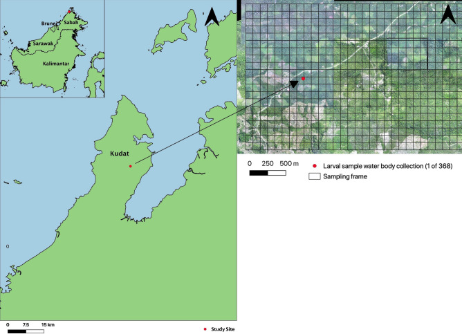
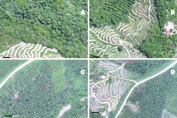
Land-use changes, such as deforestation and agriculture, can influence mosquito vector populations and malaria transmission. These land-use changes have been linked to increased incidence in human cases of the zoonotic malaria Plasmodium knowlesi in Sabah, Malaysian Borneo. This study investigates whether these associations are partially driven by fine-scale land-use changes creating more favourable aquatic breeding habitats for P. knowlesi anopheline vectors. Using aerial remote sensing data, we developed a sampling frame representative of all land use types within a major focus of P. knowlesi transmission. From 2015 to 2016 monthly longitudinal surveys of larval habitats were collected in randomly selected areas stratified by land use type. Additional remote sensing data on environmental variables, land cover and landscape configuration were assembled for the study site. Risk factor analyses were performed over multiple spatial scales to determine associations between environmental and spatial variables and anopheline larval presence. Habitat fragmentation (300 m), aspect (350 m), distance to rubber plantations (100 m) and Culex larval presence were identified as risk factors for Anopheles breeding. Additionally, models were fit to determine the presence of potential larval habitats within the areas surveyed and used to generate a time-series of monthly predictive maps. These results indicate that land-use change and topography influence the suitability of larval habitats, and may partially explain the link between P. knowlesi incidence and deforestation. The predictive maps, and identification of the spatial scales at which risk factors are most influential may aid spatio-temporally targeted vector control interventions.
土地利用变化,如森林砍伐和农业,会影响蚊子媒介种群和疟疾传播。这些土地利用变化与马来西亚婆罗洲沙巴州人类间发性疟疾病例的增加有关,如动物源性疟原虫 knowlesi。本研究旨在探讨这些关联是否部分是由于小尺度土地利用变化为 knowlesi 疟蚊媒介创造了更有利的水生繁殖栖息地。本研究利用航空遥感数据,为 P. knowlesi 传播的主要重点区域内的所有土地利用类型开发了一个具有代表性的抽样框架。2015 年至 2016 年,在随机选择的土地利用类型分层区域中,每月对幼虫栖息地进行纵向调查。为研究地点收集了环境变量、土地覆盖和景观配置的额外遥感数据。在多个空间尺度上进行了风险因素分析,以确定环境和空间变量与疟蚊幼虫存在之间的关联。生境破碎化(300m)、方位(350m)、与橡胶种植园的距离(100m)和库蚊幼虫的存在被确定为蚊虫滋生的风险因素。此外,还拟合了模型来确定调查区域内潜在幼虫栖息地的存在,并用于生成每月预测地图的时间序列。这些结果表明,土地利用变化和地形会影响幼虫栖息地的适宜性,这可能部分解释了 knowlesi 疟疾病例与森林砍伐之间的联系。预测地图以及确定风险因素最具影响力的空间尺度,可能有助于针对时空的媒介控制干预措施。